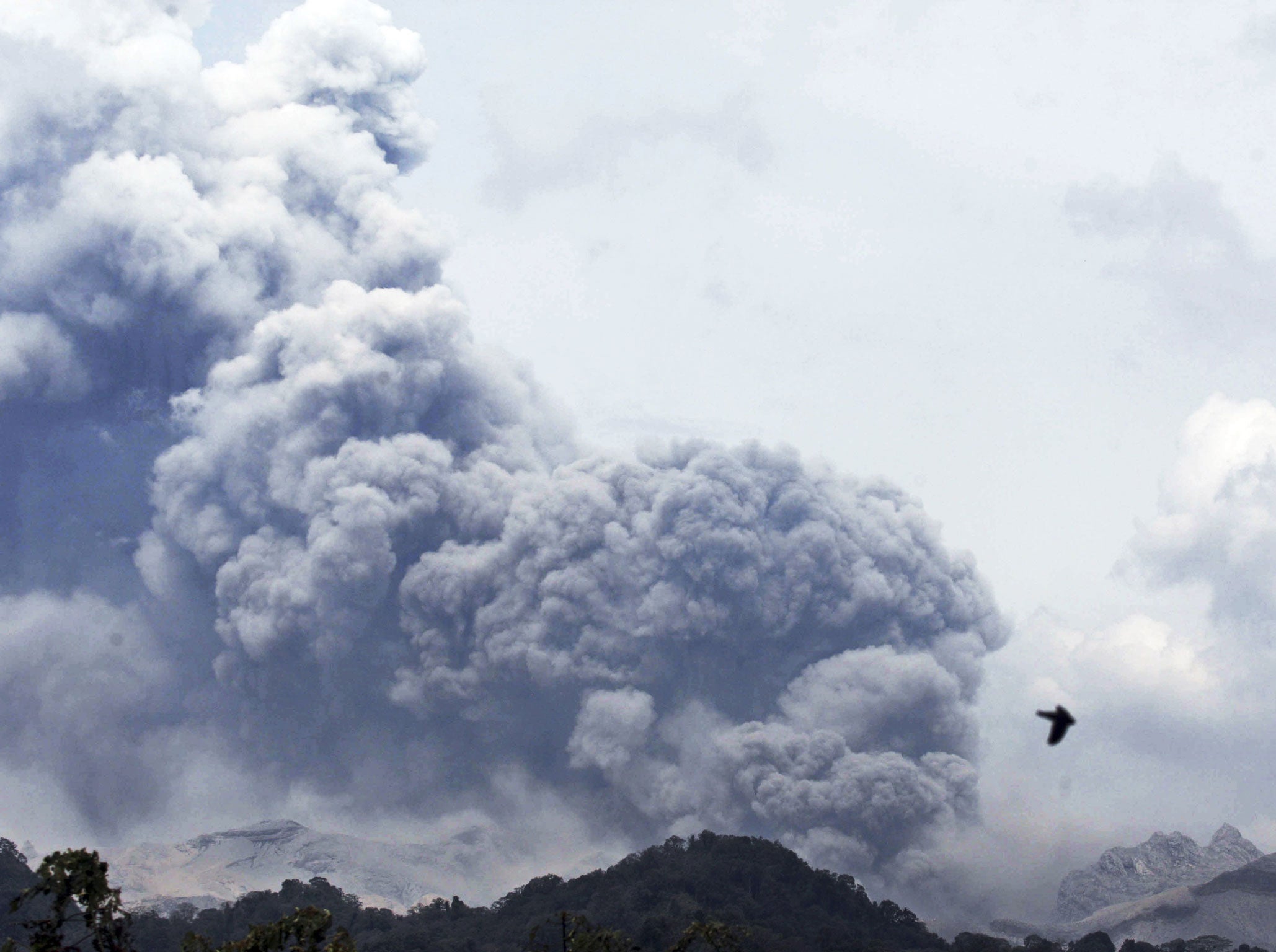
Mount Kelud eruption: Why is Indonesia the hottest spot on the Ring of Fire?
The overnight eruption of Java island's Mount Kelud has triggered the evacuation of 100,000 people, but just what causes such volatile activity?

For free real time breaking news alerts sent straight to your inbox sign up to our breaking news emails
Sign up to our free breaking news emails
Indonesia has experienced yet more volcanic activity as Mount Kelud erupted on Thursday, causing 100,000 to flee their homes and covering Java - the country’s most heavily populated island - in ash. But why is the region such a hotbed of volcanic activity?
Indonesia has approximately 130 active volcanoes. Due to its population density and the fertile soils that volcanic slopes provide, hundreds of thousands of Indonesians live close to active volcanos. They have learnt to live with the rumblings and frequently ignore orders to leave.
The huge archipelago sits between the most active seismic region in the world, the Pacific Ring of Fire, an area where a large number of earthquakes and volcanic eruptions occur, and the Alpide Belt.
The United States Geological Survey has described the region as among the most seismically active zones in the world. The Ring of Fire, or the circum-Pacific belt, is the world’s greatest earthquake belt, according to Live Science, because of fault lines running from Chile to Japan and Southeast Asia.
These fault lines are breaks in the plates of the Earth’s crust and are where earthquakes are likely to occur.
The Pacific Ring of Fire is also home to 453 volcanoes and more than half of the world’s active and dormant volcanoes are found here.
Indonesia is located between the Pacific, Eurasian, and Australian tectonic plates. When one of the plates moves, it causes earthquakes, volcanic eruptions and even tsunamis in Indonesia and the surrounding areas.
In pictures: Mount Kelud - one of the most dangerous volcanoes in Indonesia erupts
Show all 10Katherine Cashman, a professor of Volcanology at Bristol University explained: "Indonesia lies on a subduction zone, where one plate dives under the other. Subduction causes big earth quakes and volcanoes. It’s also quite a complex set of subduction zones.
"The earth is divided into plates, which are semi rigid, but they do move sometimes and interact with each other. Indonesia has the unlucky circumstance of being on a very major plate boundary, and particularly under Java, you have one plate diving directly under another plate, so as it dives under it starts to produce melt that comes up as a volcano."
Dr Steven Godby, an expert in natural hazards at Nottingham Trent University, said Kelud is regarded as one of the most dangerous volcanoes on Java because of its frequent eruptions and deadly 'lahars'.
"Lahar is an Indonesian term used to describe the hot or cold mixture of water, rock and ash that can flow down the slopes of a volcano or along river valleys", he said. "Kelud’s typically short but violent eruptions cause the ejection of water from a crater lake at its summit."
The 2004 Indian Ocean tsunami was caused by an earthquake on the ocean floor near Sumatra in Indonesia. The earthquake hit Indonesia, Sri Lanka, India, Thailand, Maldives, and even Africa in one of the worst natural disasters the world has ever seen.
Subscribe to Independent Premium to bookmark this article
Want to bookmark your favourite articles and stories to read or reference later? Start your Independent Premium subscription today.
Join our commenting forum
Join thought-provoking conversations, follow other Independent readers and see their replies