California weather: West Coast prepares for 'Pineapple Express' to bring 'atmospheric river of rain'
National Weather Service said barrage is 'expected to be one of the strongest storms in terms of wind and rain' since storms in October 2009 and January 2008

For free real time breaking news alerts sent straight to your inbox sign up to our breaking news emails
Sign up to our free breaking news emails
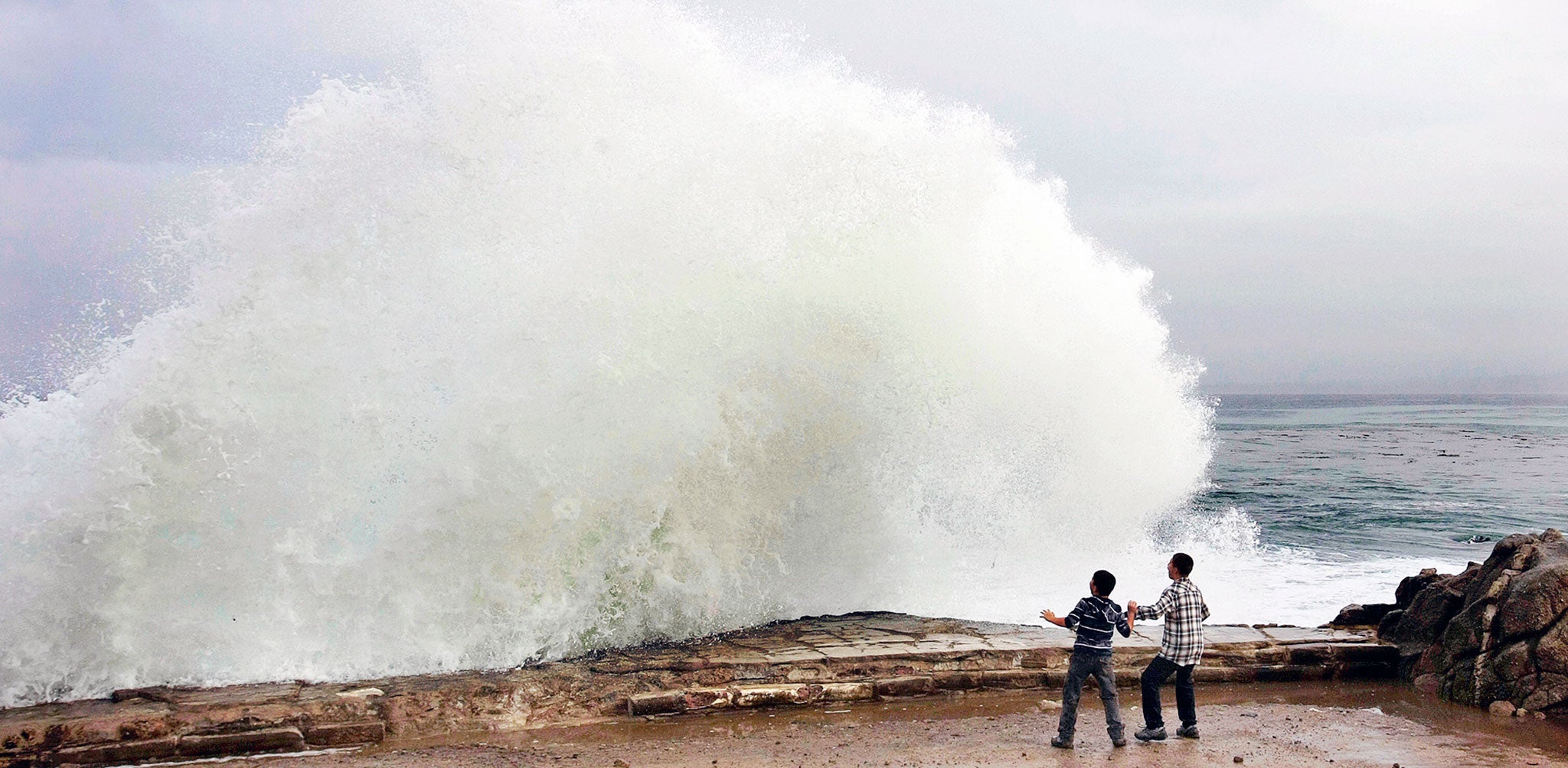
A ferocious storm is forecast to batter California with drenching rain, heavy snow, pounding surf and howling winds through Friday.
The National Weather Service said the barrage is "expected to be one of the strongest storms in terms of wind and rain" since storms in October 2009 and January 2008.
Moderate rain and gusty winds began hitting Northern California late Wednesday. Officials in San Francisco, Oakland and Marin County said schools would be closed Thursday because of expected heavy rain and winds. San Francisco closed the Great Highway, a road that runs along the far western side of the city, next to the Pacific Ocean, also because of the risk of high winds and heavy rain.
Southern California saw dark clouds move in Wednesday afternoon. Los Angeles County officials closed a pair of main roads around Castaic Lake, a state recreation area in mountains north of Santa Clarita, in anticipation of mud flow.
A system fueled by the "Pineapple Express" is delivering a steady stream of moisture directly from Hawaii to the West Coast starting Wednesday. Meteorologists describe the Pineapple Express as a long, narrow plume that pipes moisture from the tropics into the western United States.
About 3-6 inches of rain is possible in parts of Northern California, including much of the San Francisco Bay Area and Sacramento, AccuWeather said. Some spots could see as much as 9 inches of rain.
The rainfall could overwhelm waterways and road drainage systems, possibly leading to flash floods.
In the Sacramento area, strong winds expected with the storm — gusts as high as 60 mph — could take down outdoor holiday decorations.
"I'm not putting any of it up until after the storm because even though it's pretty durable, it will just blow over," Sacramento resident Tim Adams said.
People were advised to take down their holiday lights, especially inflatable decorations that are not properly anchored.
Mark Ghilarducci, director of the California Governor's Office of Emergency Services, issued a warning that the storm will present a risk of flash flooding and debris slides, particularly in the northern and southern areas of the state that had wildfires this year.
"Burned areas are especially at risk for debris slides. Even regions that don't experience regular seasonal flooding could see flash flooding during this intense storm system," he said in a statement.
The intense rain from this storm still won't end the region's drought, although it will be a major step in the right direction, AccuWeather meteorologist Alex Sosnowski said.
Runoff from the storm could cause streams to surge with high water before eventually emptying into lakes and reservoirs.
As much as 4 feet of snow could fall in the Sierra Nevada. A blizzard warning was posted for portions of the northern Sierra, where winds could rage to 80 mph with heavy, swirling snow. A winter storm warning is also in effect for the southern Sierra.
Pineapple Express: Pacific storm hits California
Show all 8The weather service warned that travel in the northern Sierra will be "extremely dangerous" because of blizzard conditions: "Do not travel. If you must travel, have a winter survival kit with you. If you get stranded ... stay with your vehicle."
The storm is expected to dump enough snow on California's mountains that the state's snowpack — currently only 35% of average for this time of year — could be at 75% or higher by this weekend.
Oregon and Washington were the first to see the storm's effects Wednesday. At least 24,000 customers had lost power by Wednesday afternoon because of the rain and wind in western Washington, with more outages and rough weather forecast through Thursday.
Oddly, along with the rain in Washington came warmth, as Sea-Tac Airport hit 66 degrees, the highest December temperature ever recorded there, according to the weather service.
Contributing: The Associated Press; KING-TV, Seattle; KXTV-TV, Sacramento; David Castellon, Visalia Times-Delta
This story originally appeared on USA Today. The content was created separately by The Independent.
Subscribe to Independent Premium to bookmark this article
Want to bookmark your favourite articles and stories to read or reference later? Start your Independent Premium subscription today.
Join our commenting forum
Join thought-provoking conversations, follow other Independent readers and see their replies