Hurricane Gonzalo: High winds and heavy rain set to lash parts of Britain
Met Office forecasters remain uncertain quite how hard and where the hurricane will strike

Get the free Morning Headlines email for news from our reporters across the world
Sign up to our free Morning Headlines email
Winds of up to 60 mph and heavy rains are set to lash parts of Britain as the remnants of Hurricane Gonzalo sweep across the country.
The death throes of the hurricane will drive down the almost balmy temperatures of up to 22 expected today to a more autumnal chill.
Met Office forecasters remain uncertain quite how hard and where the hurricane will strike but warned the public to keep an eye on forecasts and to be wary in exposed areas in western regions.
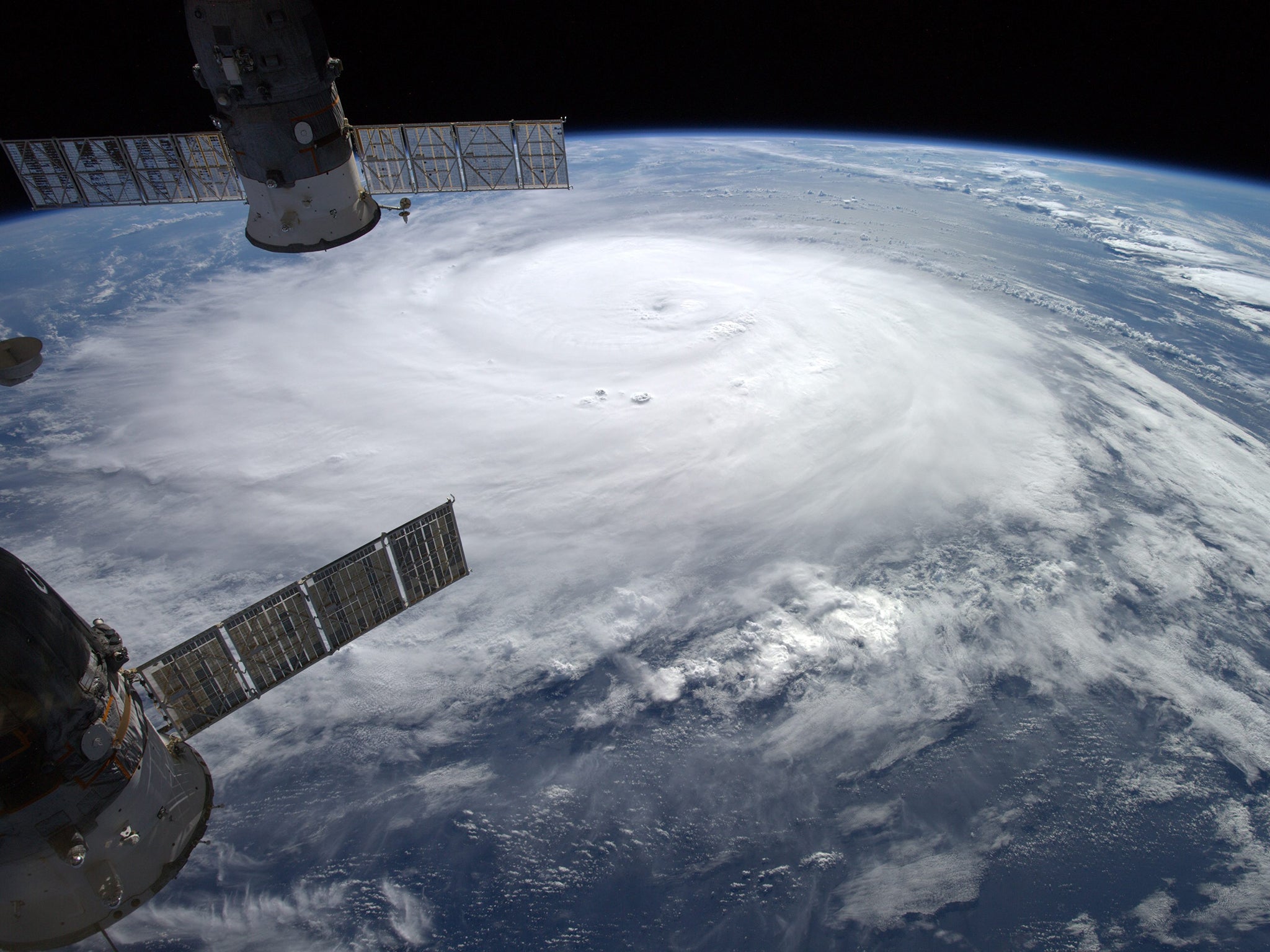
Hurricane Gonzalo was heading towards Bermuda last night before sweeping across the Atlantic towards northern Britain, bringing with it wind, rain and cooler conditions. It is expected to reach northern Britain on Monday night and sweep southwards through Tuesday.
As it heads north east from Bermuda today it will pass over cooler Atlantic waters which will help slow it and transform the macho-sounding ‘Hurricane Gonzalo’ into a somewhat more prosaic ‘mid-latitude depression’.
“It’s losing all the moisture and energy it needs to sustain strong winds,” said Emma Corrigan of the Met Office. “It will cross some cooler seas and make the transformation into a mid-latitude depression.”
The sting in the dying hurricane’s tail, however, is nothing special for October in Britain. “It’s typical for this time of year – spells of wet and windy weather. It’s nothing unusual.
“We are likely to see gale force winds with gusts of up to 50 or 60 mph but we are not expecting it to be overly disruptive.”
Hurricane Gonzalo in pictures
Show all 5Northern and western parts of Britain are expected to have showers and stiff breezes for much of the weekend, with brighter spells forecast for southern regions.
Warm air from tropical Atlantic regions will keep temperatures higher than usual across the country during the weekend, with northerly areas likely to be 16C and the South up to 21C or 22C but these will vanish as Gonzalo comes in. “People will feel a distinct change in the weather,” added Ms Corrigan.
Subscribe to Independent Premium to bookmark this article
Want to bookmark your favourite articles and stories to read or reference later? Start your Independent Premium subscription today.
Join our commenting forum
Join thought-provoking conversations, follow other Independent readers and see their replies