
For free real time breaking news alerts sent straight to your inbox sign up to our breaking news emails
Sign up to our free breaking news emails
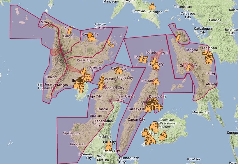
Google has created an interactive Typhoon Haiyan relief map showing rescue workers and the hundreds of thousands of Filipinos affected where they can find evacuation shelters, hospitals and medical centres.
The map, which can accessed above or found directly by clicking here, also details the parts of the country worst hit by the super-typhoon via its so-called “areas of calamity” function.
Updated roughly every 10 minutes, the tool employs a heat-map style design to chart the areas affected - as well as detailing rainfall levels and the ongoing risk of landslides and floods.
Typhoon Haiyan was one of the most powerful storms ever recorded, battering the central Philippines with sustained winds of nearly 200MPH.
Wind speeds at the point of landfall were 149MPH - 24mph stronger than those of Hurricane Katrina - forcing millions to flee their homes.
It is thought the Typhoon Haiyan death toll from has already passed 10,000.
Subscribe to Independent Premium to bookmark this article
Want to bookmark your favourite articles and stories to read or reference later? Start your Independent Premium subscription today.
Join our commenting forum
Join thought-provoking conversations, follow other Independent readers and see their replies