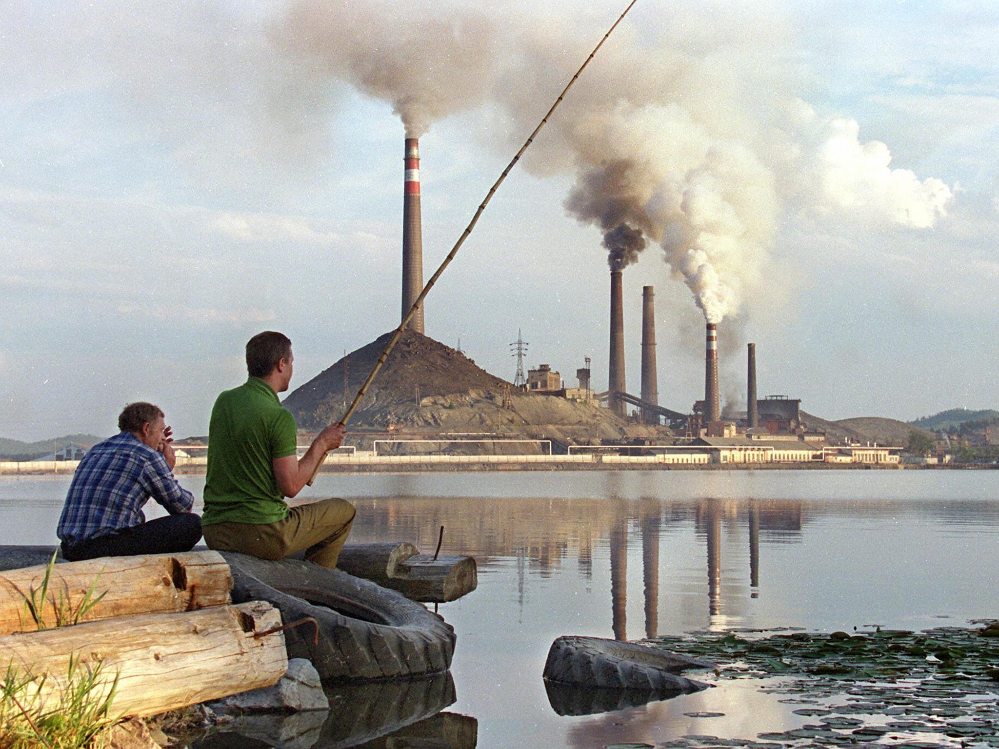
Climate change: Before and after photos show how we are killing the planet
Rising global temperatures, largely due to man-made greenhouse gases, are the source of observable changes to the Earth
Almost all scientists now agree that global climate change is caused by humans.
In late September, the British government pledged £5.8 billion ($8.8 billion) to tackle the problem in developing countries, and many other governments worldwide are also pouring money into solving the problem.
A steadily-warming planet affects the environment in different ways.
Rising global temperatures, largely due to man-made greenhouse gases, are the source of widely discussed, observable changes to the Earth, like melting glaciers, rising sea levels, warming oceans, and more extreme weather events, such as hurricanes, droughts, forest fires, and floods.
In the pictures that follow, we take a look at how climate-change-related events have affected regions around the world, whether directly or indirectly.
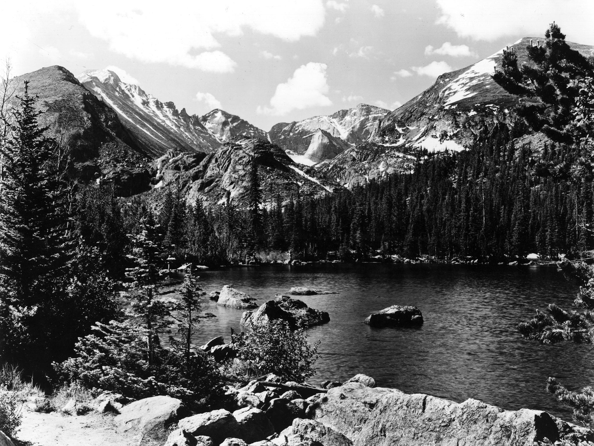
ROCKY MOUNTAIN NATIONAL PARK BEFORE: Healthy pine trees stretch for tens of millions of acres in the northwestern US and western Canada.
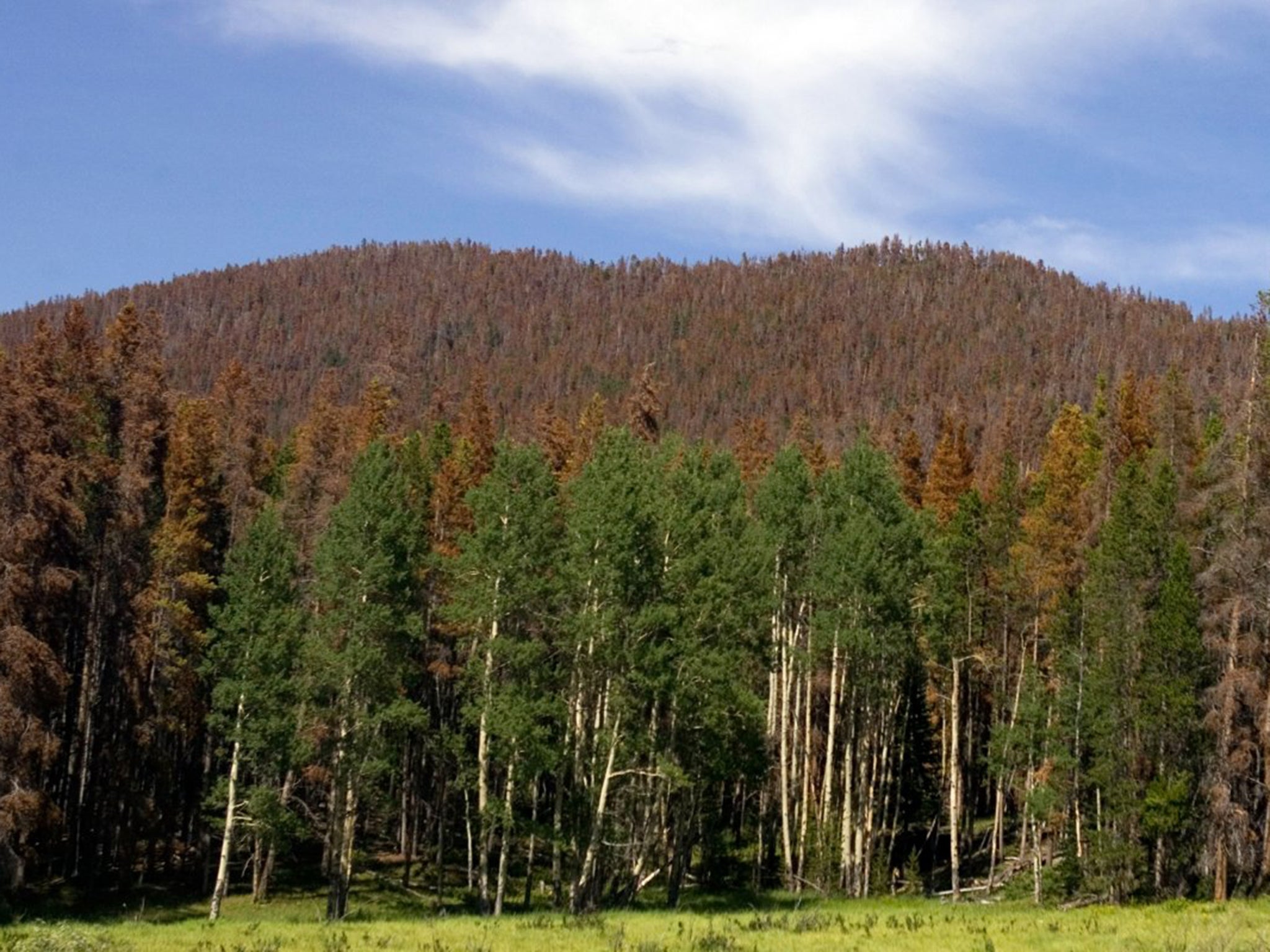
ROCKY MOUNTAIN NATIONAL PARK NOW: A hillside of dead pine trees killed by mountain pine beetles shows the effects of warming temperatures in the mountain ranges. In the past, freezing temperatures reduced insect populations. The beetles are now able to survive the milder winters, leading to devastating infestations.
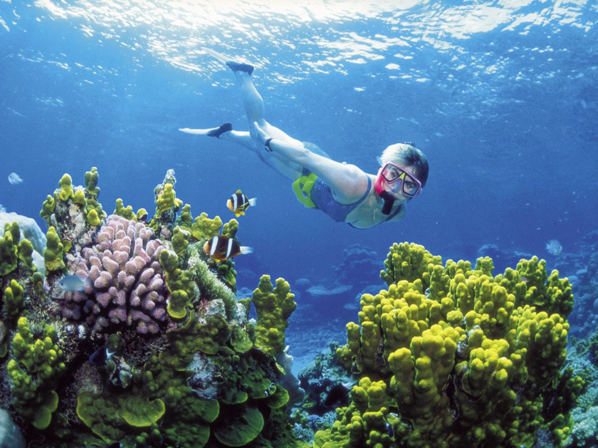
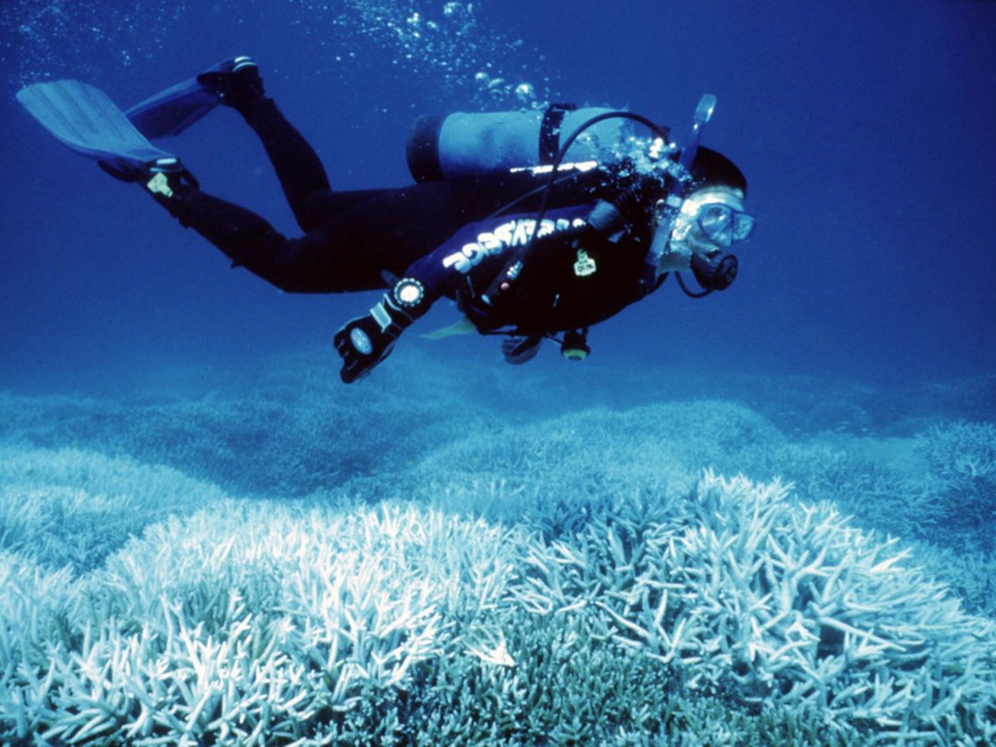
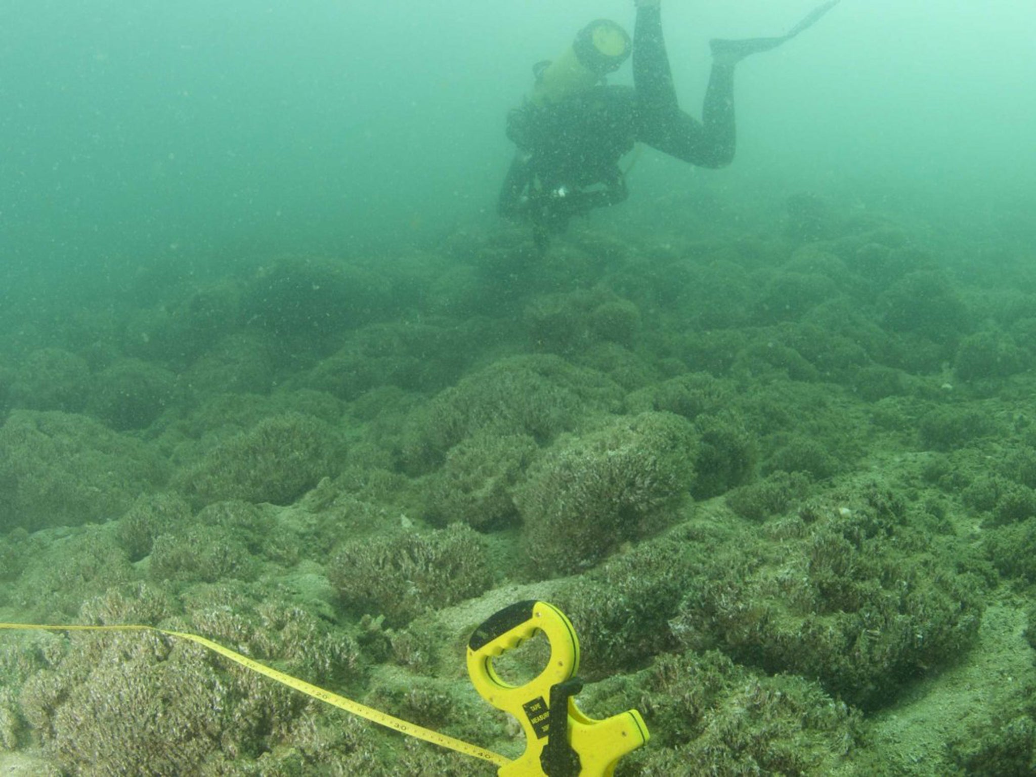
THE GREAT BARRIER REEF BEFORE: Considered one of the most biologically diverse regions in the world, Australia's Great Barrier Reef covers around 135,000 square miles, or an area that's nearly the size of Texas. Ocean acidification and temperature increases from climate change are the reef's biggest long-term threat.
THE GREAT BARRIER REEF NOW: Warmer water temperatures trigger widespread coral bleaching, when coral turns white and is more susceptible to death. Coral is vital to supporting ocean life.
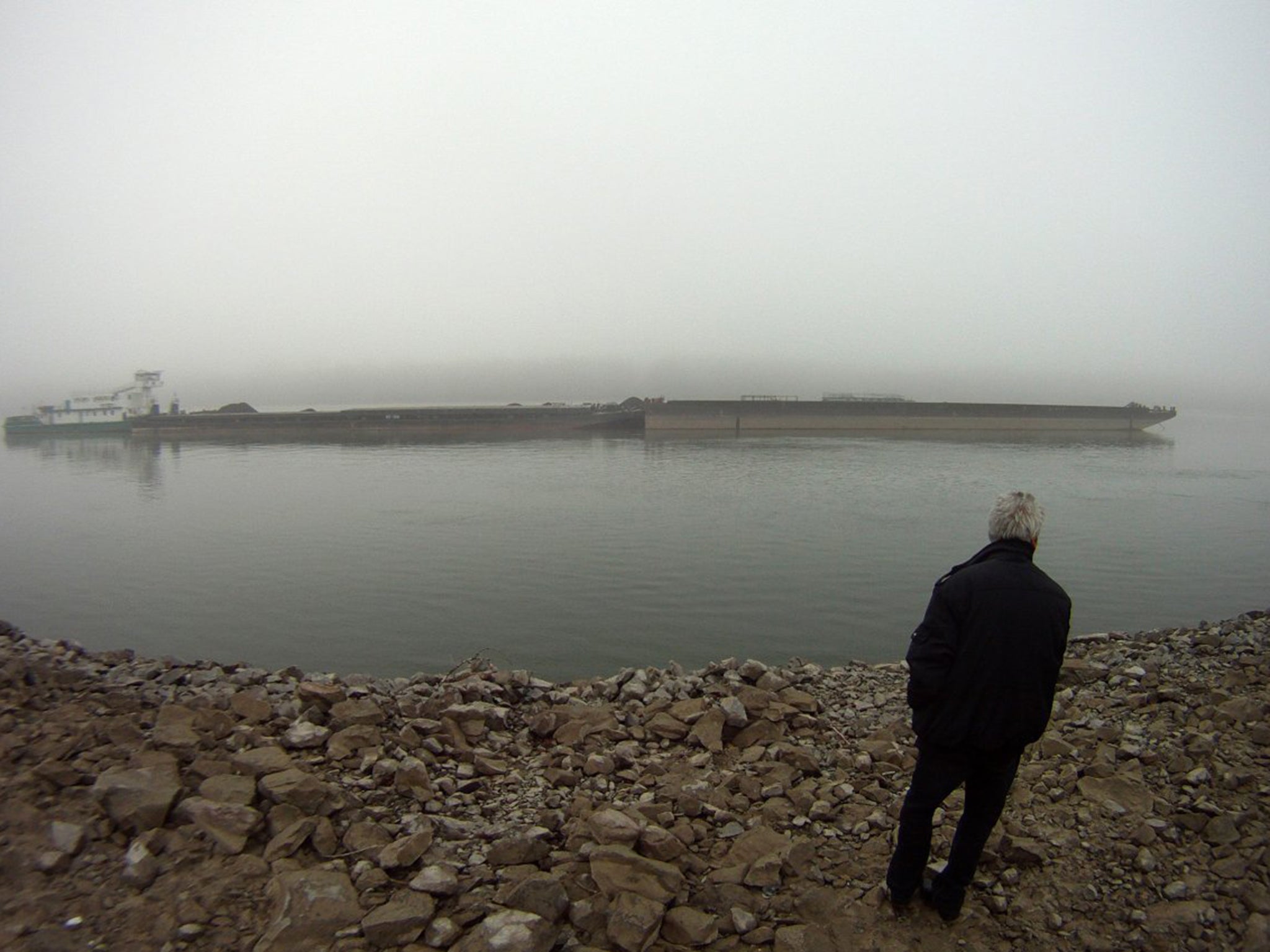
THE DANUBE RIVER BEFORE: The Danube, Europe's second-longest river, flows eastward from its source in Germany to the Black Sea in Romania. The Danube River basin is critical to supporting industry, transport, agriculture, and fishing.
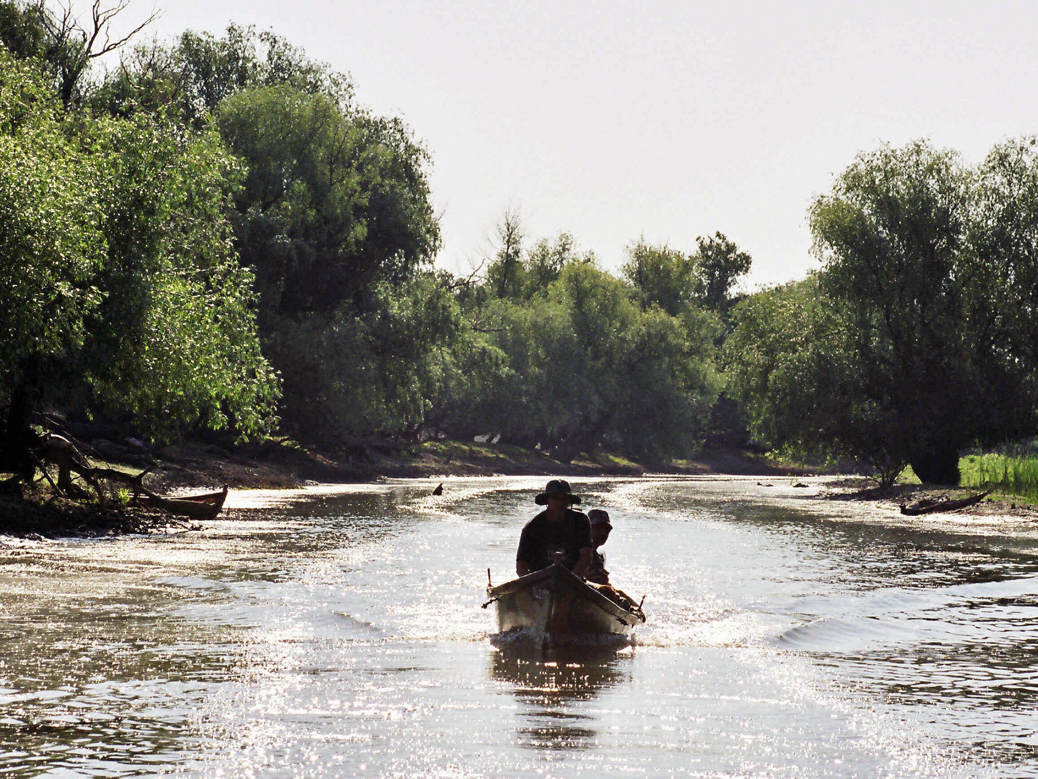
THE DANUBE RIVER NOW: Between 2011 and 2012, a persistent drought led to record-low water levels along the Danube, stranding boats and paralyzing parts of the busy waterway.
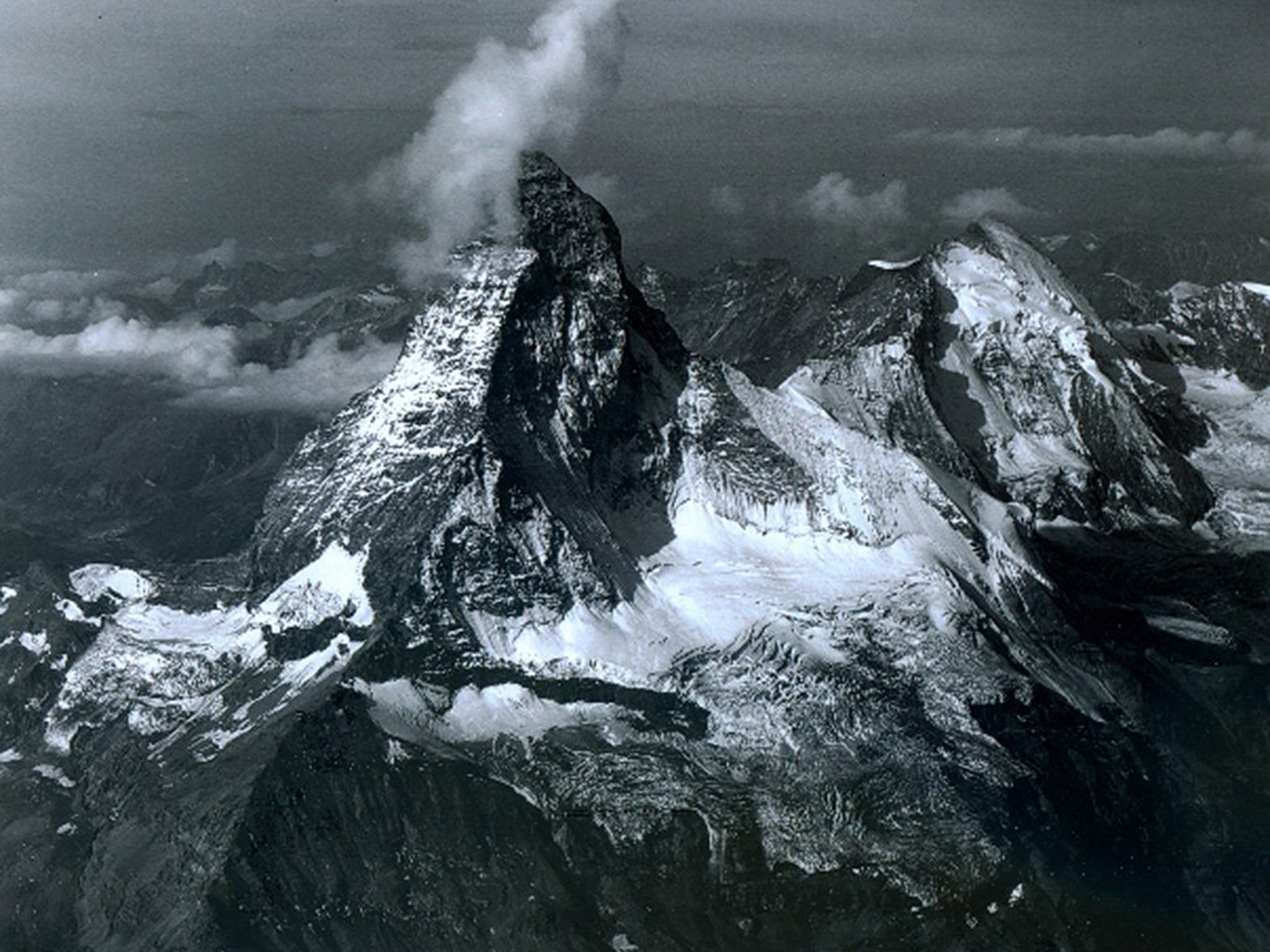
THE ALPS BEFORE: Matterhorn, one of Europe's tallest peaks in the Alps on the border between Italy and Switzerland, is pictured with a blanket of snow and ice August 16, 1960.
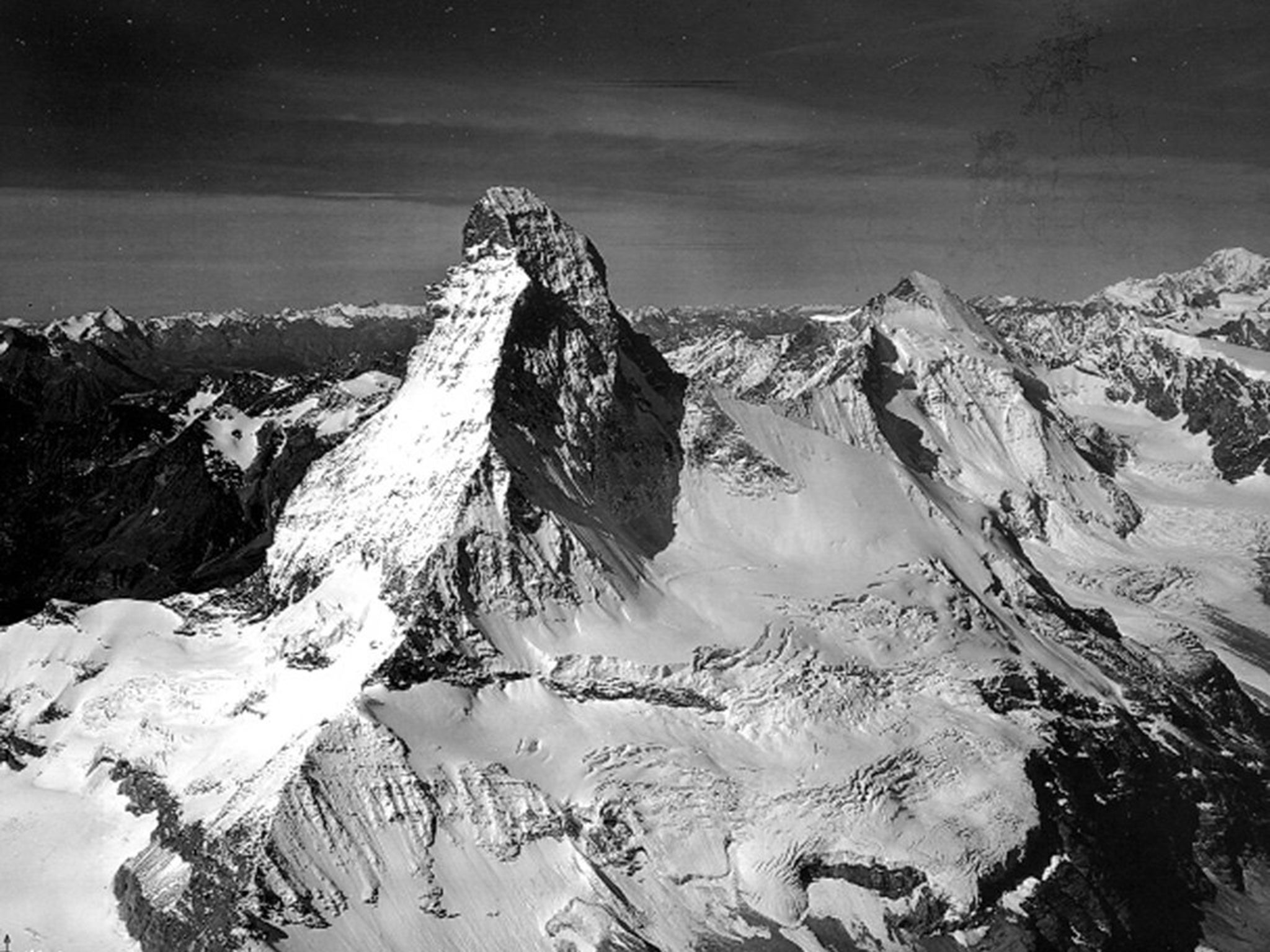
THE ALPS NOW: The Swiss peak, pictured August 18, 2005, is eroding as a result of melting glacier water at the summit. The water sinks into cracks and creates bigger fissures after several cycles of freezing and thawing. The disintegration of Matterhorn is anecdotal of the effects of climate change in most of the Alps.
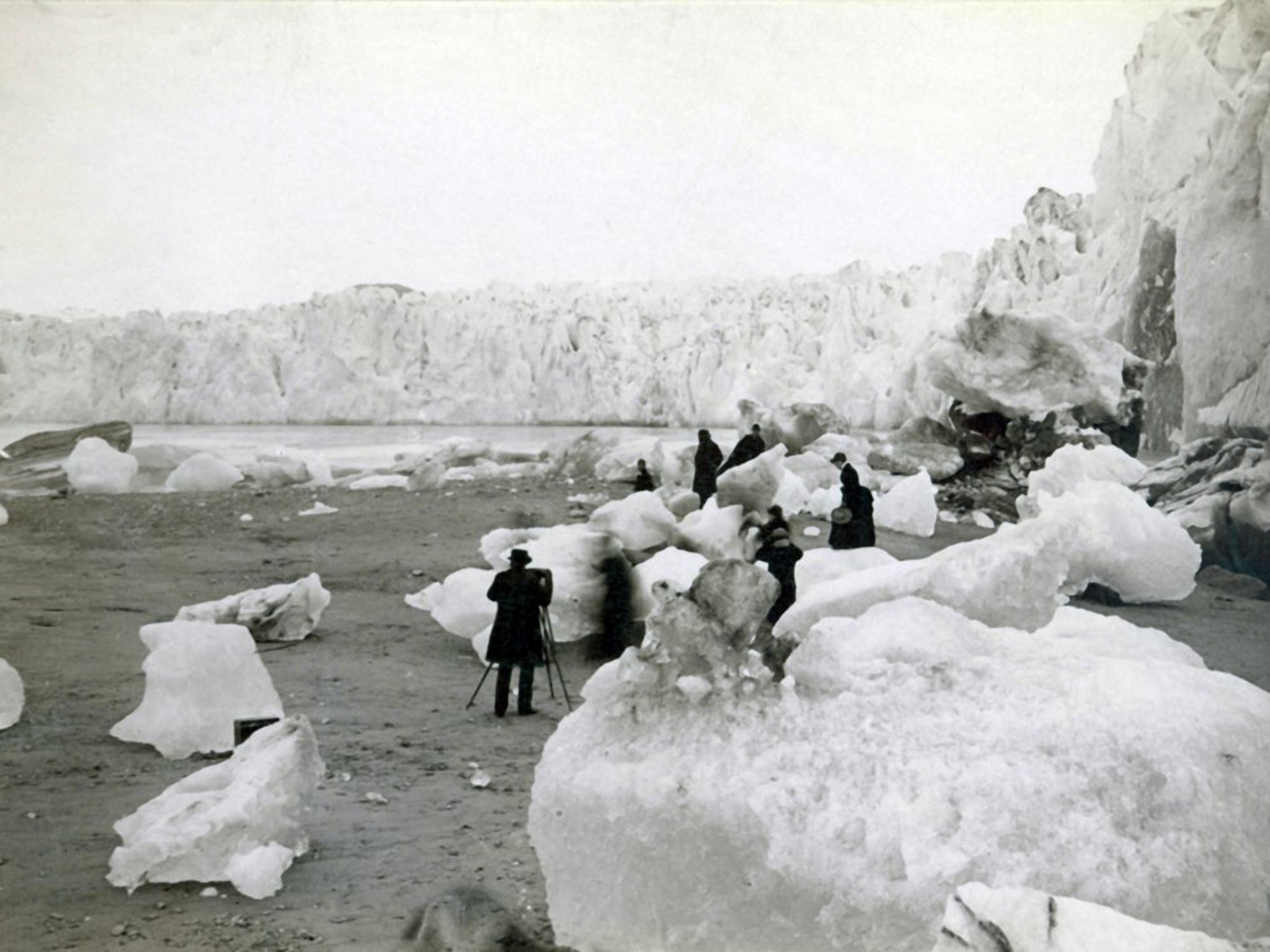
MUIR GLACIER BEFORE: A late-19th century photograph of Alaska's Muir Glacier shows many icebergs — some nearly 7 feet wide — in the foreground.
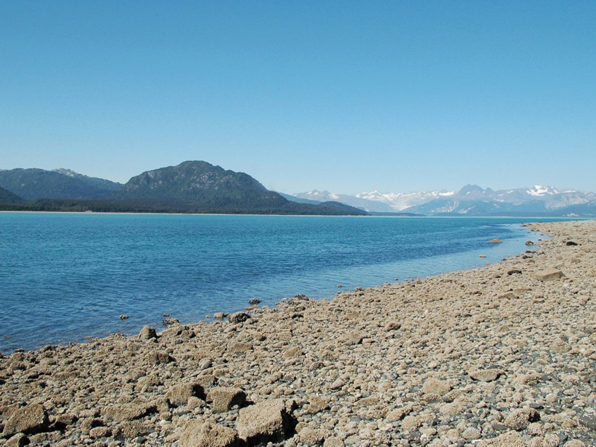
MUIR GLACIER NOW: By 2005, Muir Glacier had retreated more than 31 miles. Although this picture was taken from the same location as the early black-and-white photograph, the glacier is out of view. There's an abundance of vegetation looking to the west, and the beach in the foreground is now covered by pebbles, which came from sediment deposited by Muir Glacier and by melting icebergs on the ground.
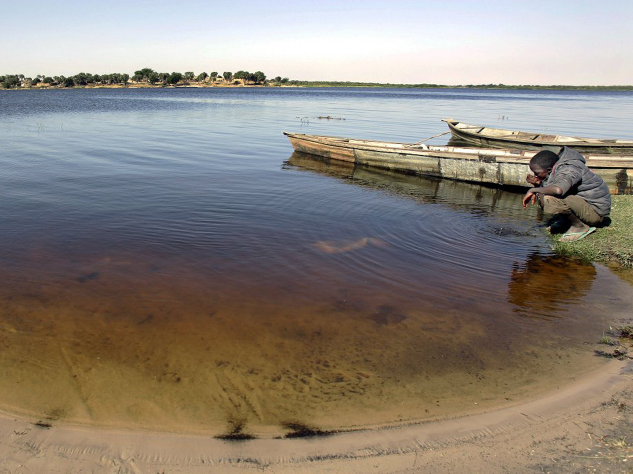
LAKE CHAD BEFORE: Africa's Lake Chad, pictured in the 1930s, was once the world's sixth-largest lake. It provided water to at least 20 million people in Nigeria, Chad, Cameroon, and Niger.
LAKE CHAD NOW: The lake has lost about 80% of its surface area since the 1960s, a combined effect of irrigation, the damming of rivers, and global warming.
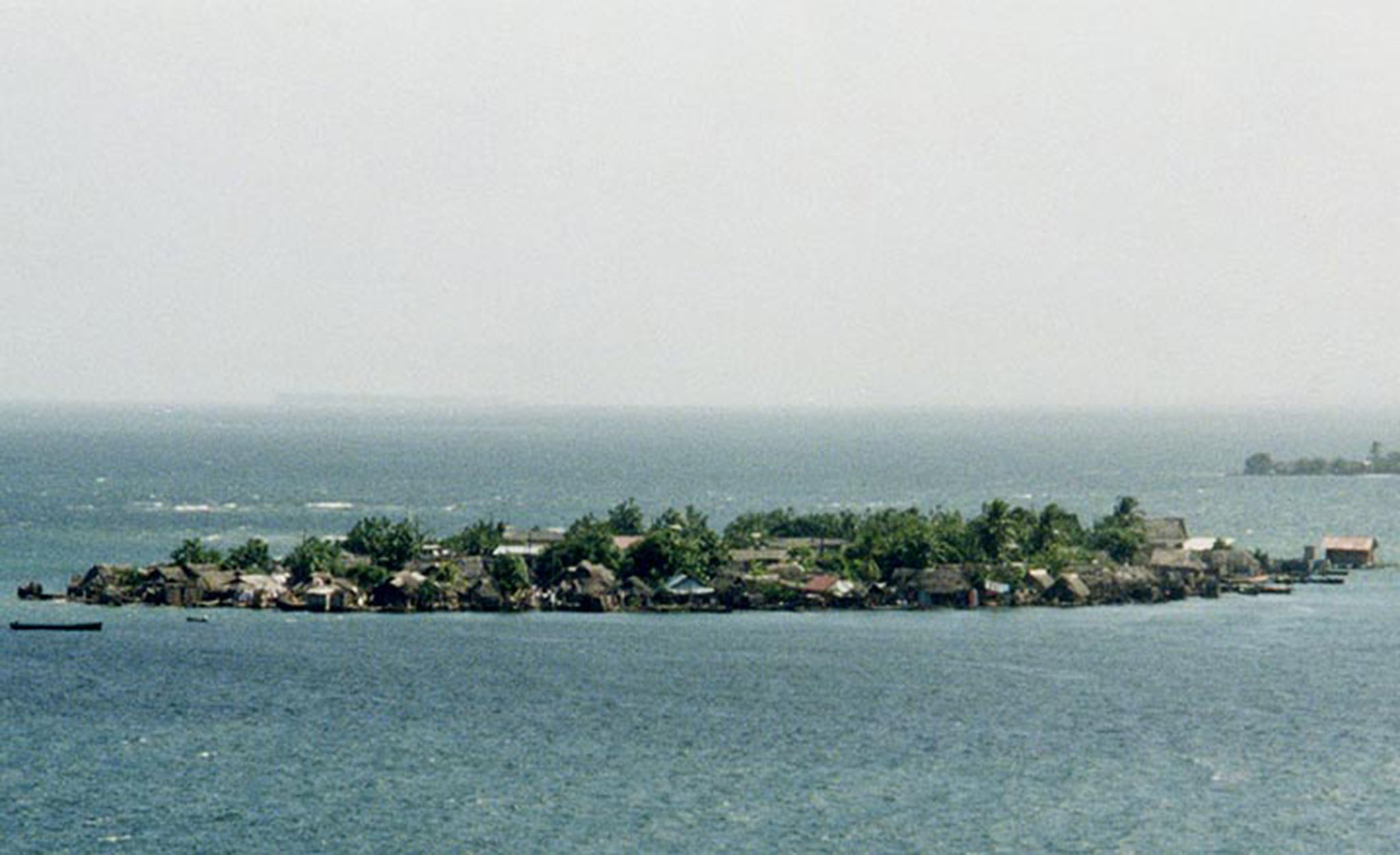
SAN BLAS ARCHIPELAGO BEFORE: The San Blas islands in Panama are home to the Guna people. Their traditional thatched-roof houses and ancient way of life are being threatened by climate change.
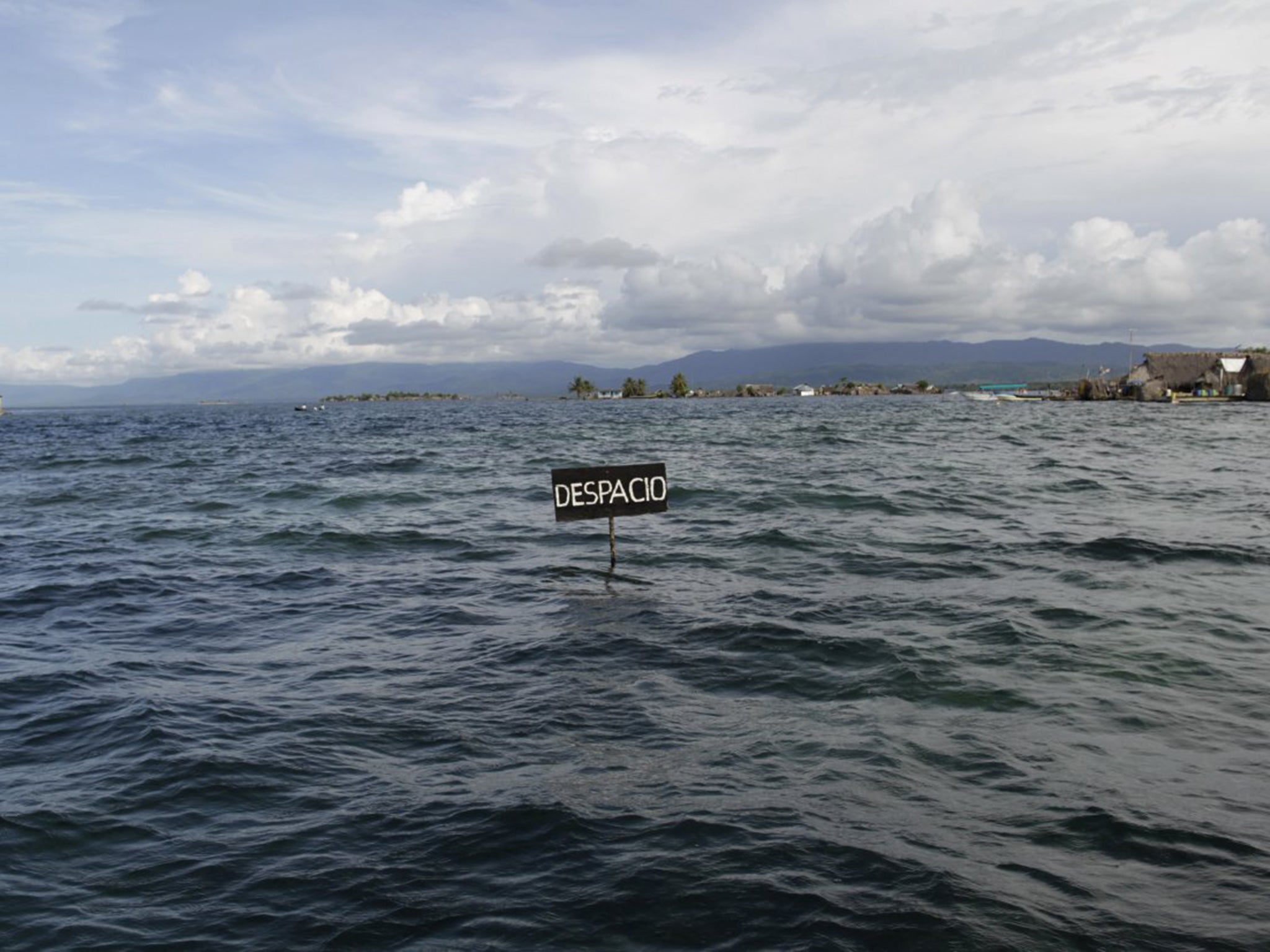
SAN BLAS ARCHIPELAGO NOW: The Caribbean island communities are flooded for several days every rainy season as a result of rising ocean levels caused by global warming. In the foreground, a traffic sign reading "Slow Down" is partially submerged.
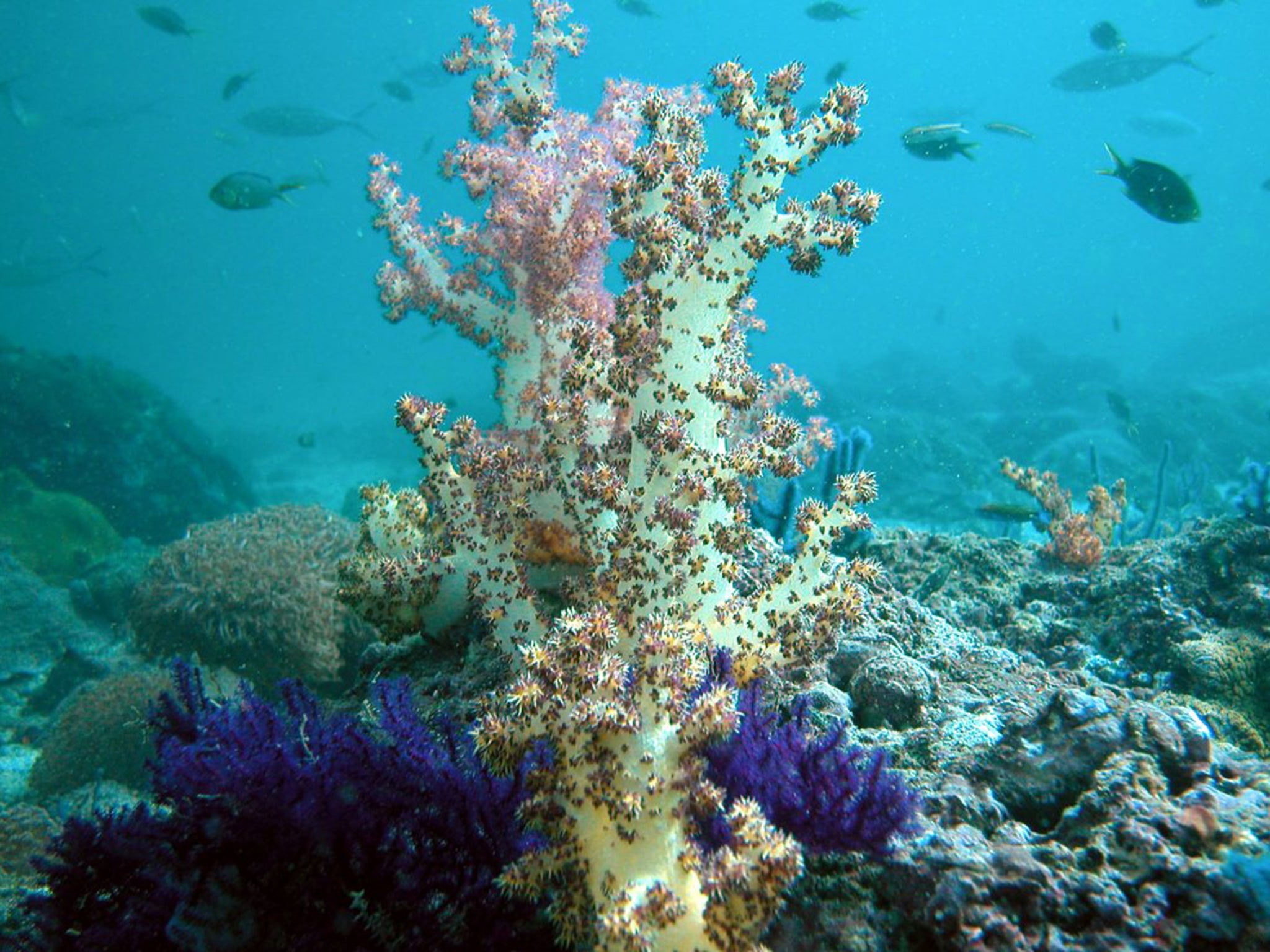
CORAL REEFS BEFORE: Corals seen in Dibba, on the east coast of the northern United Arab Emirates, are healthy and teeming with fish in 2004.
CORAL REEFS NOW: The reef was devastated in 2008 by harmful algae blooms known as red tide, potentially linked, in part, to increased greenhouse gases and rising ocean temperatures. The tide kills sea life by depleting the oxygen in the water.
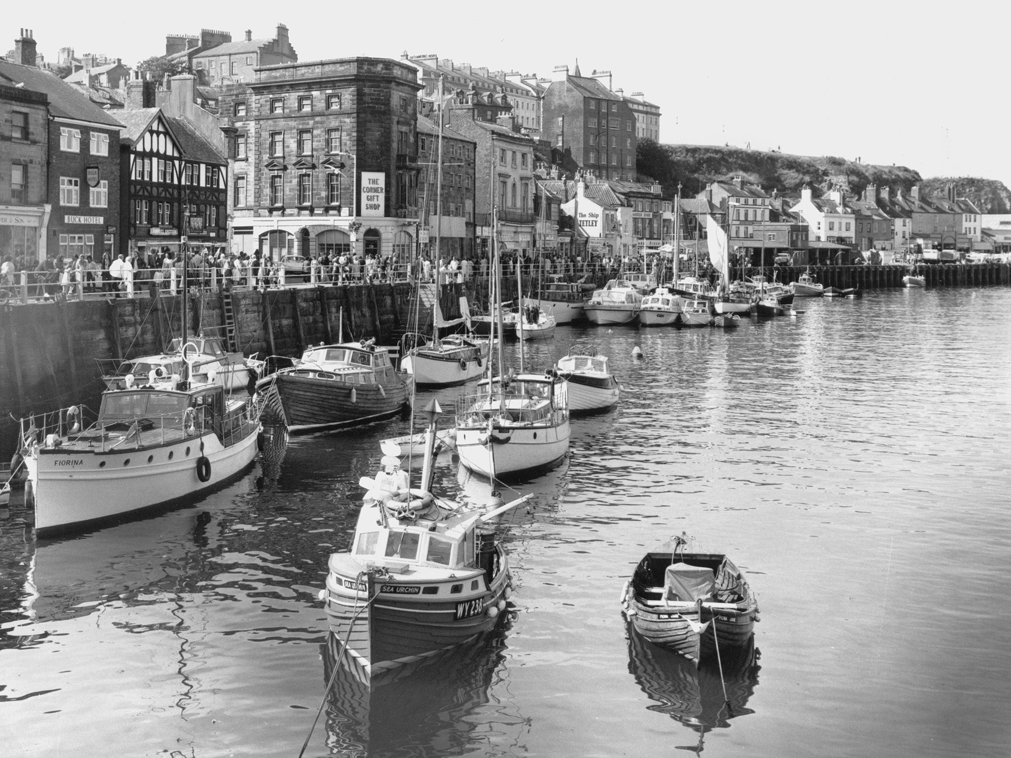
WHITBY HARBOUR BEFORE: Whitby, in northern England, was once a busy fishing town packed with boats, fish sellers, and tourists.
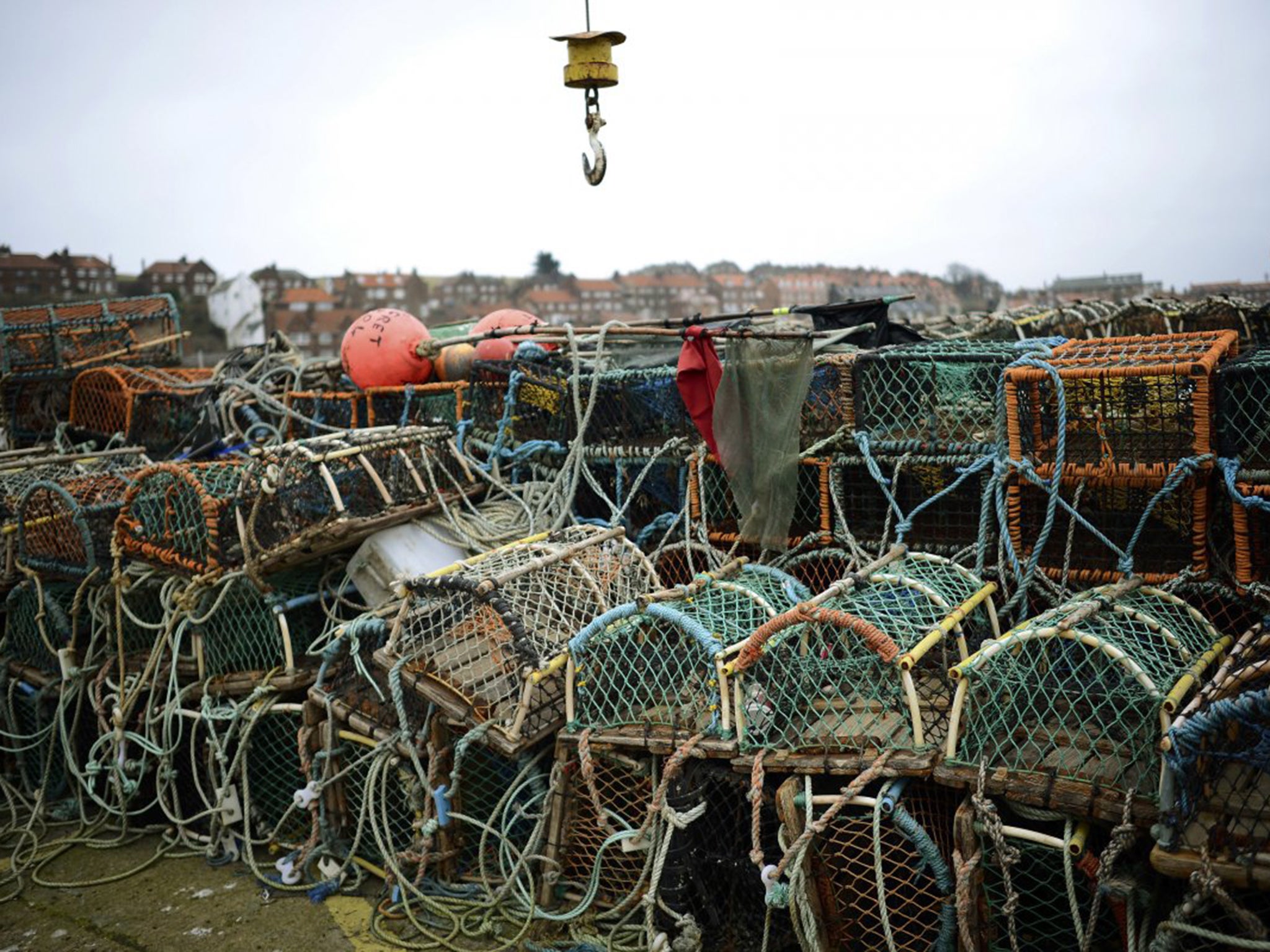
WHITBY HARBOUR NOW: The port is quiet, flanked by empty pots and nets and dried-out fishing boats as global warming has pushed fish stocks northward. Only about 200 fishermen remain in Whitby.
CARBON DIOXIDE LEVELS 2003: An infrared image from July 2003 shows the concentration of carbon dioxide in our atmosphere. The red areas indicate that carbon-dioxide concentration is at or above 380 parts per million.
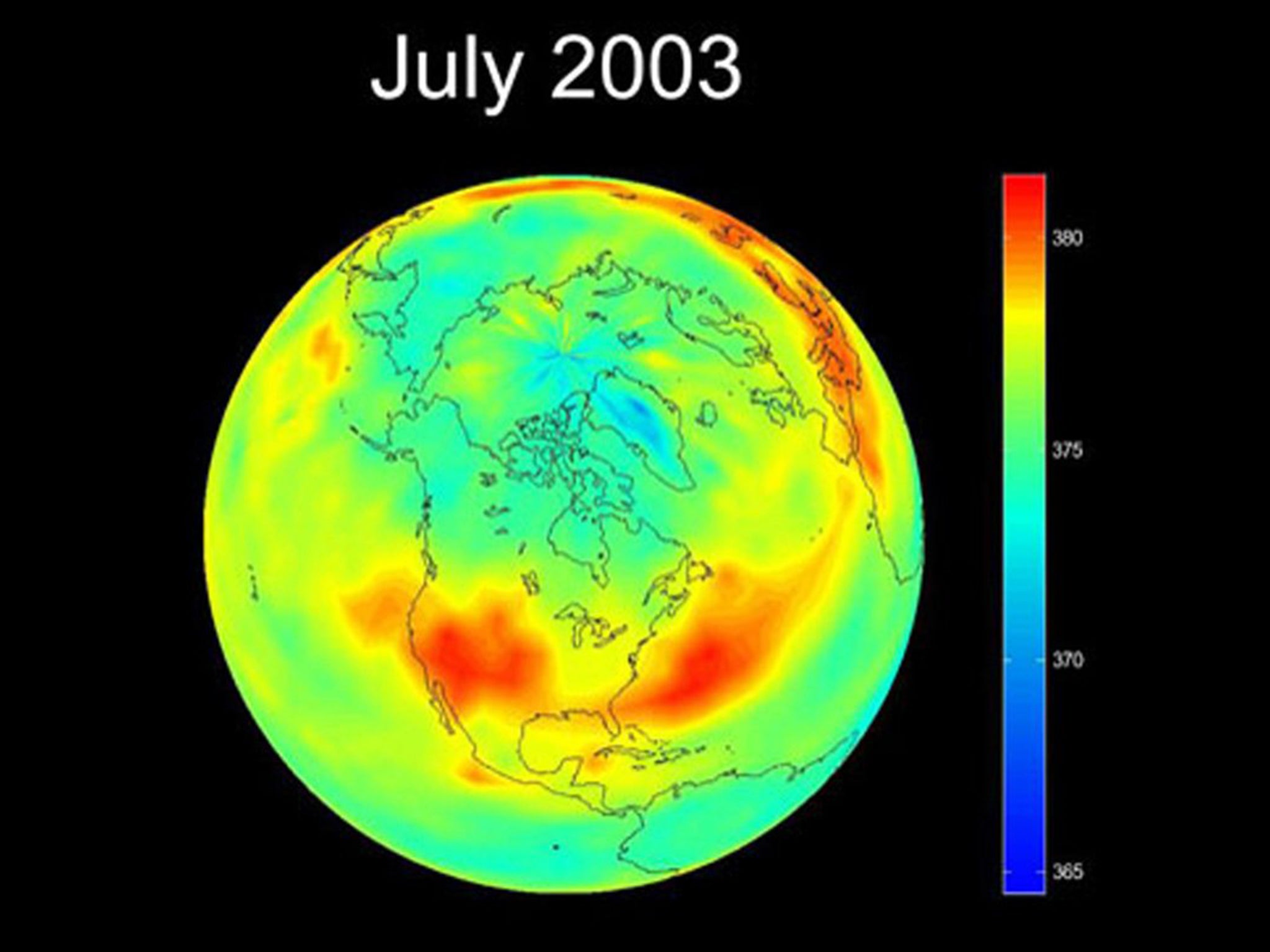
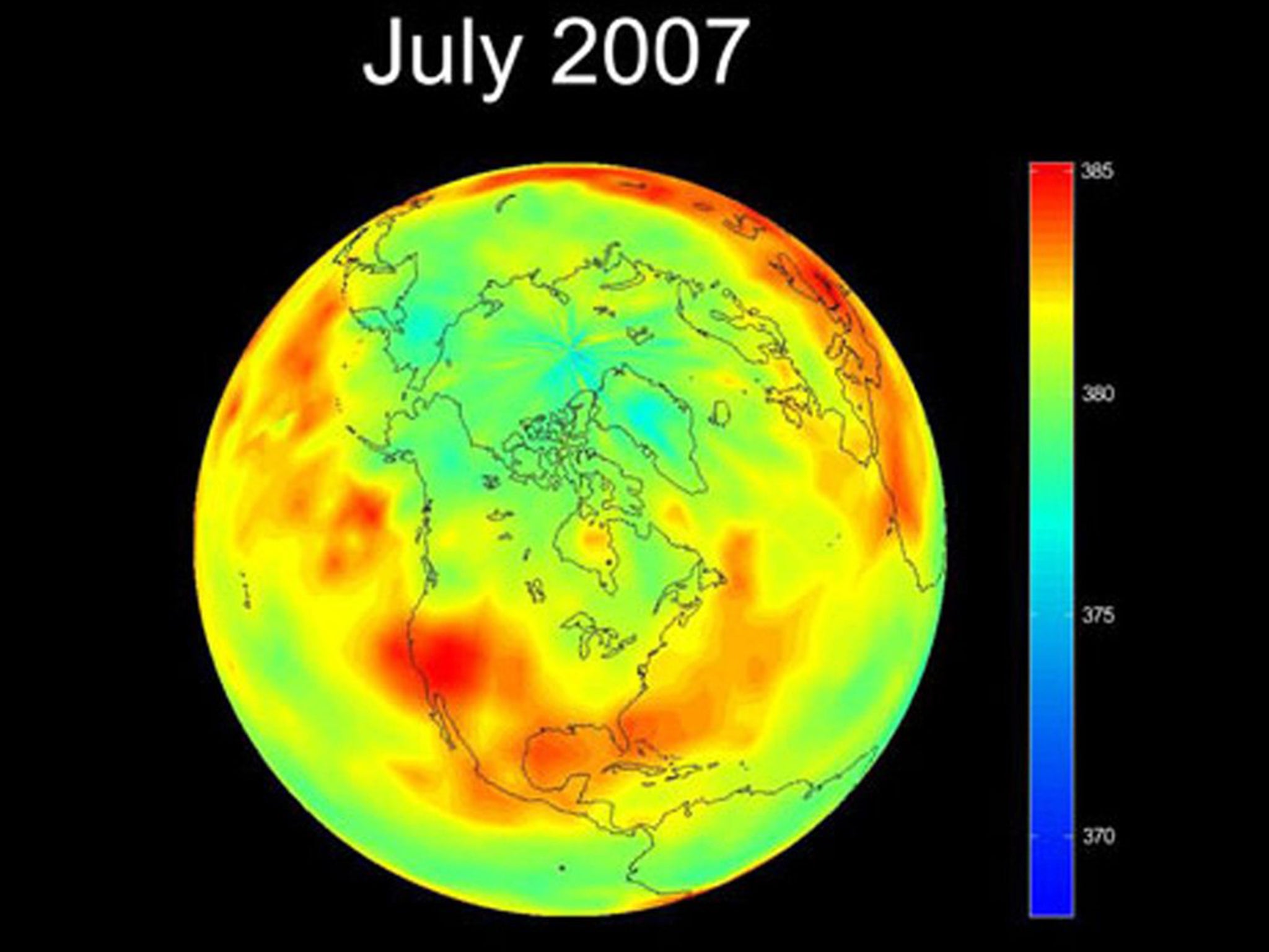
CARBON DIOXIDE LEVELS 2007: The same image of the globe, taken three years later in July 2007, shows that atmospheric carbon-dioxide levels are rising. The color bar used for 2003 had to be adjusted to account for the increase in carbon dioxide around the globe. Otherwise, the "2007 map would be saturated with reddish colors, and the fine structure of the distribution of carbon dioxide obscured," explains NASA.
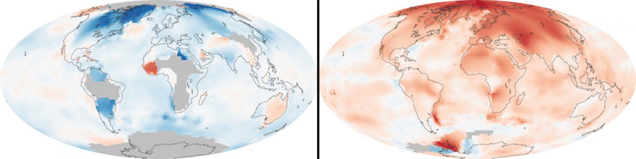
BONUS: These maps compare temperatures in each region of the world to what they were from 1951 to 1980. Earth's average surface temperature has increased by about 1.3 degrees Fahrenheit since 1880.
If this persists, humans may have to move to Mars.
Read more:
• David Cameron to warn about 'Brexit'
• Co-founder of Stripe on running $5bn startup
• China is on the brink of a major milestone
Read the original article on Business Insider UK. © 2015. Follow Business Insider UK on Twitter.
Join our commenting forum
Join thought-provoking conversations, follow other Independent readers and see their replies
Comments
Bookmark popover
Removed from bookmarks