Ex-hurricane Bertha in last blast as UK braces for more bad weather
The UK experienced the brunt of the stormy weather at 3am this morning, while flood alerts and severe weather warnings are in place for the rest of the weekend
The tail end of ex-hurricane Bertha slammed into the UK last night, bringing with it heavy rains and strong winds as a severe weather warning is placed on the whole of the country.
The main brunt of the storm arrived at 3am this morning, but it is expected to relentlessly continue into tomorrow with a "heightened flood risk", the Environment Agency said.
Shoppers in two supermarkets were reportedly evacuated when water began leaking through the roofs - in Asda, Sittingbourne and Morrisons, Maidstone. The ceiling of the latter also partially caved in.
A music and surf event in Cornwall has also called off festivities today due to the extreme weather, leaving revellers annoyed at missing out on headlining band Bastille.
In a statement, organisers of Boardmasters said: "In light of the extreme weather conditions caused by hurricane Bertha, today’s events at Watergate Bay have been cancelled. The international surf competition will be going ahead at Fistral Beach, as planned.
"Your safety and wellbeing are our primary concern and we have decided that the magnitude of the conditions is too severe for the arena site to be opened."
Hundreds of volunteers from the Red Cross were mobilised and placed on standby last night, after Friday evening’s weather saw much of the east of England struck by flash flooding, forcing the evacuation of some residents.
Head of UK emergency planning and response for the Red Cross, Simon Lewis, said: “Experience tells us that extreme weather could also lead to evacuations of homes and power cuts and we are ready to respond.
“We would urge people to keep a close eye on the forecast and think about preparing some basic emergency supplies in case the weather does take a turn for the worse.”
On Friday, more than 1,400 homes were also hit by power cuts, while yesterday was the wettest day on record in the town of Lerwick in the Shetland Islands.
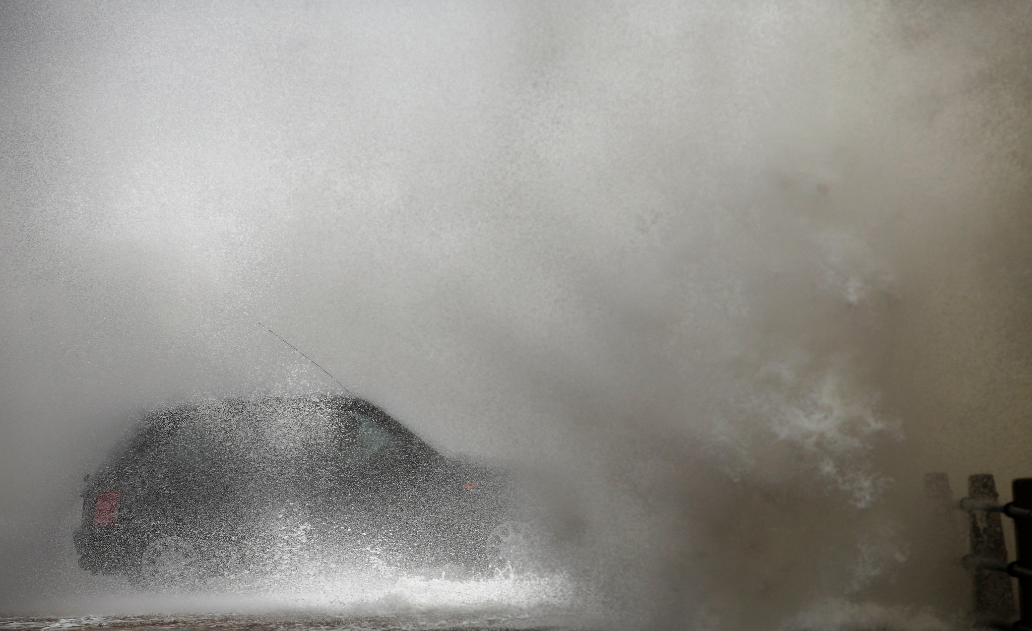
The worst is expected to travel across the rest of the UK today, with high waves and gusts of up to 50mph in some parts of the country, as well as flooding in coastal areas.
The Environment Agency has five flood warnings and 35 alerts in place for England and Wales, including Bridlington on the North Sea coast and in south and north Cornwall.
A yellow weather warning for rain has been given to the entirety of the UK, as well as wind in some parts, with the Met Office stating: “There is the potential for severe weather over much of the UK during Sunday as a complex depression tracks over the UK.
“There continues to be a great deal of uncertainty in the forecast but the public should be aware of the risk of flooding due to heavy rain as well as strong winds and large waves, particularly on the coasts of southern England and areas bordering the northern Irish Sea.
“Given the unseasonable nature of the weather this could be sufficient to disrupt transport and make outdoor activities dangerous.”
For this reason, a London to Surrey bike ride today has been shortened by 14 miles.
Organisers of RideLondon say they "reluctantly" made the decision to cut the race to 86 miles from 100 following advice from the Met Office.
In a miserable start to the week, further bad weather is also expected tomorrow and Tuesday.
The Environment Agency said: “There is a heightened flood risk today and tomorrow as widespread heavy rain falls across parts of England.
“A combination of high spring tides and strong westerly winds bring a risk of large waves and spray on the coast and possible flooding to the South West coast of England and along the Severn Estuary, moving towards the Humber and North East England on Sunday afternoon.”
Forecaster Simon Partridge said: “On top of Friday's heavy rainfall the rain we see today across the country could be quite significant.”
Additional reporting by PA
Join our commenting forum
Join thought-provoking conversations, follow other Independent readers and see their replies
Comments