Frankenstorm may disrupt travel for days
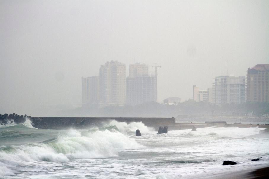
The superstorm expected to develop from Hurricane Sandy probably will mean that millions of people lose power for a week as airplanes are grounded and coastal areas are flooded by tidal surge and rain.
The system, dubbed "Frankenstorm" by the National Weather Service, will grow out of Sandy and two other storms rushing eastward across the U.S., said Tom Kines, a senior meteorologist at AccuWeather in State College, Penn.
As many as 45,000 National Guard and Air Force personnel in seven states have been alerted they may be called to duty, said George Little, a Defense Department spokesman in Washington.
"Because of the large size of the system and the slow motion, it's going to be a long-lasting event, two to three days of impacts for a lot of people," said James Franklin, branch chief at the National Hurricane Center. "The kinds of things we are looking at ultimately would be wind damage, widespread power outages, heavy rainfall, inland flooding and again, somebody is going to get a significant surge event out of this."
As of 2 p.m. New York time, Sandy's top winds fell to 75 miles (121 kilometers) per hour, down from 100 mph earlier, according to the hurricane center in Miami. It was 30 miles north-northeast of Great Abaco Island in the Bahamas and 430 miles south-southeast of Charleston, S.C., moving northwest at 7 mph.
The center's current track for the system has it going ashore just south of the Delaware Bay on Tuesday and moving northwest between Baltimore and Wilmington, Del. The path may change before landfall, the center said.
As much as 10 inches of rain may fall on parts of the Northeast, with the heaviest rain to the north of the storm's track. The damage will be spread across a wider area than that left by a typical hurricane, Franklin said.
"Our track forecast error is on the order of 150 to 200 miles," Franklin said on a conference call Friday. "We cannot be precise at this stage."
Franklin said the storm surge, or ocean water the storm pushes into the shore, will hit a larger area did than last year's Hurricane Irene. The storm will also be striking two days after the full moon, when tides are at their highest.
"The lunar tides, this is a dangerous period," said Louis Uccellini, director of the National Centers for Environmental Protection in College Park, Md. "And with the slow movement of the storm you can go through two or three tidal cycles, which also contributes to the potential impact of this event."
Where that will happen depends on the track and Franklin said no one can say yet where the flooding will occur.
Uccellini said there is the potential for at least 12 inches of snow in West Virginia and lesser amounts in Pennsylvania and eastern Ohio.
Power may be out as long as 10 days in some areas, according to a statement from the Edison Electric Institute, an industry trade group in Washington.
The storm may cause hardship for thousands, especially those that get hit by the snow and also lose power, said Mark Hoekzema, chief meteorologist at Earth Networks in Germantown, Md.
"Are you ready to potentially be without power for a week?" Hoekzema said by telephone. The windstorm that hit the Washington area in June "showed us how long it can take to get 3-plus-million people back, and in the Northeast Corridor you have even more people."
Discussions are under way to evacuate parts of New York City and close subways if necessary, said Jerome Hauer, New York State's homeland security commissioner.
"The worst case scenario is that the storm hits in the mid-Jersey area, with the right-sided winds," Hauer said in an interview. "That forces water in the ocean into New York Harbor and we get significant flooding in New York City, particularly in lower Manhattan, Brooklyn and Queens."
Sandy's approach to the Northeast will probably start disrupting air travel on Sunday as airlines move aircraft out of its way, Hoekzema said. He said he expects railroads will also have problems caused by trees falling on the tracks and power lines being knocked down.
"There is going to be a significant disruptions of pretty much everything from supply chains to travel for most of next week," Hoekzema said.
A tropical-storm watch was issued from near Savannah, Ga., northward to Oregon Inlet in North Carolina, the NHC said in an advisory. A tropical storm warning is in effect for Florida's east coast from Ocean Reef to Flagler Beach. A storm watch means tropical storm conditions are possible within the region, a warning means tropical storm conditions are expected.
"If the storm follows the current hurricane center forecast, we are looking at over $5 billion in damage," Chuck Watson, director of research and development at Kinetic Analysis Corp. in Silver Spring, Md., said Thursday.
Watson said the track may change quite a bit between now and early next week.
Sandy's apparent weakening doesn't accurately predict the storm it may become, said Matt Rogers, president of Commodity Weather Group in Bethesda, Md. Computer models suggest the hurricane may transform into a hybrid system over the weekend because of another storm moving in from the Midwest.
"When the storm phases with the energy from the west, it is forecast to deepen rapidly," Rogers said. "Indeed, it is expected to continue weakening until phasing really takes place late Sunday into early Monday."
Rogers said the barometric pressure may fall lower than when Sandy was a hurricane in the Caribbean. The lower the pressure, the stronger the storm.
New York Gov. Andrew Cuomo directed state agencies to monitor the storm and Massachusetts's Emergency Management Agency warned residents to expect the worst.
Virginia Gov. Bob McDonnell and Maryland Gov. Martin O'Malley declared states of emergency ahead of the storm.
The system crossed Jamaica on Wednesday and Cuba Thursday, tracking north across the central Bahamas. At least 29 people were killed in the Caribbean as homes were ripped apart and rivers flooded, the Associated Press reported. Dozens of flights were canceled.
Winds of at least 74 mph extend 35 miles from Sandy's core, while gusts of 39 mph reach out 275 miles. The distance from Freeport, Bahamas, to Fort Lauderdale, Fla., is 94 miles.
— With assistance from Anthony Capaccio in Washington, Freeman Klopott in Albany, Jim Polson, Henry Goldman and Steve Payne in New York, Lynn Doan in San Francisco, Yee Kai Pin and Alexander Kwiatkowski in Singapore, Julie Johnsson in Chicago and William Selway in Washington.
Join our commenting forum
Join thought-provoking conversations, follow other Independent readers and see their replies
Comments
Bookmark popover
Removed from bookmarks