Tropical Storm Andrea bearing down on Florida
Tropical Storm Andrea took aim at Florida's northern Gulf Coast today and was forecast to cut across Georgia and up the US Atlantic coast, the US National Hurricane Center said.
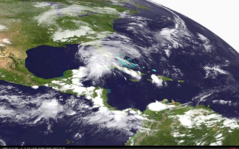
The season's first Atlantic tropical storm was churning in the Gulf of Mexico, centered about 160 miles (225 km) west of Tampa, Florida, the center said. Moving north-northeast, Andrea was expected to make landfall later on Thursday over the Big Bend area, where the Florida Peninsula meets the Panhandle.
Andrea packed top sustained winds of 60 miles per hour (95 km per hour) and was not expected to strengthen before moving ashore, the hurricane centre forecasters said.
Andrea posed no threat to US energy interests in the Gulf of Mexico.
Tropical storm warnings were in effect for much of Florida's Gulf Coast and for the US Atlantic Coast from northern Florida to Virginia, including the lower Chesapeake Bay.
"Tropical storm conditions are expected to first reach the Florida west coast within the warning area later today, making outside preparations difficult or dangerous. These conditions will gradually spread northward along the United States East Coast during the next 24 to 36 hours," the forecasters said.
The forecasters warned of coastal flooding and said the storm could bring heavy rainfall to Florida and the southeastern United States, and possibly a few tornadoes in Florida.
There were a few scattered power outages in Florida but no widespread loss of service.
The Atlantic hurricane season runs from June 1 to Nov. 30.
The US government's top climate agency warned in an annual forecast last month that this year's season could be "extremely active" with 13 to 20 tropical storms, seven to 11 of which are expected to become hurricanes.
Three of the six hurricanes could become major at Category 3 or above, with winds of more than 110 mph (177 kph), the National Oceanic and Atmospheric Administration said.
AP
Join our commenting forum
Join thought-provoking conversations, follow other Independent readers and see their replies
Comments
Bookmark popover
Removed from bookmarks