The Independent's journalism is supported by our readers. When you purchase through links on our site, we may earn commission.
The curse of satnav: On a road to nowhere...
They've put vans in ditches, sent cars down rivers and got HGVs stuck in sleepy villages. Now, satnav is coming to Britain's mobile phones. Michael Bywater laments the unstoppable rise of a technology that's spoiling the countryside, rotting our brains and wasting our money
We should have seen it coming. We should have seen all of it coming, really. Paula Ceely should have seen the railway tracks coming, and the train that hit her car moments after she got out. The 62 truck drivers who smashed into the same bridge in Grantham should have seen that coming. The stream of drivers plunging into 4ft of water at Luckington and having to pay 25 quid a go to get their cars pulled out; they should have seen the river Avon coming – just as the woman who drove down a farm track marked "unsuitable for motor vehicles" should have seen trouble ahead even before she drove into the river and was swept away. She should really have seen trouble ahead when she read the name of the village: Sheepy Magna.
Sheepy Magna? Had this poor woman never seen a Hammer movie? Nothing good could come of a place called Sheepy Magna. If it wasn't Vincent Price as the pub landlord, it would be the dead rising again, or alien children practising mind control, or even giant mutant sheep. Did she not realise? Does the £76,000-odd Mercedes SL500 not come with a windscreen?
Yes, of course it does. And no, of course she didn't, because, like all the others, she was using a GPS-based satnav system, a magnificent piece of intricate technology which guides you to your destination, helps you to avoid traffic jams, locates petrol stations when the yellow light comes on and will even, if you are a terminal dullard, offer you a guided tour of Places Of Interest wherever you are.
I say "dullard" because, if mine is anything to go by, a satnav system's notion of what is interesting is peculiarly selfish and narrow-minded. Mine is only interested, for example, in car parks. You can be driving through the most beautiful scenery in Europe, or through regions drenched in history, and the only thing that attracts its attention is a car park, seven miles off to the left. Vaut le détour, as the Michelin guides have it? I think not; but to my satnav, the sweetest words in the world are "Apcoa" and "NCP". If I weren't a decent and benevolent man, I'd think the thing had been got at.
When I say "we should have seen it coming", I mean it literally. The more we rely on satnav, the more the world becomes something seen – or unseen, or barely noticed – through glass. The glass of the satnav display and the glass of the windscreen become indistinguishable; the former is merely a better, more reliable (we believe) version of the latter. The cityscape, the buildings, the landmarks, this cathedral, that office block: they merge into something called "information", a better recension of which is available by looking at the satnav. We no longer notice the subtle shadings of terrain, the movement from escarpment down to estuarine plain, the changing crops.
There is a hill in south-western France I know where, at a precise point, the vegetation changes from temperate to Mediterranean. No satnav will point that out; anyone driving down that hill with the GPS fired up will think, "Gosh, is it still that far to Albi?" and never realise they have crossed some immemorial climatic or botanical dateline.
Or here, in Britain, is it really not possible to tell the difference between north and south? Start in the heart of England – Northamptonshire, where Earl Spencer lives – and head to London, and the capital starts announcing itself at Hemel Hempstead; by Luton, there is no doubt. Conversely, head north and, never mind the landscape and the habitations, the very placenames cry "Yorkshire! Yorkshire!" even before you arrive. Isn't Scrooby a hint? Scaftworth? Booth, Houghton, Brind, Holme-upon-Spalding-Moor, for heaven's sake?
Of course. But only if you're looking at those odd, analogue and, my dears, so passé things, road signs. If you're looking at the GPS instead, as it ticks away the flat, affectless, LCD miles, you're none the wiser. And so last week some rich people chartered a taxi to take them from Northamptonshire – indeed, from precisely where Earl Spencer lives (for one of the people was his daughter) – 85 miles to Stamford Bridge to watch a football match. Instead, they were shipped 150 miles in the other direction: to Stamford Bridge in Yorkshire. Scrooby, Houghton and all the rest were powerless. The hapless cabbie had simply typed "S-T-A-M..." into his satnav, which had obligingly come up with "Stamford Bridge" and, smiling at the wonders of technology, he had hit "accept" and gone for it. Literally. That he hadn't bothered even to think: "Hello, I'm going north, not south" should be no surprise; his brain, like all our brains when we turn the things on, had been deactivated, or, at the very least, overridden. In such a state, the cardinal directions become irrelevant. Meaningless. They have no place in the world-seen-through-glass.
But there's another explanation, which may seem absurd now but which, in a few years' time, will appear eerily prescient: that the satnav knew that in the back of the taxi there were some rich nobs, and that people like that couldn't – some might say "shouldn't" – possibly want to go to a footie match, and that grim greystone ironshod Stamford Bridge, Yorkshire, was far more to their liking.
Laugh? You wait.
But the one thing none of us can do is lay blame. I can snigger at the giant tanker I saw not so long ago, jammed solid with two wheels locked in a narrow Cotswold water-lane. I can clutch my sides with cruel laughter at the coachload of OAPs, all with, you know, bladders, trapped on a hill on a rural single-track road suitable only for elks. But I cannot lay blame. Recently, in Basingstoke, my satnav led me confidently ("at the roundabout, take the THIRD exit") into a sort of housing estate and up to a dead end, the road comprehensively barred. "Bloody thing!" I shouted – the sight of men in cars shouting at their satnavs is becoming increasingly common – and set off for where I knew, roughly, I should really be.
The damned thing went ape. "Take the next right," it yelled, "perform a U-turn! Turn right! TURN RIGHT!" The more I ignored it, the more vehement it became, until finally it gave up and fell into a sulk. Presently I found the house I was looking for. There was a soft chime, and the words "You have reached your destination."
I couldn't believe that the damned thing was claiming credit. Yes, I had reached my destination, and had done so despite its efforts to mislead me. I turned it off brusquely and stepped out of the car. Something looked familiar. Ten feet away, in this quiet cul-de-sac, was a barrier across the road. I walked to the other side and looked back. It was the exact spot that the satnav had brought me to originally. It hadn't known about the barrier; and I hadn't had the wits to look at the map.
On the way home, I decided to give it another chance. It seemed... oddly chastened. "Turn right," it said, with quiet confidence. "Turn left," it said, presently. "Turn right," it said, as we reached a dead end and a steel fence, 50ft above the road it wanted me to turn right on to. At that point, I confess, my faith wavered, unlike the Japanese man who legendarily, in the very early days of car satnavs, drove down a slipway and into the harbour, exiting his Lexus as it sank gracefully to the bottom. A man from the local paper interviewed him, and he may have been the first person to utter the now common observation: "The satnav told me to go that way and I assumed it knew what it was doing," a phrase which has subsequently become the duff navigator's Nuremberg Defence.
But it was what followed that was truly strange. "Has this damaged your faith in the new technology?" the reporter asked. The driver puffed himself up with righteous outrage. "Certainly not," he replied. "I think it's marvellous."
And there lies the problem. The machine fouls up, and we assume it's us. We have become its slaves. Instead of it becoming our assistant, we become its avatar. The satnav is like those huge disembodied brains you see in horror films, bubbling away in a tank in a barn in Sheepy Magna while the lobotomised locals do its (invariably evil) bidding. If they stopped to think, they would realise that what they were doing was wrong, and foolish, and would have Consequences; but they have surrendered themselves to its evil spell and Bob's your uncle, plus £25 for the tow-truck.
At the heart of it lies our relationship with seemingly intelligent machines. There is on my desk at the moment a new book for review, called Love and Sex With Robots. It has not yet been published, but I can tell you that the author's thesis is that in due course we will Love, and have Sex With, Robots. "Bah," you may say. "Humbug," you may add, if you are of a literary turn.
But don't be too sure. Never mind our 2,500-year discourse on what it means to be human or, indeed, alive. Never mind our thoughts about love and affection, about eros and philia; if a robot comes along that looks right, sounds right, feels right and is up for it, on past evidence we will leap upon it with cries of delight (and let's not even think about the customer service call-centre experience when things go wrong).
There is something about machines which communicate with us that makes us suspend our disbelief. We must all by now know, surely, that there is no such thing as machine intelligence, at least not yet. What machines do is simply high-speed stupidity. All a satnav device knows – the only thing it knows – is where it is, right now, on the earth's surface. It does this in precisely the same way an ancient mariner would take a fix of his position: by taking bearings (from the sun, the stars or from landmarks on shore) and locating himself where they intersect.
Satnav does the same thing using the Global Positioning System (GPS) maintained by the US Department of Defense. It was developed in the late 1970s and has been globally available since 1994. Put monstrously simply, it works by each satellite sending out signals saying: "This is me, and this is the time." The GPS receiver in your satnav knows the identity of each satellite and where it is at that time. It also knows when it receives the message, and, since the speed of light is a constant, it knows how long it took to get the message and thus how far away the satellite is. Do this with two satellites and you get two possible positions, one on each side of the earth. Get a bearing from a third satellite, and you know where you are, within the accuracy the US Defense people permit.
This, for a start, is crucial. Satnav accuracy has improved, but in the early days the US DoD used to deliberately degrade the signal for civil use so that it was accurate to within 100 metres, not the few centimetres of which it was capable. As a part-time pilot, chugging round Europe in an old Cessna, I first used GPS for aviation around the time of Gulf War Version 1, and knew precisely when serious business kicked off – as did every other pilot – because the GPS would announce that, all of a sudden, we were somewhere off the Isle of Wight when we could see Biggin Hill airfield under the starboard wing. The DoD had degraded the signal, and quite right too.
The modern GPS kit certified for blind flying is self-monitoring, and knows when it has lost the signal or something has degraded it. It alerts the pilot accordingly, who turns to other backup instruments. More importantly, all pilots are trained from the word go in "situational awareness": transferring the raw information from GPS, VOR, ADF, DME and all the other three-letter abbreviations which fill an aircraft instrument panel into a mental picture of where you are – the nearest airfield is 50 miles over my left shoulder, there's a range of mountains 20 miles off at two o'clock, north is over there, we'll be over the coastline in 17 minutes, and so forth.
So when it all goes pear-shaped, not only does the kit tell us it's gone pear-shaped, but we also, in theory, have a mental picture of the pear and know, at the very least, that we're at the stalk end and should be heading for the core.
Even then, it's only as helpful as what we tell it. I once got a severe telling-off for approachng to land at a military airfield in Adelaide, Australia, with the sublime insouciance of someone who had typed in the wrong destination code and thereafter simply followed instructions. "Nearer the north-west edge of the city than I thought," I mused. "Runways different than I expected," I observed. And kept on going until the shouting started.
And once I was accosted by a bloke on the tarmac at Broome, WA. "What're you doing?" he asked. "Putting the co-ordinates into the GPS," I said. "Why?" he said. "Because there are no bloody landmarks for 300 miles," I said. "Exactly," he said. "Mount Hart is the only thing between here and damn-all. So you just take off, fly in that direction, and after two hours you'll see it. There's nothing else to bloody see." He was right; but I felt strangely naked without my constantly updated ETA, ground speed, wind velocity and a whole lot of other stuff I had no need for.
It's worse with cars. For a start, car drivers aren't taught about situational awareness and when we rely on satnav we can get more hopelessly confused than if we didn't have it at all. I remember driving round the centre of Guildford, an ancient morass of narrow streets and one-way systems. The satnav became simply hysterical, issuing instructions faster than the synthesised voice could announce them. "Turn left at the next at the roundabout take the make an immediate U-turn right make an at the roundabout..." After 10 minutes of this, I had not the slightest idea where I was.
At which point I realised that no woman would ever have invented the car satnav. Women have a skill which renders it superfluous, a skill which men do not possess: the ability to pull over to the side of the road and ask another human being for directions.
Because that's all a satnav is doing anyway. Except that the human beings aren't there. They aren't even in a call centre. They are the people who fed the thing with its mapping data, quite possibly a long time ago. If I were a council employee on damn-all a week, charged with compiling one-way-street data for my employers to flog to TomTom or Garmin or whoever, I'd be tempted to chuck in the odd flanker ("Let's swap Laburnum Avenue with Factory Street for a joke"); wouldn't you?
Any machine – any computer – is only as good as the data that go into it, and satnav is no different. If the data are faulty, you've had it. The machine can't think, "Oh, come on, that's not true." The machine doesn't know that this road has been closed, or that this lane will trap anything bigger than a pram. It doesn't know where you really want to go. And it doesn't care. It is not, as one woman told me, "so comforting to know that the satellites are looking down upon me, from space, knowing where I am". The satnav is looking up at the stars, while we're heading for the gutter.
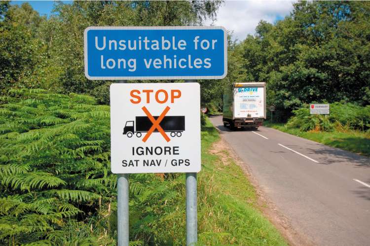
The result? Jammed lorries, cars in rivers, tiny villages used as rat-runs, the countryside spoiled with yet another rash of signs, this lot saying "Unsuitable for HGVs" on lanes which truckers would never have known about unless their satnavs had given them the literal bum steer.
But there's worse to come. The big word in information technology is "convergence" and it's coming soon to just about every piece of gadgetry you own. Once, your computer recorded your stuff. Then, with the internet, it told you other stuff, about other people or things. Now – with or without your consent – it is telling them about you. Where you go, what you buy, who you contact.
Now we have the technology to do that with mobile phones. Already they can triangulate your position roughly, according to which transmitters your phone is using. Now, as GPS becomes built in, they can tell exactly where you are. And they can tell that to the whole network. It's not only an anti-adulterer's charter (how easy to turn on the cellphone camera remotely, to collect the GPS data, and prove, with photos, that you were there, with Trixie from Goods Inward, in room 307 at the Grimsdyke Roundabout Travelodge at 3.17pm), but an instrument of general surveillance. In a world of increasingly paranoiac governments obsessed with control – terrorism is the excuse; the reason is to keep an eye on all of us, all the time – how long do you think They will be able to resist knowing where you are at any time, as well as everything else?
Already, in the United States, there's a growth industry in surveillance devices for filming your teenage kids in the family car, and for transmitting their satnav-determined position back home. Is it going to stop there? Once something designed to tell you where you are becomes able to tell Them where you are with no extra effort, the great dream of universal surveillance has come true.
And, of course, it's an opportunity for obfuscation. In "The Diamond as Big as the Ritz", F Scott Fitzgerald postulates a man so astoundingly wealthy that he can pay to have his house, on its diamond mountain, removed from the maps. Once all our maps are electronic, how much will we be able to trust them? We've already seen the US government order Google to strike or obliterate certain "sensitive" aspects from its Google Earth maps; is that as far as it will go?
Finally, let's not forget the traveller in a distant land. Equipped with a handheld GPS, one of the great joys of travel – to leave your hotel and wander aimlessly until you no longer know where you are – becomes sadly diluted. Instead, your GPS phone will be selling your location as you go; text messages will lure you into clip-joints, up alleyways, into while-you-wait tailoring stores, round the corner, special bellydance, very good very cheap – or, God help us, TRN LFT U FND GR8 NGLISH PUB W KARAOKE 2NITE.
The answer: a reliable map and an old-fashioned magnetic compass. Reclaim two great human rights: the right to get lost, and the right to disappear. Oh – and look where you're going.
How to live without satnav
By Rob Sharp
* First off, don't be afraid of paper maps. So says Ordnance Survey (OS) expert Paul Beauchamp, who recommends carrying an old-fashioned hard copy even when you have a satnav. "The battery could fail, or you could lose the satellite signal between two high buildings," he warns. "People might have bad memories of maps from school. Don't let the amount of information on them overwhelm you."
* Get up to speed on how things such as the key, index and scale work. In the case of OS road maps, colours of the roads are handily equivalent to the colours of the road signs – blue for motorways, green for A-roads – which can be brilliantly useful. In an atlas, the index can give you a quick idea of your bearings. Scale-wise, 1:200,000 means a centimetre equals 200,000 centimetres (or two kilometres). The smaller the second number, the more detailed the map.
* Plan your route before you leave, rather than trying to work it out once you've set off (and have also to concentrate on driving). You can see the areas through which you'll be travelling, prepare halfway-point stops, and work out how to avoid traffic black spots.
* Make sure you know which major towns and cities you will pass through en route – they will be the ones which appear on signposts. Once under way, make sure you or your navigator's eyes are on what you're passing. "If you remember the last village you went through, it will be easy to locate yourself if you get lost," says AA maps expert David Arnold.
* Don't think the shortest line between two places is the speediest. "If you are lucky, you can travel twice as far on motorways in half the time as travelling on an A-road," adds Arnold. The strategic "overview" in the front pages is the best place to start planning a journey using an old-fashioned atlas.
* If you have a computer, online technology can be incredibly helpful. Try the much-lauded AA Route Planner (www.theaa.com/travelwatch).
* Make sure your map is up to date. "You wouldn't use an out-of-date phone book, so don't take the same risk with a journey you want to make," advises Beauchamp. Ordnance Survey reissues its road maps every year.
* Finally... if you do end up lost, don't be afraid to ask for directions. Wherever you are, the locals won't bite!
For more information, see Ordnance Survey's video podcast on how to read a map properly at www.ordnancesurvey.co.uk/oswebsite/.
Join our commenting forum
Join thought-provoking conversations, follow other Independent readers and see their replies
Comments
Bookmark popover
Removed from bookmarks