Tropical low off northeast Australia expected to become cyclone and dump heavy weekend rains
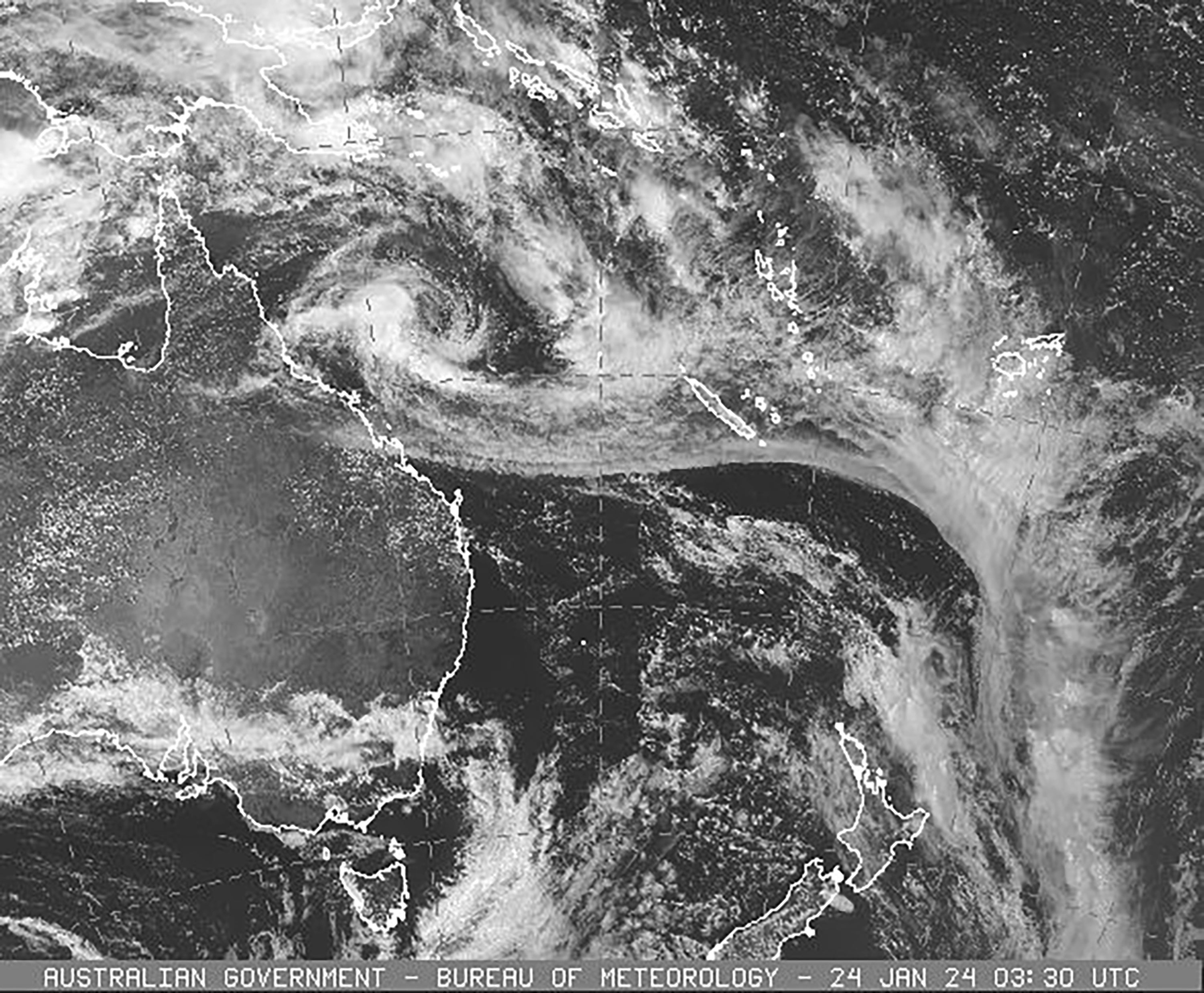
A tropical low slowly moving toward northeast Australia is expected to reach cyclone strength later Wednesday and bring flooding into Queensland state into the weekend

For free real time breaking news alerts sent straight to your inbox sign up to our breaking news emails
Sign up to our free breaking news emails
A tropical low slowly moving toward northeast Australia is expected to reach cyclone strength later Wednesday and bring flooding into Queensland state into the weekend.
The system expected to be named Tropical Cyclone Kirrily was moving west at 5 mph and forecast to make landfall overnight Thursday.
“After the cyclone crosses the coast, it’s likely to weaken to a tropical low but have very high levels of rainfall associated with it," Queensland Premier Steven Miles said at a news conference in Brisbane. "And so depending on its path, that rainfall is likely to cause flooding in parts of the state.”
Winds gusting up to 120 kph (75 mph) were expected as it crossed the Whitsunday Islands before increasing to 150 kph (93 mph) on the Australian mainland.
Australian Bureau of Meteorology forecaster Laura Boekel said Kirrily's winds may be strong enough to cause minor house damage, falling trees and power outages.
“In terms of flooding, the most intense rainfall which could lead to dangerous and life-threatening flash flooding is possible near the center and the south of that system, and that’s most likely as this system crosses the coast on Thursday,” Boekel said.
The same sparsely populated region was lashed in December by Tropical Cyclone Jasper, the first tropical cyclone of the Australian season, which spans the hot southern hemisphere months of November to April.
Heavy to intense rain is forecast for other parts of Queensland when the storm heads inland, and authorities have asked people to reconsider their plans for the Australia Day holiday on Friday, with a number of campgrounds set to be closed on Wednesday.
“As of this evening, we will ask the community to start limiting their travel in these (impacted) areas due to strong winds and rain,” Queensland state disaster coordinator Deputy Commissioner Shane Chelepy said.
“The next 24 hours is critical for our communities, all the way down from Cardwell down to the Whitsunday area, to prepare for this crossing,” Chelepy said.
The Queensland government said extra emergency services crews, specializing in flood rescues, have also been deployed.
The storm system is expected to move into inland regions of Queensland from Friday. But in welcome news for the storm-battered area, forecast models have shown the potential rainfall may be less than previously forecast.
Subscribe to Independent Premium to bookmark this article
Want to bookmark your favourite articles and stories to read or reference later? Start your Independent Premium subscription today.