
For free real time breaking news alerts sent straight to your inbox sign up to our breaking news emails
Sign up to our free breaking news emails
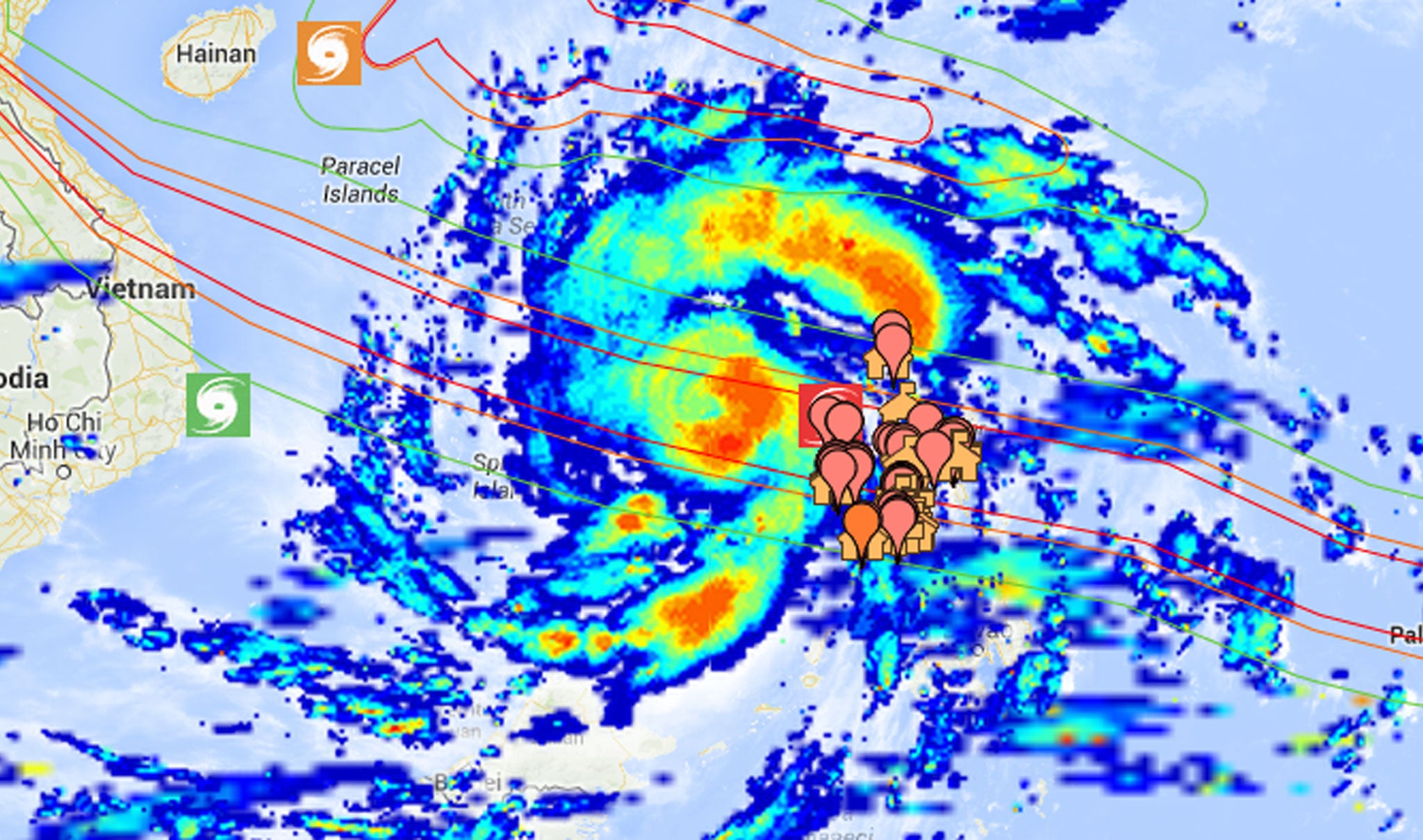
Google has created an interactive crisis response map detailing the exact path Typhoon Haiyan is expected to cut through the Philippines and where wind speeds are likely to be at their highest.
The map, which can accessed above or found directly by clicking here, also explains where those caught in the middle of the super-storm can find local evacuation shelters, command posts and medical centres.
Updated roughly every 10 minutes, the tool employs a heat-map style design to map the path of the storm, as well as detail the expected rainfall levels, landslide and flood-prone areas and other zones where the storm could cause particularly extensive damage or loss of life.
Typhoon Haiyan is likely to be one of the most powerful storms ever recorded, battering the central Philippines with sustained winds of nearly 200MPH.
Estimated wind speeds at the point of landfall were 149MPH - 24mph stronger than those of Hurricane Katrina - one of the deadliest storms in history which killed at least 1,833 people and caused billions of dollars’ worth of damage.
The category five super-typhoon has already forced thousands to flee their homes, and there are reports that four people have already died.
Subscribe to Independent Premium to bookmark this article
Want to bookmark your favourite articles and stories to read or reference later? Start your Independent Premium subscription today.
Join our commenting forum
Join thought-provoking conversations, follow other Independent readers and see their replies