Mount Agung: Where is the active volcano, and what happened last time it erupted?
Scientists still aren't sure how big an eruption would be
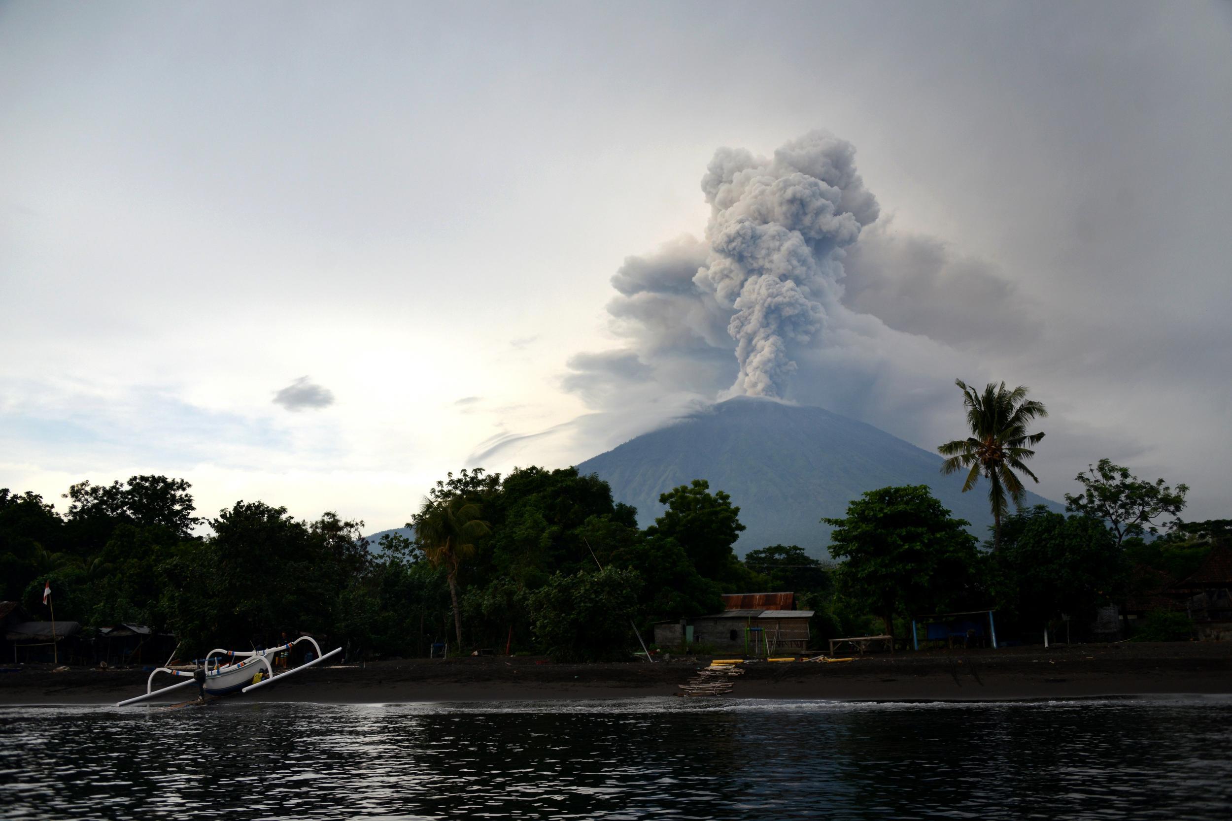
Scientists are anticipating an eruption at Mount Agung in Bali, Indonesia for the first time in more than 50 years.
Disruptions under the volcano’s surface have put the island on high alert, and hundreds of thousands of people have been told to evacuate. Residents are being shepherded to temporary shelters, and signs reading, "You're entering active volcanic hazard zone" have been erected.
But what does this mean for the island, and the rest of the world? Here’s everything you need to know.
Where is Mount Agung?
Mount Agung, the tallest mountain in Bali, is located on the island’s western edge. It is located 612 miles (984km) from Indonesia's capital of Jakarta, and 11 miles (18km) from Bali’s other volcano, Mount Batur.
When did it last erupt?
The last eruption occurred in February of 1963, and lasted almost a year.
What happened?
The 1963 eruption was one of the largest and most destructive in the country’s history. It destroyed countless villages and killed an estimated 1,600 people. Minor eruptions and pyroclastic flows continued on the island for months. About 280 million m3 of magma was ejected from the mountain over that time period, and lava travelled as far as 14km to the south.
The deadliest effects of the eruption, however, were the pyroclastic flows. The waves of superheated gas can travel hundreds of kilometres per hour, and carry ash and rock with them. The flows caused most of the deaths resulting from the 1963 event.
What has happened so far?
Experts raised the alarm about Mount Agung this September, when they detected an increasing number of earthquakes happening under the volcano’s surface. Not long after, the volcano began emitting smoke and ash.
The volcano alert status on the island has now been raised to its highest level. Mudflows have been seen running down the mountain, and villagers have reported hearing booming sounds.
Approximately 100,000 people have been told to evacuate the area nearby. The airports on the island have also been closed, leaving thousands of travellers stranded. In other countries, governments have warned travellers to steer clear of the popular tourist destination.
What could happen?
The jury is still out on exactly how big the eruption will be – or if it will even happen. Diana Roman, a geologist at the Carnegie Institution of Washington, told the Washington Post that scientists “do not have any basis for knowing whether this eruption will intensify, continue at its current level, or stop”.
If the eruption is large, it would be a major problem for the island’s inhabitants, who depend largely on tourism and agriculture to survive. Already, some airlines are allowing customers to change or refund their tickets to the island.
On the bright side, volcanic eruptions can actually cool the Earth’s temperature. Teresa Ubide, a lecturer in volcanology from the University of Queensland, told the Guardian that this is due to sulphuric emissions from the volcano. The sulphur-based aerosols block radiation from the sun, thereby lowering global temperatures.
The last time Mount Agung erupted, global temperature dropped by between 0.1C and 0.4C.
Join our commenting forum
Join thought-provoking conversations, follow other Independent readers and see their replies
Comments
Bookmark popover
Removed from bookmarks