Vast 466-mile-long canyon discovered under Greenland ice sheet, say scientists
Specialist radar uncovered the 800m deep canyon
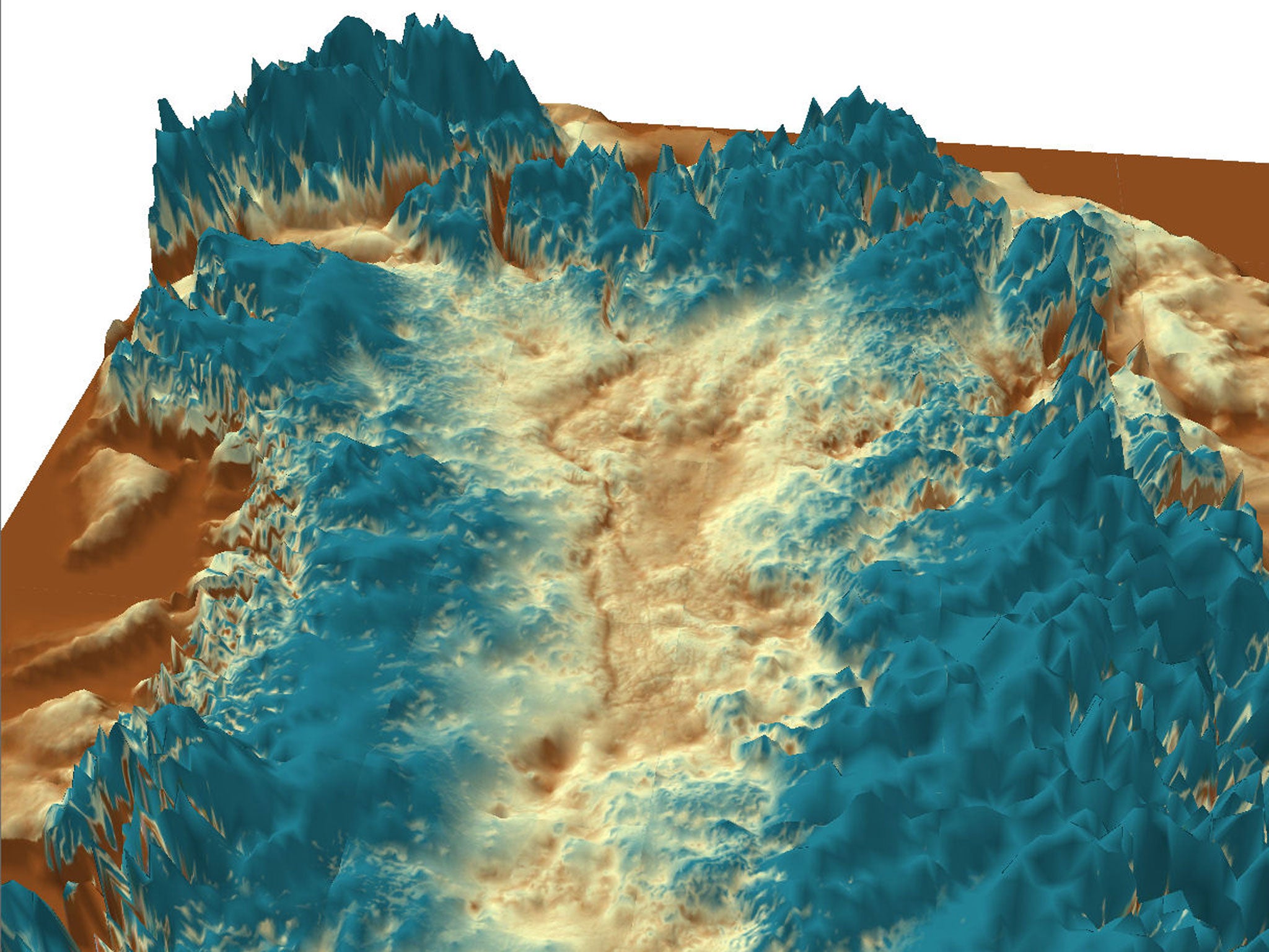
One of the world’s largest canyons has been discovered buried under ice in Greenland.
Scientists have learnt that the mega-canyon is 466 miles long and up to 800m deep in places.
The feature, resembling a meandering river channel, is believed to pre-date the ice sheet that has covered Greenland for millions of years.
Professor Jonathan Bamber, from the school of geographical studies at University of Bristol, said, “With Google Streetview available for many cities around the world and digital maps for everything from population density to happiness, one might assume that the landscape of the Earth has been fully explored and mapped.
”Our research shows there's still a lot left to discover.“
The canyon, which rivals Arizona’s Grand Canyon in size, was uncovered by airborne radar which can penetrate ice and bounce off the land beneath.
Scientists pieced together radar measurements covering thousands of kilometres collected by Arctic researchers over several decades. They found evidence of a fissure in the bedrock stretching northwards from the centre of Greenland.
The canyon ends in a deep fjord connecting it to the Arctic Ocean.
Professor David Vaughan, from the British Antarctic Survey based in Cambridge, another member of the team whose findings appear in the journal Science, said: ”A discovery of this nature shows that the Earth has not yet given up all its secrets. A 750km canyon preserved under the ice for millions of years is a breathtaking find in itself, but this research is also important in furthering our understanding of Greenland's past.
“This area's ice sheet contributes to sea level rise and this work can help us put current changes in context.”
Greenland’s ice sheet, which is up to two miles thick, makes the central area of the island sag. Central Greenland has sunk about 700m and is now 200m below sea level.
Despite this the hidden valley continues to run downwards. It is believed to play an important role in transporting sub-glacial meltwater from Greenland's interior to the edge of the ice sheet, and ultimately to the ocean.
Co-author Dr Michael Studinger, from the US space agency Nasa's Goddard Space Flight Centre, said: “It is quite remarkable that a 750km-long channel the size of parts of the Grand Canyon is discovered in the 21st century below the Greenland ice sheet. It shows how little we still know about the bedrock below large continental ice sheets.”
Even before the ice sheet appeared, at least four million years ago, the canyon probably provided a major pathway for flowing water.
If Greenland’s thick ice sheet melts completely it is estimated to raise global sea level by 7m, swamping many world cities.
Join our commenting forum
Join thought-provoking conversations, follow other Independent readers and see their replies
Comments