Jaw-dropping ‘Bomb Sight’ map shows where Blitz hit London streets

Sign up for the View from Westminster email for expert analysis straight to your inbox
Get our free View from Westminster email
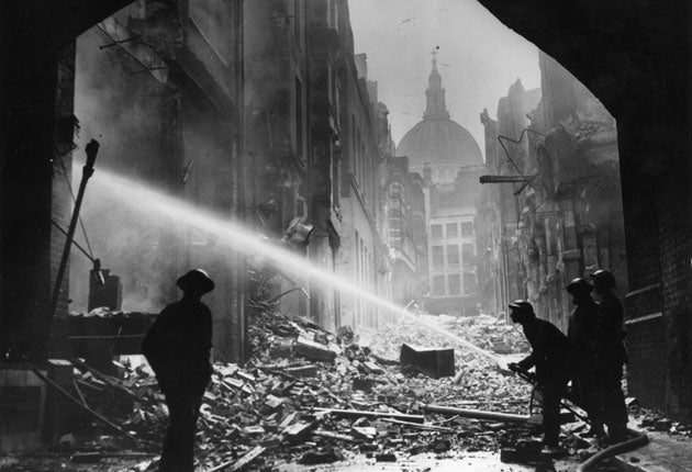
A searchable online map showing where German bombs fell during the 1940-41 Blitz has gone viral as Londoners discover whether their street or home was hit.
The 'Bomb Sight' project was set up to map where bombs fell from 7th October 1940 to the 6th June 1941, a period of "blackout" many Londoners spent moving between home and impromptu bomb-shelters.
The project scanned original bomb census maps, previously available only in the Reading Room at the National Archives, and transferred them to an online application that lets users type in their postcode and see the damage wrought.
Twitter users responded in shock:
"How was there anything left?", said @grifferz.
"Utterly astonishing", said @lauratosney.
"The most amazing site", added Times columnist @indiaknight.
Join our commenting forum
Join thought-provoking conversations, follow other Independent readers and see their replies