The best mountains to climb in the UK
There are plenty of impressive summits to be found on British shores – discover the one that’s right for you
Your support helps us to tell the story
This election is still a dead heat, according to most polls. In a fight with such wafer-thin margins, we need reporters on the ground talking to the people Trump and Harris are courting. Your support allows us to keep sending journalists to the story.
The Independent is trusted by 27 million Americans from across the entire political spectrum every month. Unlike many other quality news outlets, we choose not to lock you out of our reporting and analysis with paywalls. But quality journalism must still be paid for.
Help us keep bring these critical stories to light. Your support makes all the difference.
From K2 to Kilimanjaro, there are dozens of famous mountains across the world that each year attract thousands of visitors in attempts to scale their heights.
With the world’s highest peaks reaching over eight thousand metres, such mountains are a serious – and expensive – challenge, with only the experienced able to attempt them.
Luckily, the UK offers a blend of challenging as well as more manageable climbs, often with stunning countryside views that can take your breath away (if the incline hasn’t already done that).
From novice climbs in the Lake District to the UK’s highest elevations in the Grampian Mountains, the country offers great hiking and climbing opportunities, whatever your level of experience.
To aid you further on your climbing journey, we’ve compiled a list of the best mountains to climb in the UK, helping you to choose the best for you based on location, height, difficulty and natural surroundings. Grab your hiking boots, walking poles and your route guide – it’s time to head skywards.
Read more on UK travel:
Ben Nevis, Grampian Mountains
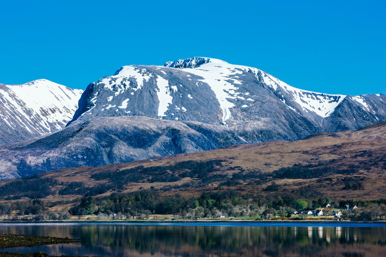
Standing at 1,345m, Ben Nevis is the UK’s tallest peak. Located in the Highland region (near the town of Fort William), the area has beautiful views over lakes, rivers and various other mountains, such as the nearby Ben Macdui (the country’s second-highest mountain).
The height alone makes it a reasonably challenging peak, but there are routes suitable for all levels of experience. The “easier” Mountain Track route (also known as the Pony Track) that starts at Glen Nevis is walkable without any specialist equipment and can take between five to eight hours. More experienced climbers will want to head to the North Face, where there are no actual walking routes – just climbing and mountaineering ones.
Where to stay
For the ultimate luxury before and after your ascent of the UK’s tallest peak, the Inverlochy Castle Hotel has traditional and elegant interiors alongside views of the countryside and Loch Eil.
Snowdon, Snowdonia National Park
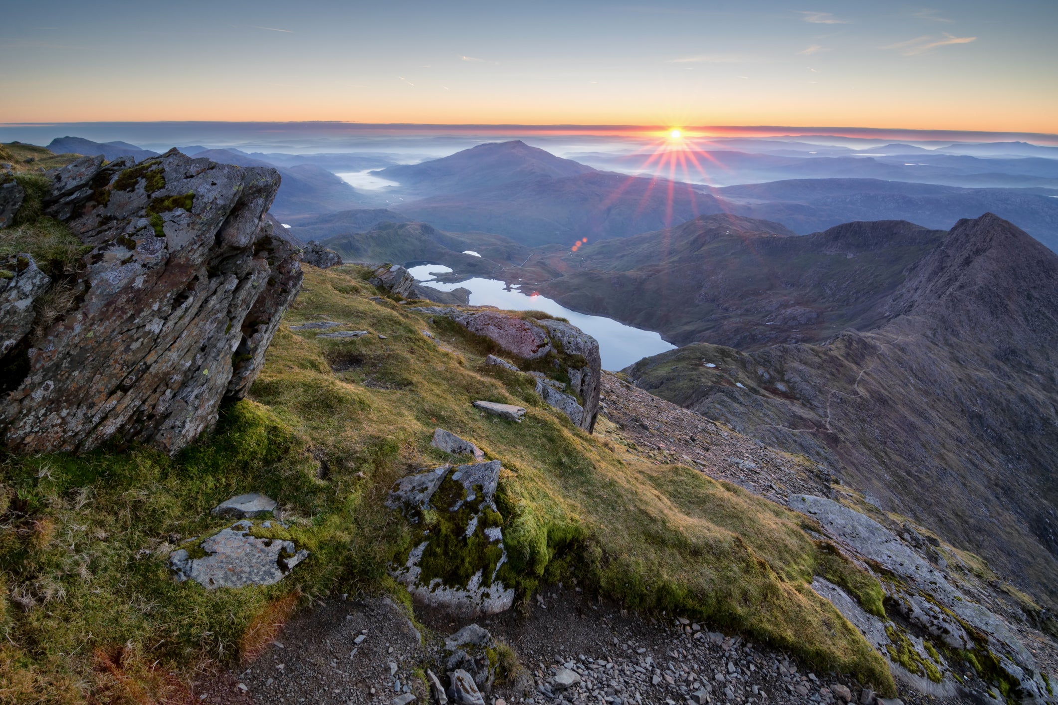
The tallest peak in Wales (known as Yr Wyddfa in Welsh) attracts over 500,000 visitors per year, thanks to the stunning surroundings of Snowdonia National Park which includes valleys, lakes, forests and even Conwy and Caernarfon Castle, two Unesco Heritage Sites. Unlike many other national parks in the UK, this 823-square-mile site also contains coastal areas, with the villages of Harlech and Aberdyfi providing excellent beaches.
With a height of 1,085m, reaching Snowdon’s peak is no mean feat. There are six routes to the summit, and while the park’s official website ranks them all as being hard or strenuous, some are known to be easier. The Llanberis Path is considered the easiest (and most popular), usually taking five to seven hours over a distance of nine miles. The Ryd Ddu Path is one of the quietest routes, while the Watkins Path is well known as the most difficult: you start just over sea level, therefore climbing almost the entire 1,085 metres on your steep ascent.
Where to stay
The Plas Dinas Country House is set in 15 acres of grounds less than 30 minutes away from the foot of Snowdon. Rooms are refined and sophisticated, with features such as four-poster beds and ornate wooden sinks.
Scafell Pike, Lake District
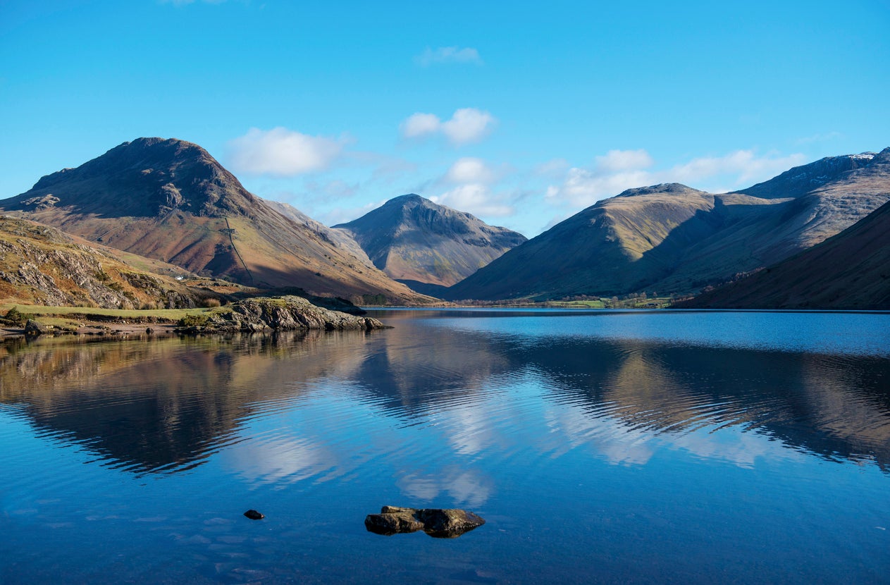
The Lake District is England’s premier destination for mountain climbing. The national park is home to some of the most picturesque lakes, mountains and forests in the UK, with Windermere, Helvellyn and Grizedale among them (Wastwater, the deepest lake in the UK, sits at the foot of Scafell Pike). Away from nature, it’s also home to some of the most charming market towns you could imagine, including Kirkby Lonsdale and Bowness-on-Windermere.
There are three main routes up to the top of the mountain, which lies at 978 metres above sea level. The shortest and most direct route starts at Wasdale Head and includes 700 metres of vertical ascent over a distance of 2km, after which the mountain starts to flatten out. Conversely, the longest route (which takes a full day) begins at Borrowdale, running alongside the River Derwent and passing Styhead Tarn, a mountain lake near the top of Sty Head Pass.
Where to stay
Set in a private woodland estate, The Langdale boasts a spa and leisure centre alongside 50 sleek rooms and chalet-style slate and timber buildings. Its bar and restaurant offer casual dining both inside and on its two terraces.
Catbells, Lake District
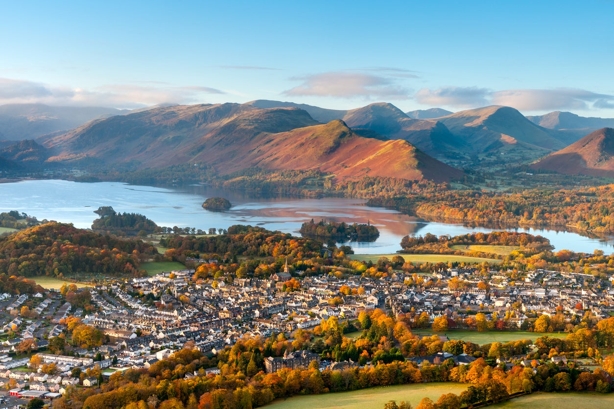
Having sung the praises of Scafell Pike, there is one better place to start (especially if you’re a novice). Catbells stands at just 451 metres tall, making it a far more manageable task for novices – or those just wanting a slightly more relaxing walk or hike. Overlooking the popular market town of Keswick, and with amazing views over the town, Derwent Water and Borrowdale, Catbells is among the most popular fells in the area. For the best view of the peak itself, visit Friars’ Crag.
The main walking route covers roughly three-and-a-half miles and takes three hours (plus any stops you make). It starts at Hawes End Landing Stage, which can be reached with a short shuttle bus from Keswick.
Where to stay
A stay in the nearby market town of Keswick is the best choice if climbing Catbells. The aptly named Inn on the Square overlooks the town’s market square, with slick, contemporary interiors.
Slieve Donard, Mourne Mountains
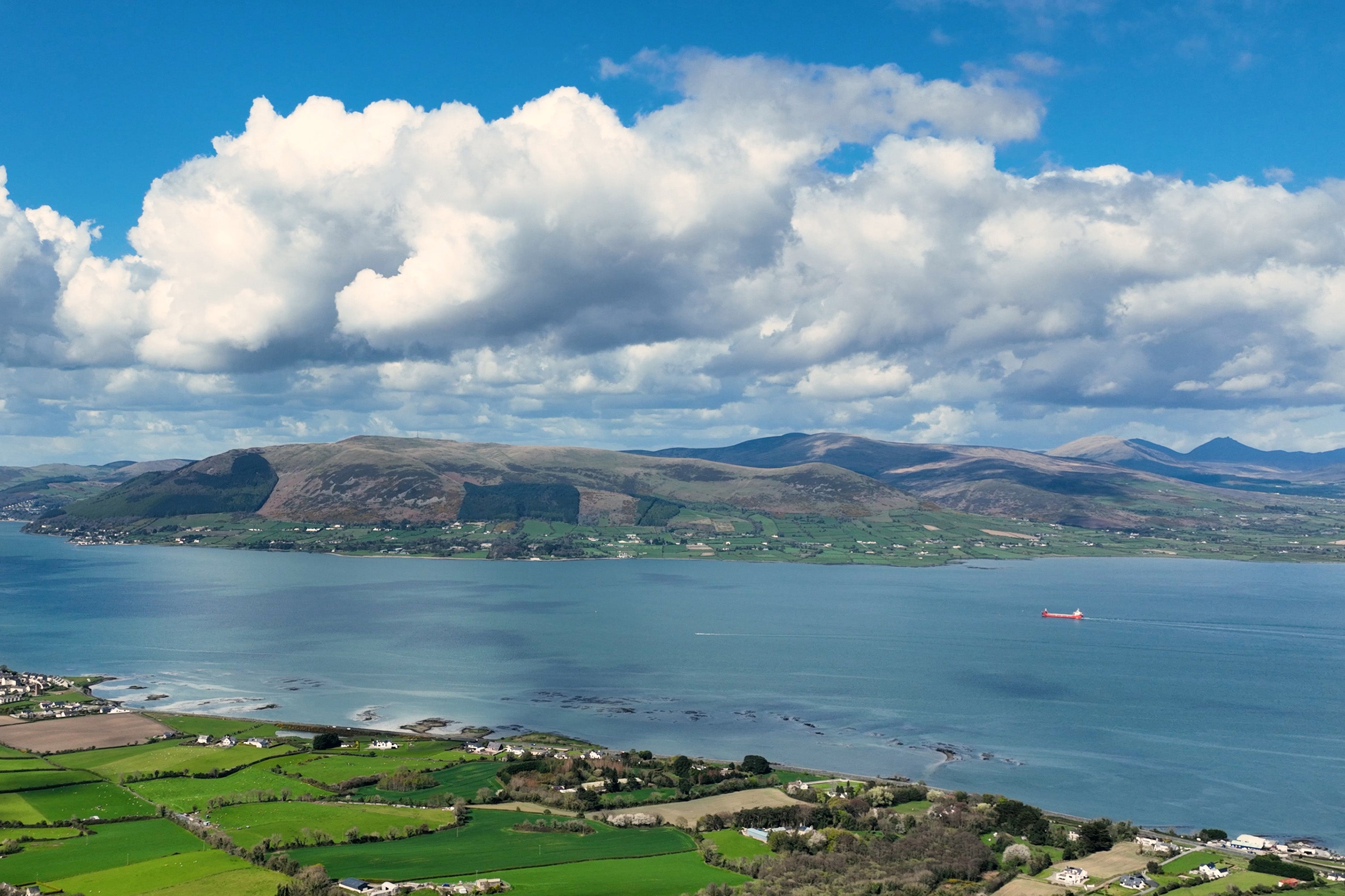
The highest mountain in Northern Ireland, Slieve Donard stands at 850m, making it a reasonably challenging task even if you’re an experienced climber. Located near the seaside town of Newcastle in County Down, the mountain provides scenic views over the Irish Sea – on a clear day, you can also see Newcastle Beach, Donegal, the Isle of Man and parts of Wales and Scotland.
There is a well-defined trail starting at the Donard car park, which should take four to five hours overall and pass the iconic Mourne Wall. Alternatively, the “Bloody Bridge” route is roughly one kilometre longer overall, following the Bloody River until reaching the Bog of Donard, where there’s a moderately steep climb before the summit.
Where to stay
Where better to stay than a hotel named after the mountain? Slieve Donard sits at the foot of the Mourne Mountains on six acres of grounds, bordered by a golf course and golden sands on two sides.
Pen-y-ghent, Yorkshire Dales
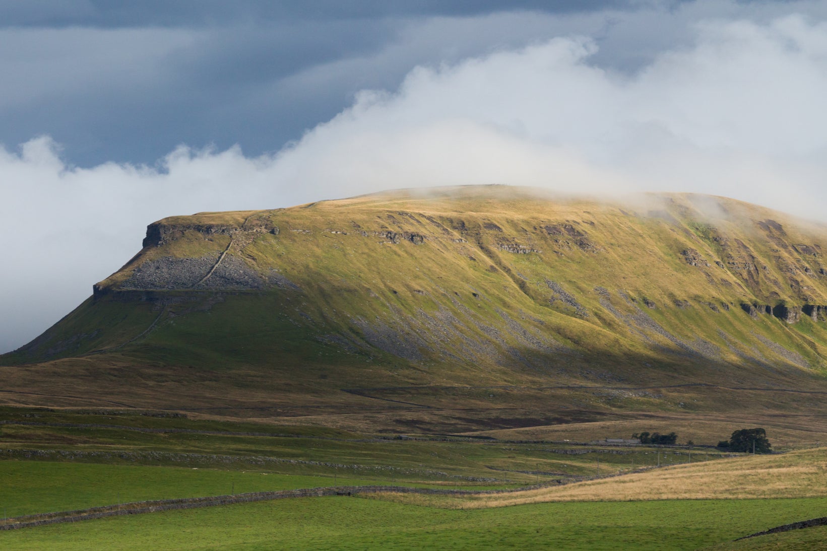
The lowest of Yorkshire’s Three Peaks, Pen-y-Ghent only has an elevation of 694 metres but offers scenic, panoramic views over the surrounding Yorkshire Dales. The national park features several natural and manmade attractions, including the Aysgarth Falls, Malham Cove and the Ribblehead Viaduct. The other two main peaks, Whernside and Ingleborough, are often climbed together as part of the Three Peaks challenge.
Starting from Horton-in-Ribblesdale, the main route takes you gently up Brackenbottom Scar, and then follows the Pennine Way to the summit; on the way back, you can follow the Horton Scar Lane back into town. The route is roughly six miles, usually taking between three and four hours to complete.
Where to stay
The Traddock is one of the closest hotels to Pen-y-ghent and is surrounded by the Yorkshire Dales hills and woodlands. This cosy, family-run hotel is eco-friendly and has retained many of its period features while offering smart interiors across its 14 rooms.
Read more: I’ve hiked in some of the most extreme heat in the world – this is how I stay safe
Join our commenting forum
Join thought-provoking conversations, follow other Independent readers and see their replies
Comments