England Coast Path is up and walking - Norfolk's first official stretch connects Hunstanton to Sea Palling
This segment of seaside hiking forms an early part of a trail that will trace England's shores

Sign up to Simon Calder’s free travel email for expert advice and money-saving discounts
Get Simon Calder’s Travel email
As gulls wheeled above, and the North Sea thumped the shore below, I turned my back on Cromer Pier and headed left. It was one small step for me, one not-insignificant leap for man. Well, the kind who love the idea of walking around the whole country.
The disgruntled water, the paintbox-bright beach-huts, the sweep of sand merging into a salt-spray haze ... I'd been here before. A few years ago I'd completed (or so I'd thought) the Norfolk Coast Path National Trail, a 72km hike from Hunstanton to Cromer, via the bird reserves and dapper villages of the county's north. But last December, the goalposts moved. The trail has recently been extended by 28km, and now continues south-east from Cromer to the village of Sea Palling.
This add-on promises its own interest, running via Blue Flag beaches, historic churches and the discovery site of the West Runton elephant, a 700,000-year-old mammoth skeleton. Also, according to Coast Path Trail Officer Russell Wilson, about 50 per cent of the route was previously inaccessible; it genuinely opens up more of the coast.
"There have been some really ancient finds here," adds Wilson. "We've found fossilised footprints from a million years ago – the oldest in Europe; now there will be new footprints."
But, more than that, Cromer-Sea Palling is also Norfolk's first official chunk of the England Coast Path (ECP), which – on completion, due 2020 – will be a 4,400km-ish walking trail around the entire English shore.
"In many ways Norfolk is representative of the English coast," says Sally Fishwick of Natural England, the environment advisory body spearheading the ECP. "Land use is varied; there's already access in parts, but not everywhere; and coastal change presents a significant challenge."
The latter has long been an issue. I walked away from Cromer Pier via the Prom, and while this sturdy vantage seems designed for pleasure strolling, it was constructed as the town's first sea wall, after a huge storm demolished beachfront properties in 1836. I soon reached the wall's end, and descended a ramp to take my chances on the beach. Here, wooden groynes lunged into the waves, trying their hardest to protect the high cliffs behind. Yes, high: in a county famed for its flatness, these cliffs – part of the Cromer Ridge, the remains of a 430,000-year-old glacial moraine – soar in excess of 60m; Beacon Hill, the highest point in Norfolk (103m!), is here, just west. So, feeling unusually dwarfed, I strode along while sanderlings skittered in the shallows and a less nimble runner tried the same.
Later I'd feel sympathy for this plodding man. While the walk is largely gentle, sections of the route are on shingle and sand. This is part of the pleasure; it's a coastal walk after all, and a key criterion of the ECP is always to try to keep the sea in sight. However, after 28km, it can be testing.
For now, though, my legs were fresh and I was enjoying walking by the sea. At first I seemed to be strolling across the sky – the clouds' peachy-pink billows were perfectly reflected in the wet sand. Then I switched to the shingle, a cornflake-crunch across pebbles of all colours and sizes. At Overstrand, I hauled uphill, then on via windswept trees and old flint cottages. I skirted the cliff, a frayed hemline that looked as if it might unravel further at time now; inland, a gulls picked over a ploughed field, while a kestrel scanned for brunch.
I ducked into woods to enter Trimingham, and was distracted by a sign: "Pottery, 150m". In a pleasingly ramshackle studio I met local artist William Craig, who makes earthenware bowls and unusual beehive mirrors. "I used to keep bees and wanted to do something with the old equipment," he said. I explained that I was walking the new coast path. "There's been quite a lot of excitement in the village about that," he said. "Trimingham used to be an important pilgrimage spot; we hope the path might bring more people again." In medieval times, pilgrims descended on this tiny parish to visit its squat church of St John the Baptist's Head (it once had an alabaster cast of the saint's skull). Trimingham still has a Pilgrim's House, which – thanks to the new path – is being re-energised. Sadly, it was closed, so I continued to Mundesley and hunkered down in a cafe for a cup of tea. Mundesley is 13km from Cromer, and the obvious place to break the route. After passing Bacton (the least scenic stretch), I stopped again, sat on a bench and ate a sandwich.
"Ah, a picnic by the sea!" A man in fluorescents and a woolly hat smiled at me; it turned out he was Jules, chair of the local Seal and Bird Rescue Trust. He'd had a call about a seal and was checking it out. Seals like the Norfolk Coast, although their favoured spots are Hunstanton, Blakeney and Horsey. "They're frequent visitors," Jules said. "And we've seen more this past year than in the previous 10. Then there's Scroby Dick ...."
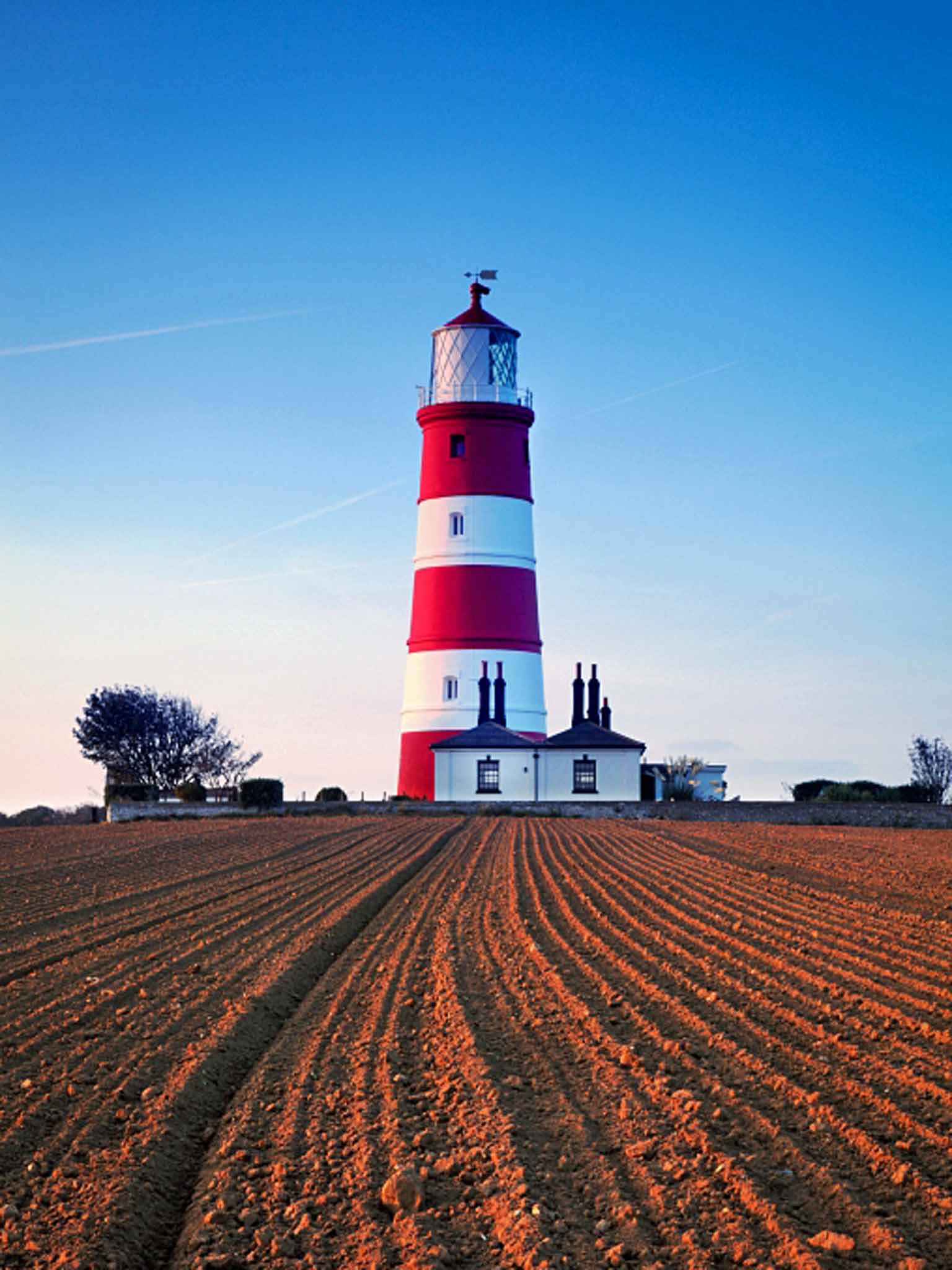
Scroby Dick? "A humpback whale, first spotted near Scroby Sands. We've seen him for the past couple of years. The fishermen can't fish around the wind farm up near Sheringham, so the whale hunts there." After leaving Jules, I kept more of an eye on the water – though it was impossible not to look to the land as I entered Happisburgh. This village, with its over-sized church and red-white-stripe lighthouse, is the unfortunate poster-child of coastal erosion. I passed several teetering caravans.
In Natural England's proposals for the path at Happisburgh, it was recommended it should "roll back" to follow the changing coast: "When the current route is no longer safe for walkers, the trail will be repositioned inland." From the ill-fated village, I walked along the sand. A few surfers were out; as I stopped to watch, I noticed something else black and shiny in the waves: a seal.
Just before sunset, I reached Sea Palling. But this wasn't really the end. Norfolk's next section of ECP, from Sea Palling to Hopton-on-Sea (on the Suffolk border) is currently in the latter stages of consultation. It's hoped it will open within the next 12 months. So I guess I'll be back soon.
Getting there
Trains connect Norwich and Cromer in about 45 minutes. Bus X11 runs Norwich-Stalham, Bus 34 runs Stalham-Sea Palling (0871 200 2233; travelineeastanglia.org.uk).
Staying there
Durdans B&B, Mundesley (01263 722225; thedurdans.co.uk). Doubles from £70.
More information
Subscribe to Independent Premium to bookmark this article
Want to bookmark your favourite articles and stories to read or reference later? Start your Independent Premium subscription today.
Join our commenting forum
Join thought-provoking conversations, follow other Independent readers and see their replies