UK weather: Brits brace for more rain after hottest June on record
More showers expected before hotter conditions return

For free real time breaking news alerts sent straight to your inbox sign up to our breaking news emails
Sign up to our free breaking news emails
Parts of the UK were under a yellow weather warning overnight with more showers continuing on Wednesday, but a weather change is soon on the horizon, according to the Met Office forecast.
The yellow weather warning for heavy rains and strong winds was in place between 9pm Tuesday and 6am Wednesday, with the Met Office issuing an alert for potential “flooding and disruption”.
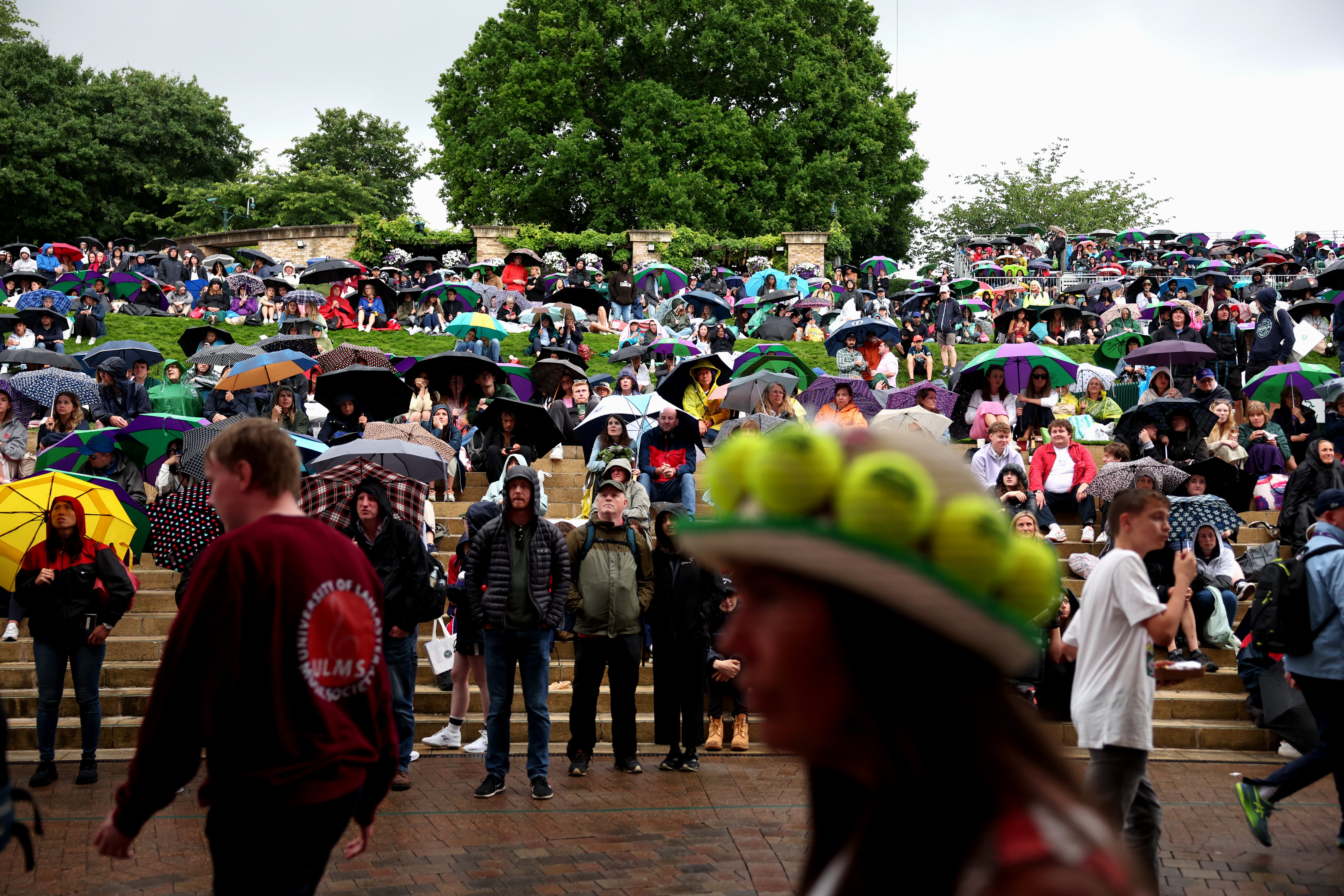
Showers on Tuesday suspended the Wimbledon tournament as a “heavy band of rain” passed over the championship, with the Princess of Wales taking shelter under an umbrella as she watched the tournament.
Some more showers are expected on Wednesday before hotter conditions return, the Met Office said.
“An unseasonably deep area of low pressure is expected to bring disruption to parts of continental Europe on Wednesday,” the forecaster said in a statement.
“For the UK, the most likely scenario is for some heavy overnight rain and strong coastal winds across eastern England, clearing early on Wednesday without impacts.
“However, there is a small chance that rain will become much heavier for a longer period across parts of east Norfolk and east Suffolk, producing 50 to 100mm in six hours and bringing a risk of flooding and disruption.
“There is also a very small chance of gusts 50 to 60mph near the coast, which could also cause some disruption,” the forecaster said.
The conditions, however, will be “slightly warmer for many”, the forecast revealed, with the Met Office predicting Saturday to have temperatures between 28-32C.
The ongoing spell of rains and cooler conditions, after the UK experienced its hottest June on record, are attributed to the southward movement of the jet stream, which has resulted in unsettled and breezy weather across much of the country.
But a shift in the weather pattern is anticipated as the jet stream diverts north of a building high-pressure system near Greenland, leading to a more amplified and wiggly jet stream configuration.
By the end of the week, a marked change is expected, with low-pressure systems to the west of the UK and a warmer southerly airflow across the country.
Thursday will see longer sunny spells but showers are expected to continue in some areas, with an increasing risk of heavy rains in the north and west on Friday.
But as the weekend begins, there will be more sunshine, according to the Met Office. The weather will turn hot and humid for many, it said.
This July is expected to bring “above normal” temperatures, with some weather maps showing a possibility of 40C, a repeat of last year’s scorching heat, by the end of the month.
It’s not certain yet how high the mercury will rise even as signs point to a hotter summer.
Subscribe to Independent Premium to bookmark this article
Want to bookmark your favourite articles and stories to read or reference later? Start your Independent Premium subscription today.
Join our commenting forum
Join thought-provoking conversations, follow other Independent readers and see their replies