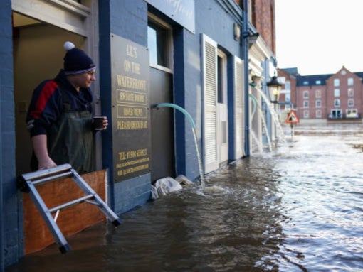
Climate maps let voters in Britain see impact of crisis in their area
Users can click to discover forecasts – such as how most of the southeast will suffer an extra 20 or more dangerously hot days

A newly devised series of maps of Britain allows voters to find out how the climate emergency is affecting their area and compare that with the rest of the country.
The interactive maps, drawn up by a PhD student at University College London, let users click in each constituency to see past and future changes in temperatures, rainfall and drought.
They show how the number of dangerously hot days is forecast to rise locally, as well as how drought periods are set to lengthen, for example.
Together, the projections build a picture that backs up warnings by scientists and climate campaigners on how a heating planet will affect everyday life.
For instance, the number of dangerously hot days every year is predicted to rise by more than 20 across most of the southeast, and by more than 22 or 23 in most London constituences.
Even in Hampshire, Dorset and parts of Somerset the annual tally is calculated to increase by at least 20.
The map on temperature changes between 1900 and last year reveals that in many districts in London and the southeast, temperatures have already gone up by at least 1.3C or 1.4C - close to the 1.5C tipping point that scientists warn must not be breached.
Further north, rises are less extreme, but even around Manchester, the thermometer is already up by at least 1.3C in many places.
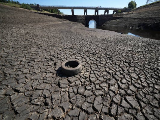
The map of projected drought duration changes until 2080 reveals that Ross, Skye and Lochaber will experience a rise of 0.09 days, whereas Taunton Deane, Somerset, will suffer an extra 3.931 days.
Across most of London, the east of England, the southeast and even into the Midlands and parts of Wales, droughts are forecast to last more than three days extra.
Daily rainfall totals are set to drop across the vast majority of Britain, with a few exceptions only in south and west Wales, northwest England and spots in western Scotland.
The maps, released during key global climate talks, cover:
- Projected maximum temperature changes by 2080
- Projected changes in the number of dangerously hot days
- Projections of daily rainfall
- Projections of maximum five-day rainfall change
- Projections of drought duration change
- Temperature changes 1900-2021
- Maximum temperature changes 1975-2021
- Change in daily rainfall rate 1900-2021
The past and future changes vary between districts, but very few will be unaffected.
English regions
London: On projected maximum temperature changes by 2080, the capital surprisingly does not fare quite as badly as the rest of the south. The Cities of London and Westminster, for example, will suffer 5.927 C of warming, not as much as districts in the home counties.
The south and east: From Ashford in Kent to Stevenage in Hertfordshire and the New Forest, swaths of the area will suffer at least an additional 20-22 dangerously hot days a year. This extends even as far as Kettering in Northamptonshire.
The Midlands and west: This is where drought durations are set to be extended the most, with 3.358 in Tewkesbury and 3.178 in Birmingham Yardley. Projected maximum temperature changes by 2080 of 7C stretch as far west as Hereford and North Wiltshire.
The north: The chart on maximum five-day rainfall changes shows Westmorland and Lonsdale, Barrow and Furness and nearby Copeland all hit harder than most of the country, while drought will be longer by at least three days even in places such as Bishop Auckland, Redcar and Sunderland Central.
Scotland
Residents north of the border suffer the effects of climate change more lightly but do not get off not altogether. Berwickshire, Roxburgh and Selkirk is predicted to have more than three extra dangerously hot days a year, and in Edinburgh South West the figure is 2.663.
While rainfall totals changed little in the southeast until last year, in Scotland they increased a little more. Like swaths of southeast England, eastern Scotland, from Edinburgh to Aberdeen North, are due to receive less rainfall.
Wales
Temperatures are due to rise by 2080 across all of Wales, like everywhere else, with Pontypridd measuring 6.917C more.
Even Brecon and Radnorshire is set to suffer 8.403 extra days of dangerously high temperatures.
While rainfall is forecast to reduce in Montgomeryshire and Newport East, it is forecast to increase further west, in places such as Bridgend, Swansea East and Arfon.
Take a look at the maps here.
Join our commenting forum
Join thought-provoking conversations, follow other Independent readers and see their replies
Comments
Bookmark popover
Removed from bookmarks