Severe drought at US’s largest reservoir revealed through the decades by Nasa satellite images
Reservoir last reached full capacity in 1999
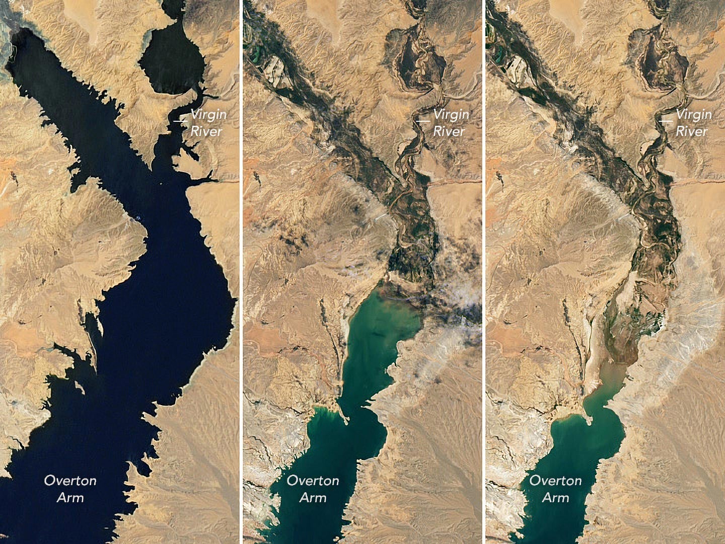
New satellite images released by Nasa have shown water levels at historic lows in Lake Mead, the US’s largest reservoir, as a result of a severe 22-year “megadrought” in the American southwest.
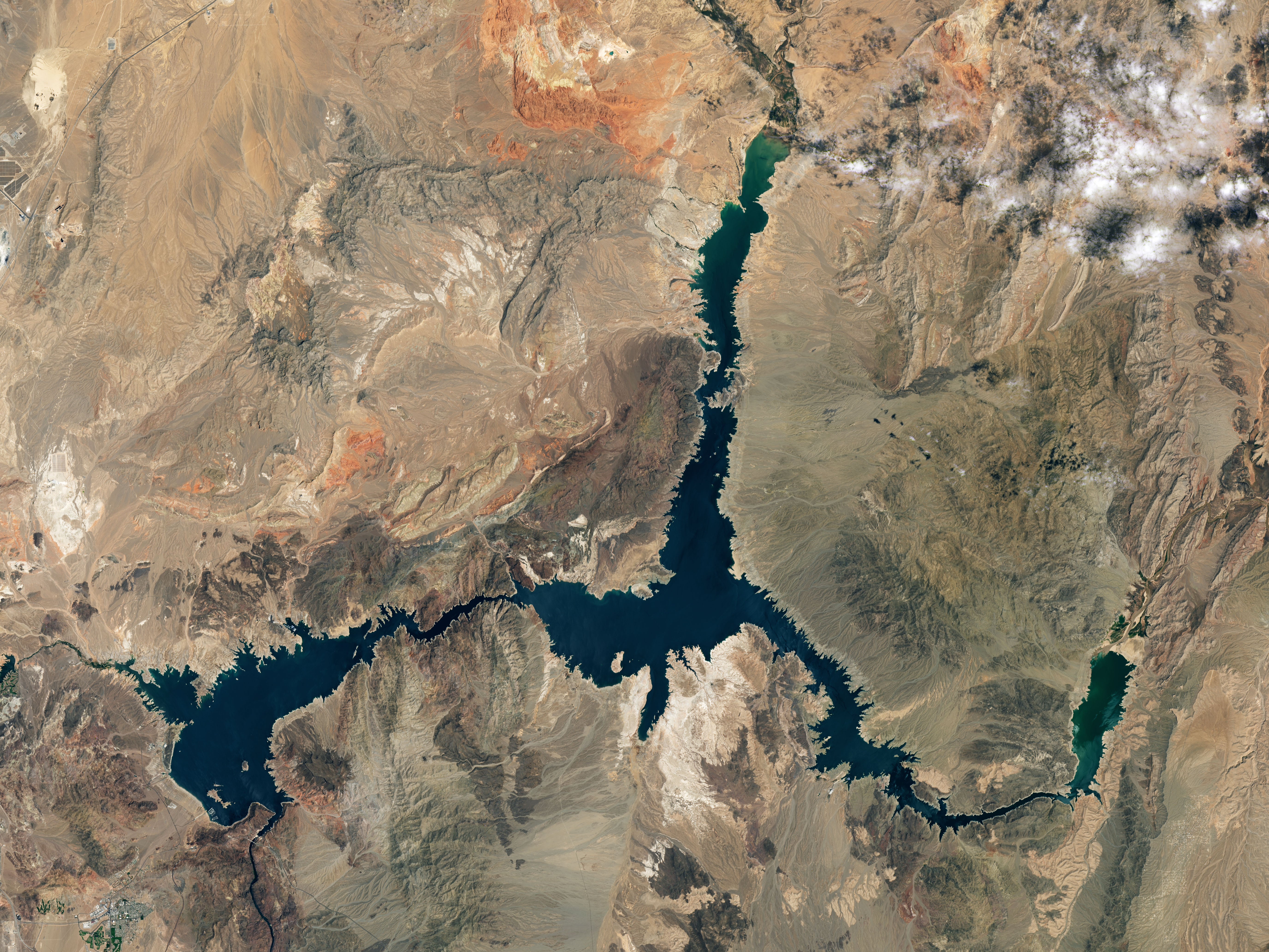
The images show the extent of the drought’s effects on Lake Mead, which is at an all-time low of 1,043ft above sea level, or 27 per cent capacity.
In 2020, when the first of the three images from Nasa’s Landsat satellites was taken, Lake Mead was at nearly 1,200ft above sea level.
Since 2020, water levels have fallen more than 150ft. The dramatic drop in water has revealed human remains and sunken boats.


The lake has ibeen on a 22-year downward trend since the summer of 199 when it last reached full capacity of 1,220ft, Nasa added.
The record-low water level was recorded by the US Bureau of Reclamation on 18 July. Nasa said it satellite images provided “a stark illustration of climate change and a long-term drought that may be the worst in the US West in 12 centuries”.
The climate crisis is linked to a reduction in rainfall and an increase in drought conditions, as well as higher demand for irrigation and household water use. It has left reservoirs such as Lake Mead unable to build-up supplies during winter months, and has led to long-term decline.
Some 35 per cent of nine Western US states are currently facing extreme drought and 74 per cent are experiencing some drought, leading to water restrictions being enforced.
Lake Mead serves about 25 million people. The reservoir was created in 1937 along with the opening of the Hoover Dam. The dam requires a water elevation of 1,000ft to continue operating hydropower turbines at normal levels.
Of the images, Nasa’s Earth Observatory added: “The light-coloured fringes along the shorelines in 2021 and 2022 are mineralised areas of the lakeshore that were formerly underwater when the reservoir was filled closer to capacity.”
The phenomenon is often referred to as a “bathtub ring” because of the light-coloured bands created by mineral compounds left behind when a lake falls below its usual waterline, with calcium carbonate creating a white colour for example.
“The only time the bathtub ring is not visible is when the lake is completely full,” says the US Geological Survey of the phenomenon.
Join our commenting forum
Join thought-provoking conversations, follow other Independent readers and see their replies
Comments
Bookmark popover
Removed from bookmarks