London flood risk: Map shows areas that could be regularly underwater by 2030
These are the areas of London that face alarmingly frequent flooding by 2030
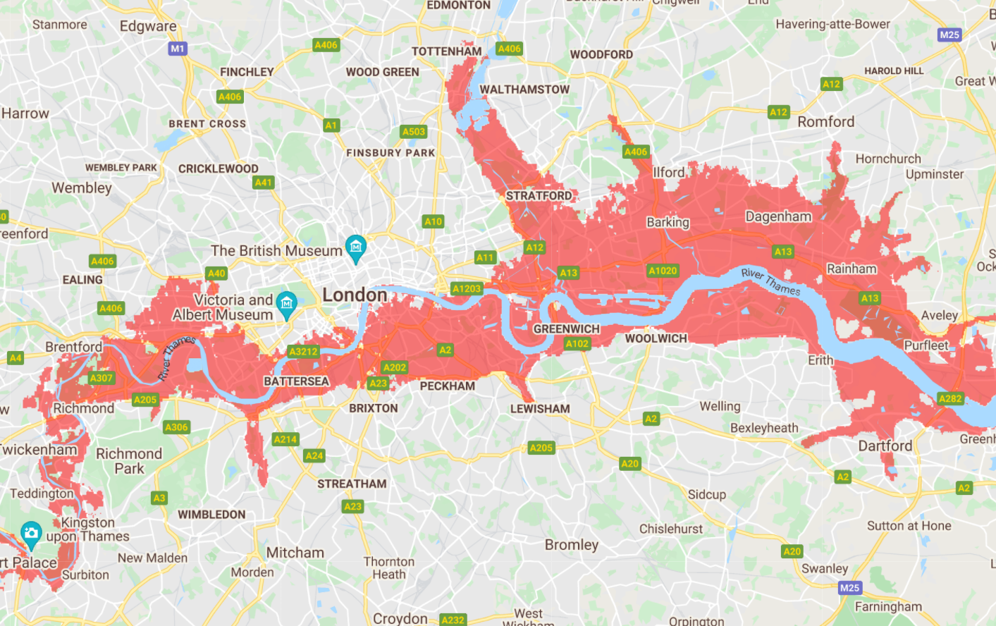
This map shows the areas of London that face regular flooding by 2030 as extreme weather becomes more common because of the climate crisis.
The startling image, created using a new NASA tool to visualise sea level increases in the coming decades, shows vast swathes of the capital vulnerable to rising waters.
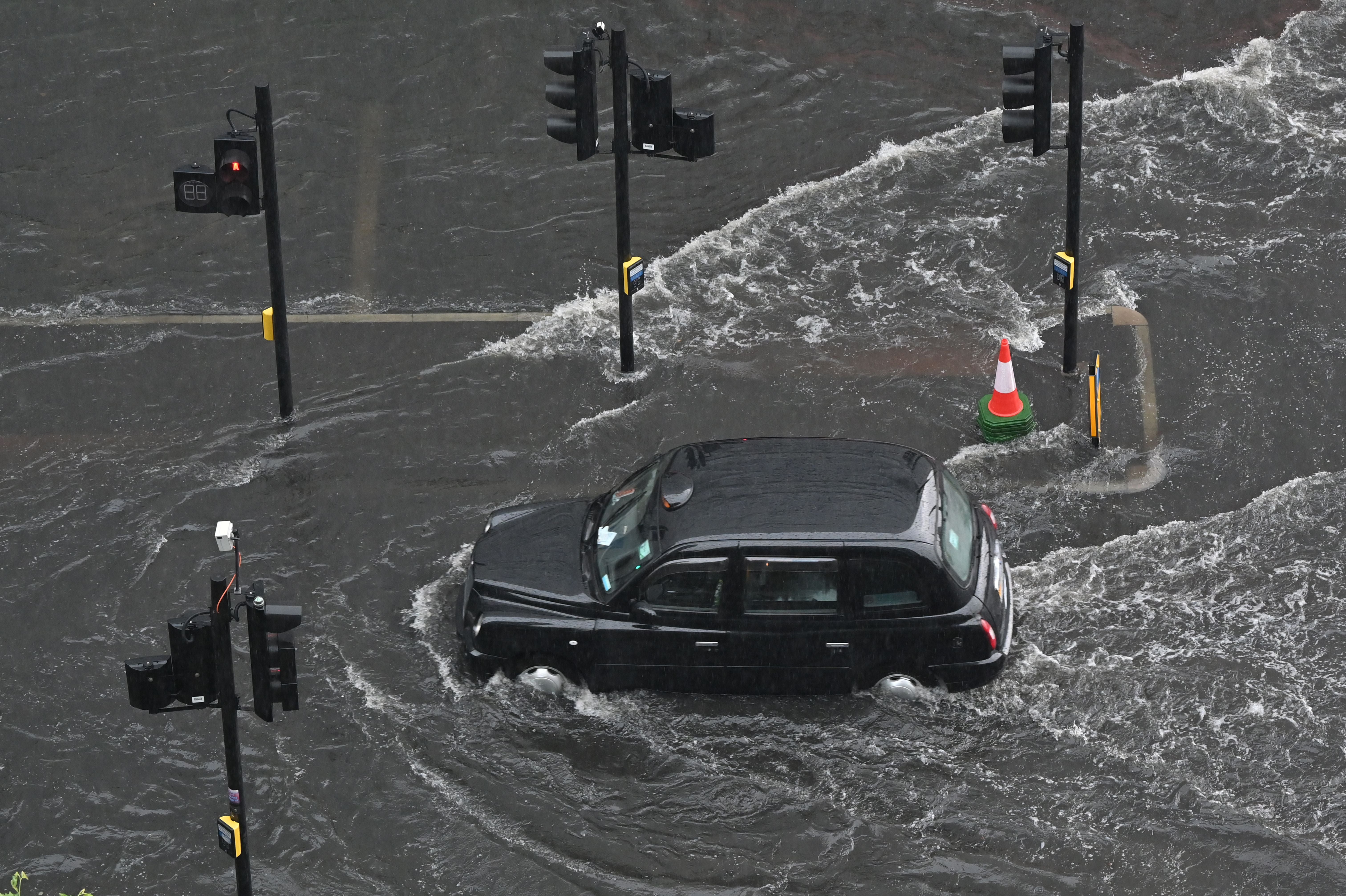
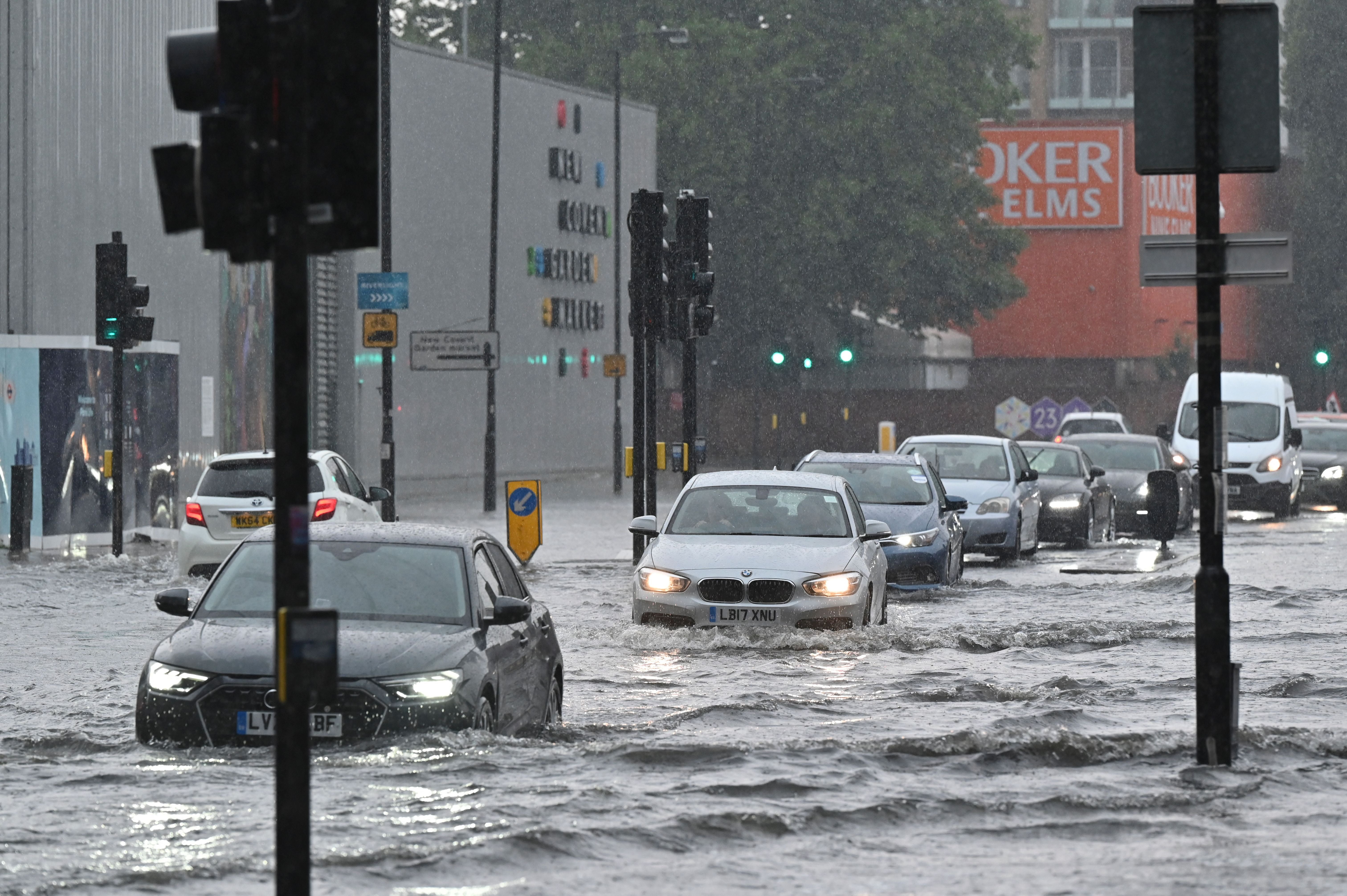
In July, London and other parts of the UK were flooded as torrential rain triggered Met Office weather warnings.
Public transport services were affected in the capital, while footage shared on social media showed cars driving on submerged roads in Battersea and Tooting in southwest London.
It was the third time within weeks that London was hit with flash flooding, and experts have warned climate change is likely increase the risk of deluges.
NASA’s sea level projection tool was launched after the release of the Intergovernmental Panel on Climate Change’s (IPCC) first chapter from its sixth assessment report.
The tool, hosted on NASA’s Sea Level Portal, shows in detail how different parts of the world will be impacted by sea level rise under a range of emissions trajectories.
By selecting options from a drop-down menu, users can zoom into locations across the ocean and on every coastline between 2020 and 2150 to see what will happen depending on how rapidly the curve does – or doesn’t – bend on cutting emissions.
The tool also provides a look at different processes behind sea level rise like the melting of ice sheets and glaciers, and the extent to which ocean waters shift their circulation patterns or expand as they warm.
Sea levels have risen increasingly rapidly since about 1970 and in the past 100 years, sea level has risen more than in any century over at least the past three millennia. Global average sea level has risen at a rate of about four millimeters (0.16inches) per year over the last decade.
With nearly half of the global population living within 60 miles of the coast, the rise in sea levels is already impacting people in many parts of the world.
Join our commenting forum
Join thought-provoking conversations, follow other Independent readers and see their replies
Comments
Bookmark popover
Removed from bookmarks