Taming the mighty Mississippi: Troubles run deep in changing US waterway
A tour of infrastructure reveals a struggle for control along America’s great river, full of questions about what it once was, doubts about what it will become and who will pay for any of it
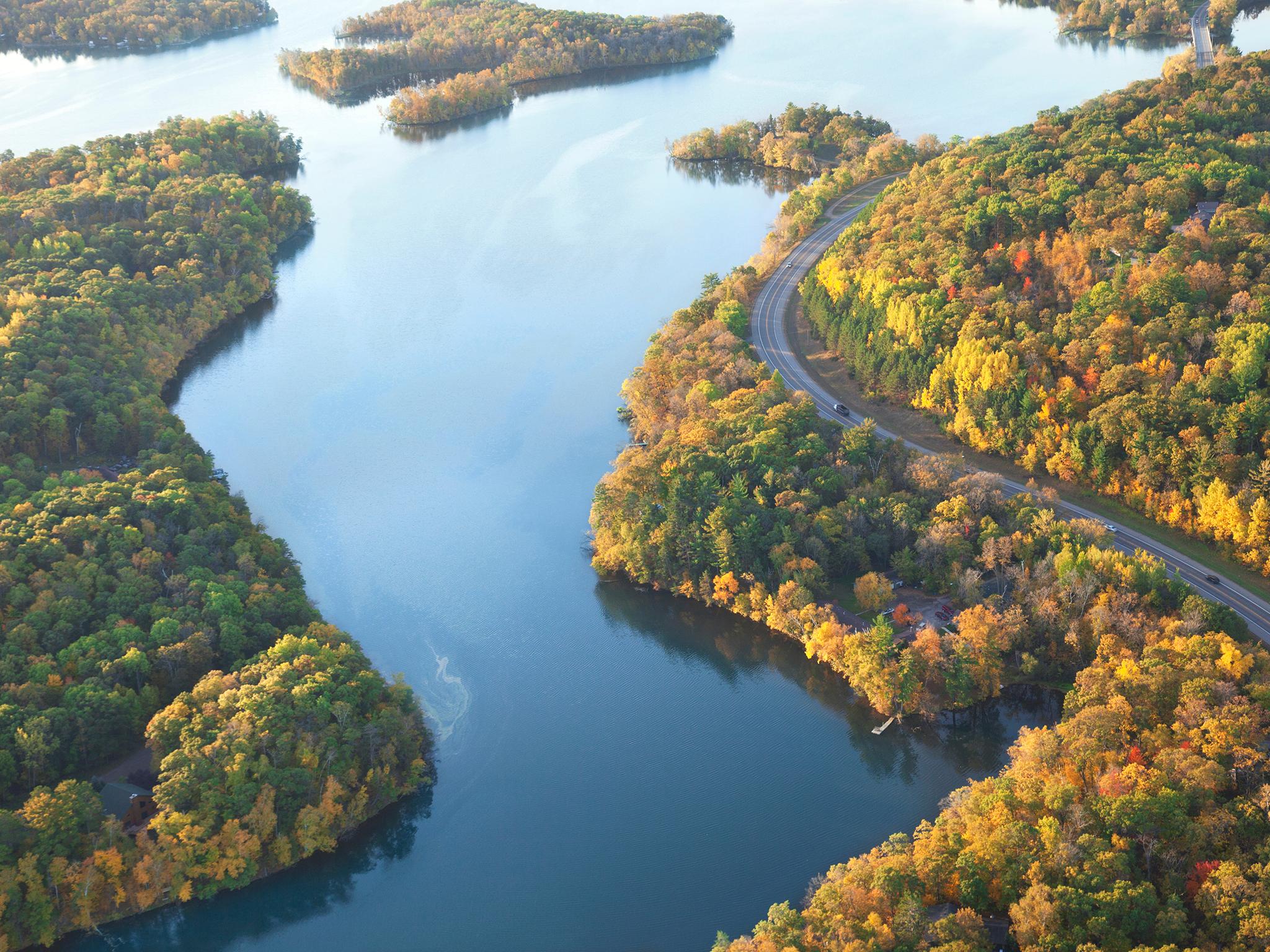
The Mississippi runs through the spine of America, touching 10 states and draining waters from 21 more, a vast waterway with a rich mythology, a sometimes powerful beauty and an always alarming propensity to flood.
Nearly 30 locks and dams hold back water in the river’s upper reaches. Every river bend to the south is lined by concrete to slow the water’s corrosive force. Levees corset thousands of miles of riverbanks and 170 bridges run above. All of this infrastructure is aimed at permitting barge traffic and protecting farms and cities. Most of it is decrepit.
Now, with Donald Trump’s push for a $1.5 trillion (£1 trillion) infrastructure plan, there are hopes of billions to fix up the Mississippi. But there are clashes over which projects to pursue, and no agreement on how to pay for any of it.
A move to tame one portion of the river can create chaos for people somewhere else along its 2,350-mile path, and in that precarious balance is the key to understanding the competing interests and enduring problems that vex the entire country.
“To understand America at this time,” says RD James, a Missouri farmer and new US army assistant secretary overseeing its Corps of Engineers, “you have to understand the river.”
At the same time, it’s clear that the river itself has changed.
“It doesn’t behave like it used to,” says John Carlin, a towboat pilot who has worked the Hannibal, Missouri, riverfront for more than 40 years. “Seems like it doesn’t take much to get out of control.”
Now, the Mississippi is flooding again. Recently, after a deluge of late-winter rain, the corps opened a massive floodway just above New Orleans, an emergency relief valve that it has been forced to use with increasingly regularity – three times in just the last seven years.
Infrastructure is a bureaucratic word, a way of describing human efforts to impose order on nature. More than almost anything government does, the effects of the infrastructure it builds can be felt for generations. Earth is moved. Water redirected. Tunnels dug. Roads paved. It is man’s hubris on naked display. Sometimes, the infrastructure turns out to be the enemy, and that fact makes the people working and living along the Mississippi wary of the promises coming from Washington.
Some river watchers perked up when Trump mentioned “waterways across our land” as part of his infrastructure target list during his recent State of the Union speech. That sounded like good news. But Trump’s plan mostly scales back the government’s long-running role in charting the Mississippi’s course, calling for more private investment and less federal oversight along the river.
That, many here say, will create a host of new problems.
“It’s disappointing,” says Mike Toohey, president of the Waterways Council, a barge industry group, echoing the reaction of many people who use the river. “We’re running on an interstate of water. And we’re always being overlooked.”
The trouble with controlling the Mississippi today is that it has evolved into three different river systems.
The upper Mississippi is a string of slack-water pools held behind dams, with water so placid that water skiing was invented there in 1922.
The middle portion is a mishmash of wing dikes and arched chevrons – man-made structures to “train” the river. Here, it is artificially narrowed, only half as wide in St Louis as it was in the early 1800s.
The truly fearsome Mississippi doesn’t start until the confluence with the Ohio river at Cairo, Illinois, where the water emerges like a monster on par with the Amazon or Congo rivers. The Mississippi then runs to the Gulf of Mexico, hidden behind an extensive levee system built after the Great Flood of 1927, a disaster that displaced 1 per cent of the American population as levees fell like toppled dominoes.
That flood’s legacy still guides how the river is controlled today.
The Army Corps of Engineers oversees most of the river’s infrastructure and runs it with a battle general’s intent. It’s the corps that operates the locks and dams, that built the levee system in the lower Mississippi; it maintains the tools used to control the water levels throughout and regulates levees farther north.
But a growing number of critics say the corps’ flood-fighting efforts make flooding worse.
“It’s like fighting the moon,” says Robert Criss, a hydrogeologist at Washington University in St Louis, who studies the river running just a few miles from his office door. “It’s stupid to fight.”
And it can look like a losing battle.
In the past seven years, the Mississippi river valley has been hit with 100-, 200- and 500-year floods – ones that had a 1 per cent or less chance of happening in each timespan – that caused damages of more than $50bn. Disasters along the river “have become persistent and systemic”, noted a group representing 75 cities from 10 states in a report last year.
The White House response sketched out in Trump’s infrastructure plan is inadequate, says the group, the Mississippi River Cities and Towns Initiative. It actually makes it harder to fund new flood protections by slashing the federal government’s project cost-sharing from the current 50 to 80 per cent down to 20 per cent, says Colin Wellenkamp, the group’s executive director. So for every $1 in federal funds, local and state governments would need to chip in $4.
“That’s interesting,” Wellenkamp says dryly. “How are we going to be saddled with that?”
The group is also worried that the White House’s proposed budget cuts will kill off other federal programmes that already pay for river infrastructure, such as a transportation department grant programme that has spent $162m in recent years to help pay for new bridges, ports and riverfront improvements.
Meanwhile, historic river crests are falling like home-run records during Major League Baseball’s steroids era. In Hannibal, Missouri, where people have been recording river heights since Mark Twain’s time, four of the top 10 crests have come in the past decade.
In Brainerd, Minnesota, it’s five of the top 10.
In Natchez, Mississippi, it’s three of 10.
“You can call it climate change, but whatever you call it, things are changing,” says Major General Michael Wehr, who oversaw the corps’ operations on the river until being promoted last year to be second in command at the corps’ headquarters in Washington.
But Criss considers the corps and its use of river infrastructure to be one of the problems.
“The water has nowhere to go,” he says.
You don’t flood out your neighbours. It’s one of the unwritten rules of the river.
Just the accusation is enough to spark a fistfight. But people had long suspected that the levees across from Hannibal were too tall, making the flooding worse for neighbours downstream.
So a crew from the corps came out two years ago in ATVs, riding along 200 miles of riverbanks to measure levee heights. The corps found that the walls were 2 to 3 feet taller than the agency allows in many spots, stretching from Burlington, Iowa, down almost to St Louis.
The Hannibal-area levees belong to Sny Island – an Illinois drainage district so carefully maintained that it has flooded only once in 110 years, a point of pride for vigilant farmers and volunteers there.
But today, the Sny’s levees frighten people such as Nancy Guyton, who leads a group accusing the district of breaking with long-held tradition.
“If they get away with this,” Guyton warned recently, “they’re going to ruin the river.”
She and her husband own a small farm outside Annada, Missouri. They have lived through several major floods. But now the water seems high all the time.
Now, Guyton is sitting in Calvin’s Restaurant in tiny Eolia, Missouri, with Mark Harvey, another member of the group Neighbours of the Mississippi, which represents residents of three counties downriver of the Sny.
Harvey is not a farmer. He’s not going to lose any crops if the river floods.
But he is the superintendent of Pike County schools. He knows that flooded farmland is worthless. He sees the Sny’s levees as a threat to buying textbooks and paying teachers.
“You can’t just build a wall and say to heck with it,” Harvey says.
In an office across the river, Mike Reed sounds offended.
Reed runs the Sny levee district from New Canton, Illinois, a town tucked next to a limestone bluff that served as the riverbank eons ago. Today, the river is six miles away – across some of the most fertile farmland in the world – and kept there by a levee wall.
Reed says Sny farmers and residents feel as if they have been “smeared” by the corps.
“Why are they going after us?” Reed says. “Why are we made to look like a rogue levee district that raised its levees in the dark of night?”
The corps says its position is simple. Some levees have soared past their federally authorised levels, with most of the height added after a major flood in 2008.
“Their levees have been altered without careful evaluation and no permission,” says Scott Whitney, flood risk manager for the corps’ Rock Island district.
A couple of feet might not sound like much. But every inch of levee height pushes floodwaters from one place to another. With levees blocking the river from its natural flood plain, the water has only one place to go: up.
The corps can’t force a levee district to lower its levees. It can only stop paying for levee repairs. Each state regulates its levees – and the Mississippi touches 10 different states.
“The science is clear,” says Nicholas Pinter, associate director at the Centre for Watershed Sciences of the University of California at Davis, who has extensively studied flood risks on the Mississippi. “When one levee district builds bigger levees, it increases the size and magnitude of flooding across the river, 10 miles up and down, too.”
Pinter says he was surprised that so many levee districts were building walls that are clearly too tall.
“The Sny is one of the players in what I would call levee wars,” Pinter says. “And to have it springing up there is puzzling and unnerving. We thought the levee wars [featuring sabotage and gun-toting safety patrols] were a thing of the past.”
Reed says if the Sny district is forced to lower levees, it would lose its 100-year flood rating, meaning the Federal Emergency Management Agency would no longer consider the area to have protection from a once-in-a-century flood. Insurance premiums would skyrocket and the value of Sny farmland would plummet to half the current $12,000 an acre, “which would be devastating”.
Trump’s infrastructure plan proposes reducing the corps’ role in monitoring levee heights. The plan also proposes stripping the corps of authority for some levees in the name of reducing costs and complexity. That’s good news for districts looking to raise their levees unfettered. It’s bad news for neighbours hoping the federal government continues to referee disputes along the river.
Guyton and other small groups dotting the riverbanks are alarmed. They say they wouldn’t be able to keep up if flood protection becomes a race to see who can build the biggest.
“This would be a disaster,” Guyton says.
Efforts to control the river start way up north, including at a lock and dam that once gave Minneapolis bragging rights as the river’s “Head of Navigation”. This is where the river that begins as a trickle in Upper Minnesota crashes like a white-water fist into a 50ft limestone gorge, all under the lonely gaze of lockmaster Mike DeRusha.
He loves this view. It might be the most dramatic on the entire Mississippi. DeRusha stands at the wide windows of a brick control tower atop the lock and dam at Upper Street Anthony Falls. He used to have 12 workers with him here. They kept this corps facility humming 24 hours a day for boats and barges to pass around the falls. Today, DeRusha is the last man left.
The official reason this lock closed three years ago was worries about invasive Asian carp swimming their way further north and using the lock to get around the falls. But that wasn’t the real culprit. Instead, the extraordinary decision to mothball a major piece of infrastructure illustrates how much the Mississippi’s role in American life has changed.
“Minneapolis decided to give up on a dream its predecessors fought so hard for – to be the economic bookend to New Orleans,” says river historian John Anfinson. “But they have new dreams now.”
Minneapolis is powered today by healthcare and corporate headquarters for giants including the Target discount store. The shuttered brick mills next to the falls are now sought-after lofts and condos. Planners look at the corps’ control tower, built in 1967, and see an event space. Shutting down the lock, they argue, would speed the river’s transformation from industrial waterway to recreational asset.
The lock at Upper Street Anthony Falls was the first one closed on the Mississippi – and it sent a shudder down the river.
Now, the corps is studying whether to close two more nearby locks – perhaps even pulling out the concrete and steel, returning the river to something approaching its wild state.
This is the barge industry’s worst fear, especially if this idea spreads.
“We’re not happy about it,” says Russell Eichman, a consultant for the barge trade group Upper Mississippi Waterway Association. “It might set a precedent.”
The 29 locks and dams on the Upper Mississippi were not built for flood control. They were built for barges. The river drops 420 feet in the 670 miles between the first and last lock, so barges need the staircase of locks and dams for navigation.
Barges move 300 million tons of goods a year on the Mississippi – a number that has remained mostly flat since 2000. Still, it’s the route for 60 per cent of US grain exports. And a single barge can transport the equivalent of 60 to 70 tractor trailers – a bragging point you’ll hear within five minutes of talking with the industry or the corps.
The barge industry argues that ending shipping on the river would result in epic highway traffic jams.
What the river needs, barge boosters say, is to make the Mississippi’s locks bigger and better. Most were built in the 1930s and expected to last 50 years. They can’t accommodate huge, modern barge flotillas. When a lock breaks, the river can be closed for days or weeks.
“This a huge issue for the US to compete on the world market from a transportation standpoint,” says Rodney Weinzierl of the Illinois Corn Growers Association.
The barge industry thought it scored a major win in 2007 when Congress authorised the doubling in size of seven locks – five on the Mississippi, two on the Illinois river. The price tag was more than $4bn. But Congress never funded it.
So they were excited by Trump’s talk of infrastructure spending – and alarmed by his proposal for paying for it. Trump and others have hinted that they might use private-public partnerships. Companies would invest in new projects and charge user fees. It’s commonly referred to as “P3”. Barge companies hate P3.
“If you were to go with P3 to build a lock and dam and start charging a toll, then you’re going to bankrupt operators,” says Toohey of the Waterways Council.
Barges pay nothing to go through locks now. No one does. The locks are run in the public interest.
In Minneapolis, the veteran lockmaster DeRusha, who plans to retire this year, knows he probably won’t be here to see what becomes of his old workplace.
“I just hope the site remains and it’s an asset,” DeRusha says. “It’s a jewel.”
Locks and levees are the most obvious infrastructure on the river.
But concrete matting is the most common.
There are 1,000 miles of it covering every river bend south of Cairo, Illinois, to the Gulf of Mexico. Most of it is unseen, hidden below the waterline.
The Mississippi moves with such force that it eats away at its outer bends. Unimpeded, the river could move hundreds of feet a year. The concrete mats are engineered to keep the river in its place. In the 1800s, sudden changes in the river’s path altered the fortunes of towns. A river city that nearly became Mississippi’s capital, Rodney, today is a ghost town because the river shifted.
“It’s a never-ending problem,” says Joel Brown, the corps’ chief of river operations for the Vicksburg district. “The river wants to move. Most of what we’re doing is just slowing the process.”
The corps’ main tool in this fight is called the mat-sinking unit.
Now, in the fog and rain of summer, it looks like something out of a steampunk fever dream. The giant barge near Eudora, Arkansas, crawls with more than 150 men – many wearing yellow raincoats, some in orange life vests, all in grey hard hats.
Every few minutes, with no warning, the floor becomes a rolling carpet of concrete blocks. The men need to fasten together these blocks with copper wires before they roll off the barge and into the river. The only things keeping the crew from being swept away are quick feet and a single wire about waist-high at the edge.
Armouring of the Mississippi’s bends began in the late 1800s. Willow branches were tethered into mattresses and sunk to the bottom. In the 1930s, the corps switched to concrete. In the work known as revetment, little has changed since.
But the river is so strong that even the concrete blocks last only 50 years. The mat-sinking unit just replaces old blocks during low-water season – or what passes for low water these days.
But it’s good work. Workers can earn almost a year’s salary in four months.

Ed Adcock, chief of revetment for the corps’ Vicksburg, Mississippi, district, watched recently as the crew rolled out sheet after sheet of new concrete mats. “This whole thing will be pretty much automated soon,” he says.
It’s true. The corps is building a new mat-sinking unit called Armour One. Robots, not humans, will do most of the work.
Not far from the mat-sinking unit, on a stifling summer day in Vicksburg, more than 100 people climbed aboard the nation’s largest towboat, the M/V Mississippi, and took refuge in the air conditioning of the vessel’s ornate meeting room.
Twice a year, this towboat turns into a floating hotel and conference centre to allow the public to vent to the seven people with power to chart the river’s future.
The Mississippi River Commission is an unusual creature. It’s a mix of military officials and civilians appointed by the president. It has been staging week-long river inspection trips since shortly after it was created in 1879 – and its ability to control the river has been doubted almost as long. Mark Twain noted in 1883 that “ten thousand river commissions, with the mines of the world at their back, cannot tame that lawless stream, cannot curb it or confine it, cannot say to it, go here, or go there, and make it obey”.
But they continue to try. Near the end of a journey from Missouri to Louisiana, Delbert Hosemann, Mississippi’s secretary of state, politely asks the commission to stop dumping floodwater into his home state during big floods – a typical plea that highlights the river’s eternal conflicts.
The commission already has heard from a hunter complaining that backwater flooding is getting worse. A local politician complains that her suburbanised rural county – cotton tops turned into rooftops – is seeing 100-year floods every few months.
The commission oversees how the corps runs the system of levees and emergency floodways in the Lower Mississippi. Launched after the devastating 1927 flood, the Mississippi River and Tributaries Project represented a change from controlling the river with “levees only” towards using levees and floodways that could be opened to relieve pressure. In 2011, the project successfully digested the largest flood ever recorded on the lower river. Floodways were opened, but no levees were breached.
The corps says billions of dollars in losses were avoided.
It’s considered one of the most successful infrastructure projects in the nation’s history.
But it’s still not completed. At least $7bn more is needed, supporters say, for works including raising the height along 370 miles of levees and flood walls. They’ve been making their case for years. Others want to fund different projects – putting the first floodways on the Upper Mississippi or expanding locks or undertaking a total rethinking of how the river is managed.
And no one knows from where the money for any of this will come. Trump’s infrastructure plan offers few specifics. It’s hard to imagine a private company helping pay for taller levees without an obvious way to profit from them.
The arguments continue, and the tools for holding back the water get older and weaker as the river rages on.
© The Washington Post
Join our commenting forum
Join thought-provoking conversations, follow other Independent readers and see their replies
Comments
Bookmark popover
Removed from bookmarks