New NASA satellite sends back its first images of a warming planet
Scientists say Landsat 9 will monitor the effects of climate change in unprecedented detail
NASA’s newest satellite, Landsat 9, has started taking pictures of the Earth.
In collaboration with the US Geological Survey, the space agency launched Landsat in September to take thermal and infrared images of the planet, tracking the effects of climate change in unprecedented detail.
“Landsat 9’s first images capture critical observations about our changing planet and will advance this joint mission of NASA and the US Geological Survey that provides critical data about Earth’s landscapes and coastlines seen from space,” NASA Administrator Bill Nelson said in a statement.
“This program has the proven power to not only improve lives but also save lives. NASA will continue to work with USGS to strengthen and improve accessibility to Landsat data so decision makers in America – and around the world – better understand the devastation of the climate crisis, manage agricultural practices, preserve precious resources and respond more effectively to natural disasters.”
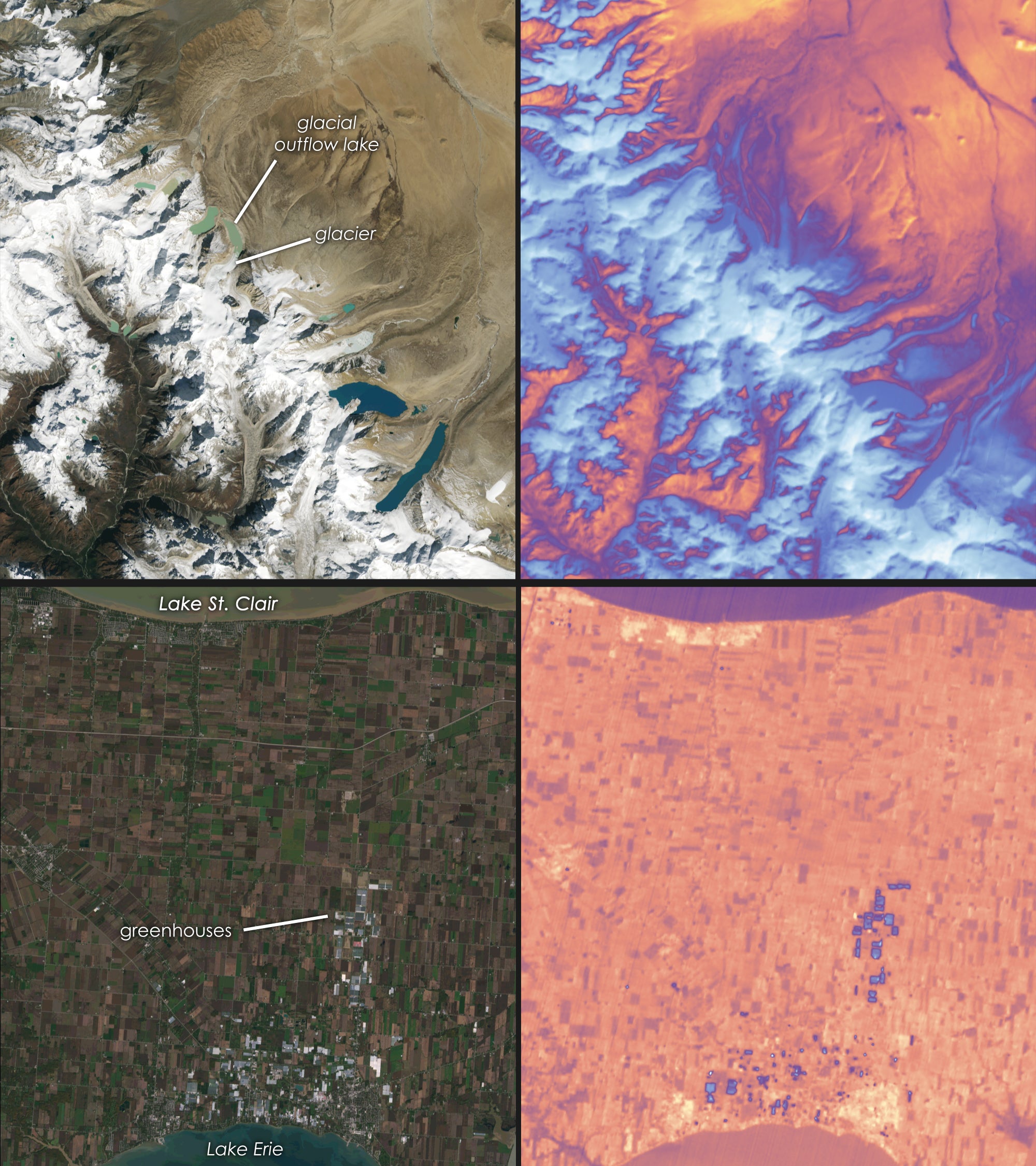
Landsat’s first snapshots show aerial views of Michigan, Florida, and Arizona, in vividly high resolution.
“First light is a big milestone for Landsat users – it’s the first chance to really see the kind of quality that Landsat 9 provides,” said Jeff Masek, the NASA scientist overseeing the project. “And they look fantastic.”
NASA says the satellite’s wide range of imaging tools – capturing many different wavelengths of light and heat – will help gather data on everything from changing coastlines to the health of crops.
And unlike its predecessor, Landsat 8, Landsat 9 can detect incredible levels of detail, differentiating between more than 16,000 shades of a given colour.
“When we have Landsat 9 operating in coordination with Landsat 8, it’s going to be this wealth of data, allowing us to monitor changes to our home planet every eight days,” Mr Masek said.
As the planet continues to warm, scientists say Landsat will help monitor changes in vegetation health, irrigation use, water quality, wildfire severity, deforestation, glacial retreat, and other issues.
“The data and images from Landsat 9 are expanding our capability to see how Earth has changed over decades,” said Karen St Germain, NASA’s Earth Science Division director. “In a changing climate, continuous and free access to Landsat data, and the other data in NASA’s Earth observing fleet, helps data users, including city planners, farmers and scientists, plan for the future.”
Join our commenting forum
Join thought-provoking conversations, follow other Independent readers and see their replies
Comments
Bookmark popover
Removed from bookmarks