Satellite images show massive Saharan dust storm engulfing western Europe
Storm Celia has carried dust from North Africa to Europe, affecting air quality in a number of countries
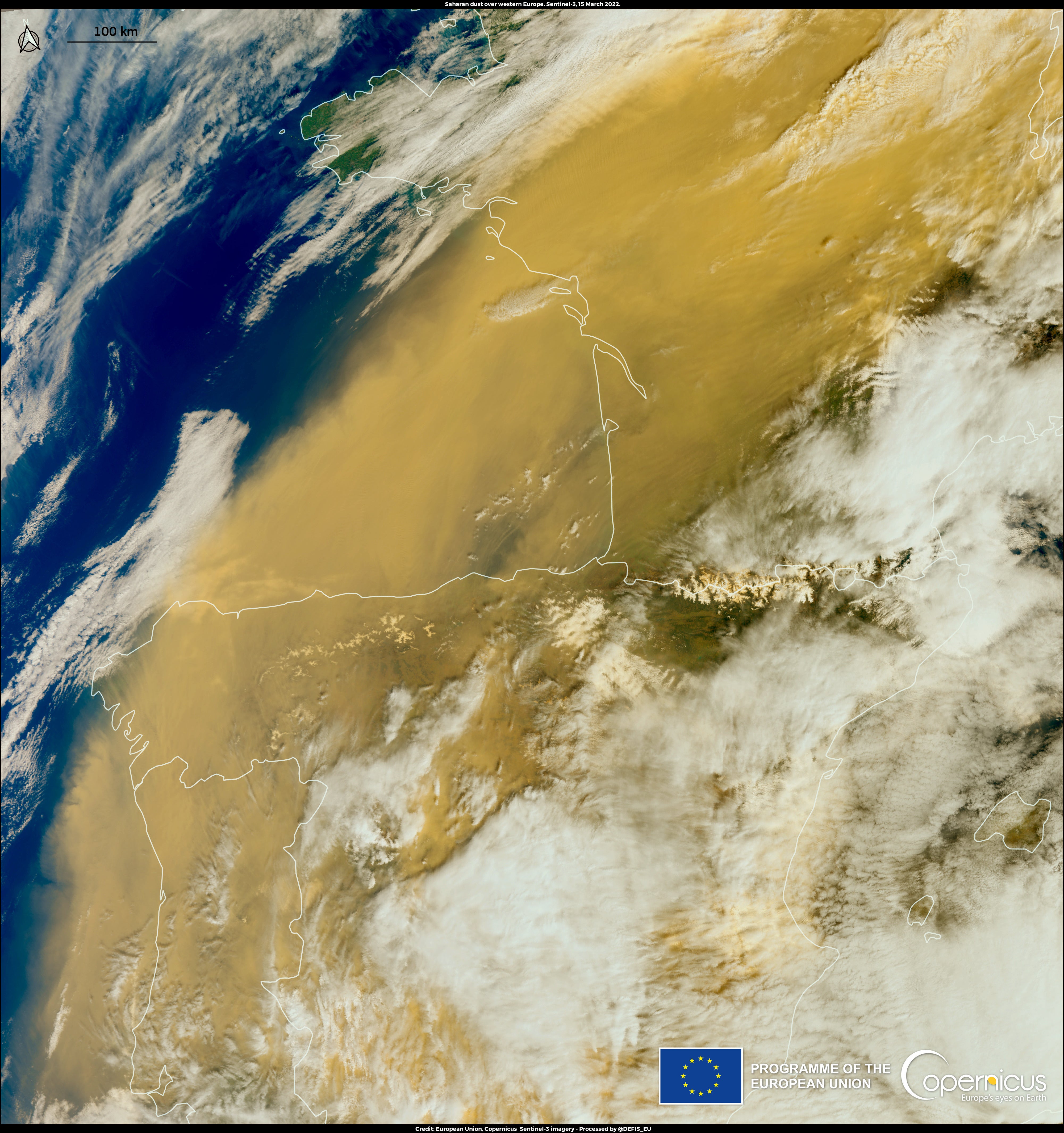
New satellite images have revealed the scale of the vast Saharan dust cloud blanketing western Europe.
Storm Celia is driving a warm air mass filled with dust from North Africa to Europe, affecting the air quality in a number of countries.
Spain was particularly impacted with local officials advising citizens to wear masks when outside and avoid outdoor exercise. Those with allergies and respiratory problems are particularly vulnerable to spikes in small-particle air pollution.
Madrid, along with resort towns in the Southeast, saw skies darken to a “Bladerunner”-like orange. The dust impacted visibility in most of the country, and caused cancellation of seven flights from the Canary Islands.
The Saharan dust reached the United Kingdom on Wednesday and led to hazy skies over southern England including across London.


The UK Met Office said the clouds would be most visible at sunset on Wednesday and cars may be blanketed with dust in areas where there are rain showers.
Although harmful to human health, the dust clouds bring nutrient-laden minerals from the Sahara, the planet’s largest and hottest desert, to ocean life and vegetation.
Sand and dust storms occur annually when powerful, hot winds, sweep across loose soils on arid land.
In summer 2020 an enormous dust storm, named “Godzilla”, swept nearly 24 tons from the Sahara to North and South America. It was so vast that astronauts tweeted photos of the dust cloud from the International Space Station.
After “Godzilla” took off, Nasa used satellite data and computer modelling to study the plumes. While dust clouds will still vary from year to year, scientists predict that plumes will be the smallest in 20,000 years this century due to climate-driven ocean heating.
This is because sea surface temperatures have a direct impact on wind speeds. If warming occurs in the northern Atlantic Ocean, then trade winds will weaken and can carry less desert dust.
Those weaker winds also means bands of tropical rain can more easily move into desert regions, keeping the sand damp and less likely to be blown away.
Smaller dust clouds are part of a feedback loop that is increasing global heating. Particles in the air have the ability to reflect the sun so with fewer suspended, more sunlight and heat reach ocean water, causing it to get even warmer.
The satellite images were captured on Tuesday by the Copernicus Sentinel-3 satellites, which are part of the European Union’s earth observation programme.
Join our commenting forum
Join thought-provoking conversations, follow other Independent readers and see their replies
Comments
Bookmark popover
Removed from bookmarks