Most homes in America now face at least some wildfire risk, research shows
Some homes have more than a one in four chance of wildfire in the next three decades
Over half of American homes have some risk of wildfire in the next 30 years — and that threat is increasing dramatically as the climate crisis makes parts of the country hotter and drier, a new report found.
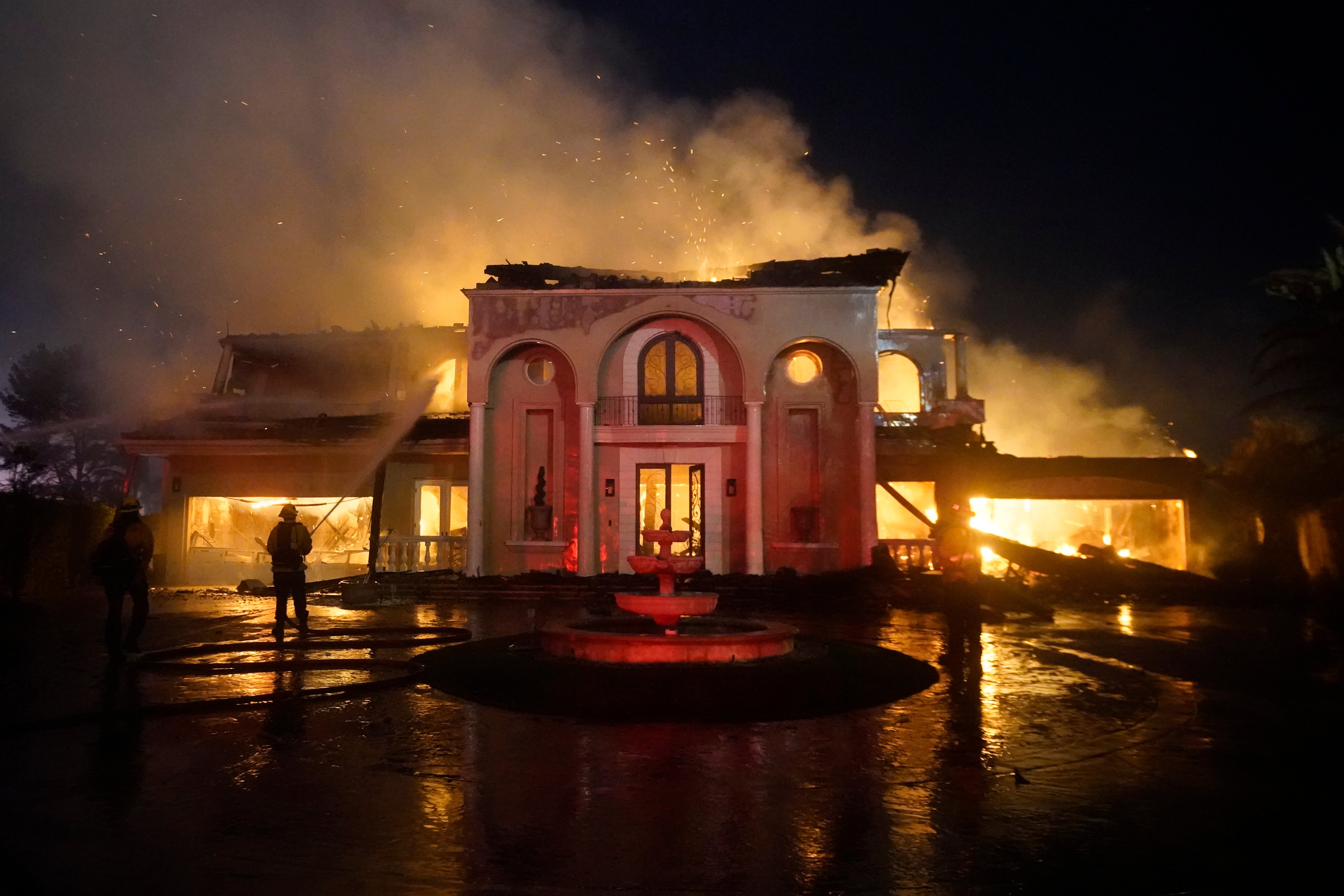
Wildfires are already a common and devastating disaster in much of the country, especially in the West. Last year, massive blazes — including the largest single fire in the state’s history — ripped through northern California.
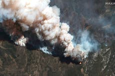
This week, the biggest fire in New Mexico history has been spreading for weeks, destroying homes and spurring mandatory evacuations.
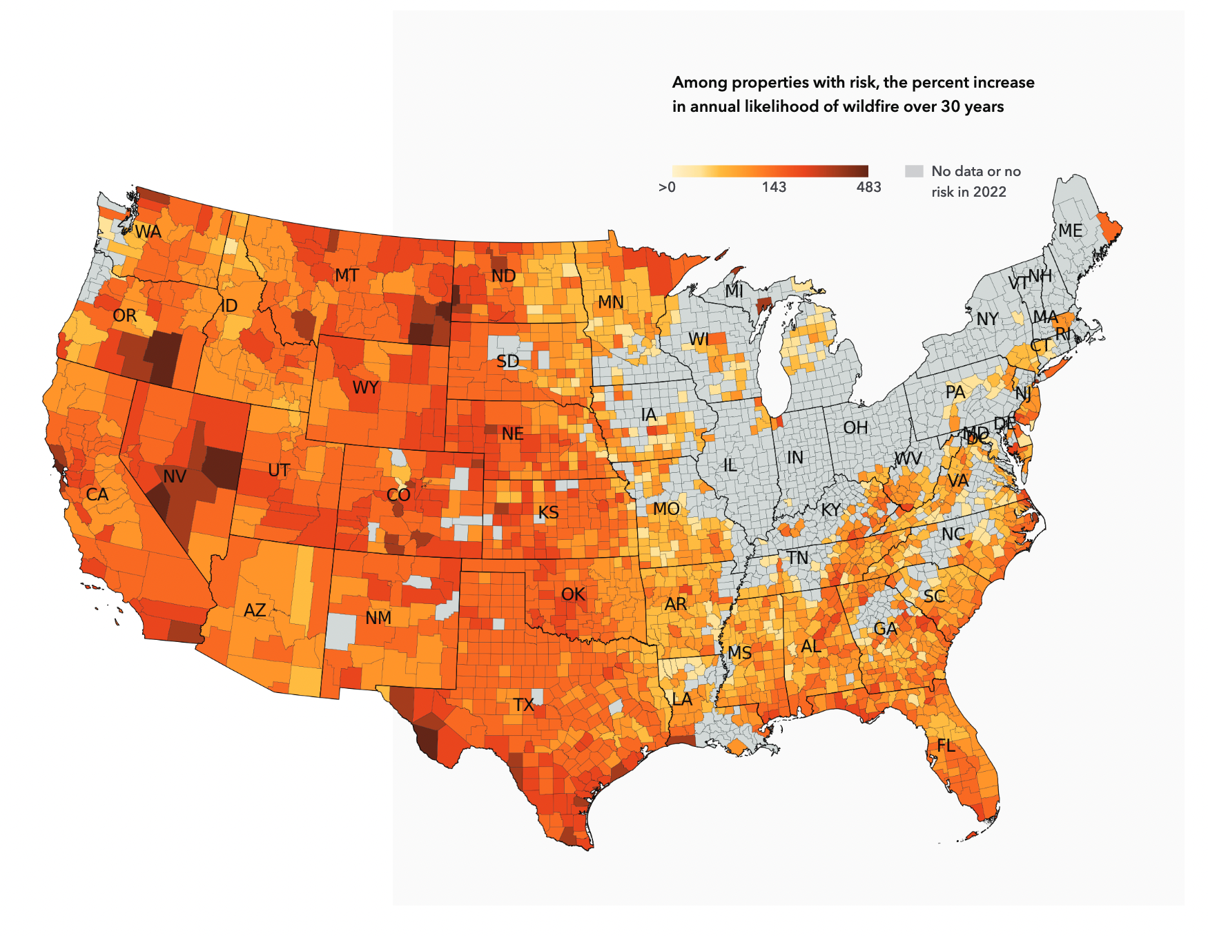
The new report, published this week by the non-profit First Street Foundation, maps fire risk across the country, showing Western states and Florida as particular hotspots.
In the West, 800,000 properties are at an “extreme” risk of fire — meaning those properties have at least a 26 per cent chance of burning in the next 30 years.
An additional 1.7 million properties in the West are at “severe” risk of fire, with somewhere between 14 and 26 per cent chance of burning in the next 30 years. In total, almost 20 million properties in the West have at least 1 per cent chance of burning over three decades.
Particular hotspots include areas from Arizona through New Mexico and northern Texas, as well as Utah, Nevada and Idaho.
But while the West has the highest proportion of properties in serious danger, the South has a higher number of properties at risk. In total, 43 million properties in the South have at least a 1 per cent chance of burning over the next 30 years — though only 1.5 million of those are at “severe” or “extreme” risk.
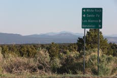
Some of the locations at highest risk aren’t surprising. In Los Alamos County, New Mexico, 98.9 per cent of properties have at least a 0.03 per cent chance of burning this year alone — the highest for any county in the country. Right now, the Cerro Pelado fire is burning in the next-door Sandoval County, prompting an evacuation warning in Los Alamos.
But there are other potential wildfire hotspots less frequently associated with blazes than the American West. Central and southern Florida show up bright red on the report’s risk map — with Polk County, between Tampa and Orlando, having an 87.8 per cent of properties with at least a 0.03 per cent chance of burning just this year, comparable to counties in many Western states.
And while the Northeast and Midwest have lower overall risk from wildfires, there are small hotspots in places like southern New Jersey and northwest Minnesota. Just last year, a wildfire in southern New Jersey burned through hundreds of acres.
But wildfires out West are typically far larger and more destructive. The Calf Canyon/Hermits Peak fire currently raging in New Mexico has exploded across 300,000 acres — about the size of the entire city of Los Angeles.
Last year’s Dixie Fire in northern California reached over 960,000 acres — about the size of the entire state of Rhode Island.
Conditions are only expected to get worse as the climate crisis progresses. The new report’s map shows increasing wildfire risk across much of country, including the entire West, much of the South and the mid-Atlantic Coast.
Warmer temperatures and more frequent drought are likely to increase fire risk in the western US — and fire seasons, usually peaking in the summer, are expected to get longer, with blazes coming both earlier and later in the year.
A lot of the risk to homes comes from building at the wildland-urban interface — which experts call the “WUI” — the boundary between human development and more natural landscapes.
In Colorado, for example, a home built on a forested mountainside in the Rockies would be right at the WUI, while a home built well within the city of Denver would be far from the WUI. The home in the Rockies, being much closer to more open, burnable land, is likely at a far higher risk of wildfire than the home in Denver.
But the WUI can show up in more urban areas too. Last week’s fire in southern California, for example, started in a nearby open canyon before spreading to neighbourhoods and burning homes.
The US federal government estimates that in places like New Mexico, Wyoming, Montana and northern New England, more than 60 per cent of all homes are within the WUI.
The WUI is also growing across much of the US as new homes are built near wilderness areas — which experts warn will lead to increased risk of wildfire damage to property, in addition to potentially more total fires as the risk of human activity igniting a blaze in these areas increases.
Join our commenting forum
Join thought-provoking conversations, follow other Independent readers and see their replies
Comments
Bookmark popover
Removed from bookmarks