Winter storm warning: ‘Once-in-a-generation’ storms sweep the US today
The powerful winter storm will produce widespread, disruptive and potentially crippling impacts across the central and eastern United States
An Arctic blast will sweep the United States on Thursday, impacting nearly every state this holiday season with a miserable mix of dangerous cold, blinding snow squalls and flash freezing.
The powerful winter storm will produce widespread, disruptive and potentially crippling impacts across the central and eastern United States between now and Christmas Eve, the National Weather Service warned.
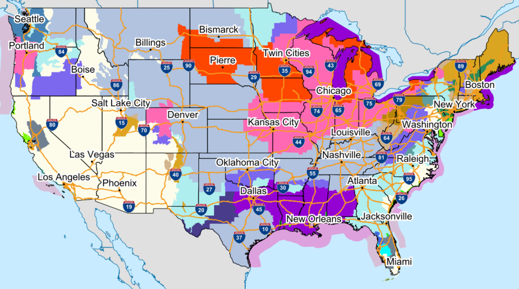
The weather system is so large that about 200 million people across 30 states, from Washington to Florida, were under winter storm warnings and advisories today, and some states declared emergencies due to the conditions.
Daytime temperatures across the central Plains will struggle to get above freezing, while areas further south in Texas and the Gulf Coast will experience temperatures in the single digits and teens on Thursday evening.


NWS’s Buffalo office warned of a “once-in-a-generation storm” while Kentucky Governor Andy Beshear described the conditions as ‘really, really dangerous” as he declared a state of emergency.
“After tornadoes and floods, pandemics and multiple ice storms just in these last three years, I don’t want to lose one person to this Arctic front that is coming through,” Gov Beshear said on Wednesday.
Snow squalls, or a brief burst of moderate to heavy snow lasting up to two hours are likely to occur immediately behind the Arctic front as it treks from the mid-Mississippi Valley to the East Coast.
Developing snow squalls could lead to extremely hazardous travel conditions at times, as they will be accompanied by gusts to 40 mph and the potential for sudden whiteout conditions.
Areas with standing water ahead of the approaching cold front, particularly throughout the Ohio and Tennessee Valleys, could experience a flash freeze on Thursday afternoon and evening.
Flight and road delays are expected across the country during what is one of the busiest travel periods of year. Early on Thursday, US airports had 62 flight cancellations and 157 delays.
Power outages and downed trees will also be likely across many areas as forecasters also warned of powerful, gusty winds. More than 11,000 homes were without power in Kansas on Thursday and nearly 8,000 in Oregon, according to utility tracker poweroutage.us.
Record-breaking cold and life-threatening wind chills are forecast over the Great Plains before moving into the eastern half of the country by Friday.
Temperatures across the Plains have already plummeted 50 degrees Fahrenheit (F) in a matter of hours in places. These temperatures, combined with 20-30mph sustained winds, and gusts of up to 60 mph, will cause wind chills as low as minus 40F across mountainous parts of the western US and the Plains. In some spots, minus 50-70F is possible in the coming days.
“Wind chills of this magnitude can cause frostbite in less than five minutes if precautions are not taken, with hypothermia and death also possible from prolonged exposure to the cold,” the National Weather Service warned.
Significant freezing rain is possible across parts of western Oregon and Washington from Thursday.
This article is being updated
Join our commenting forum
Join thought-provoking conversations, follow other Independent readers and see their replies
Comments
Bookmark popover
Removed from bookmarks