What is a ‘bomb cyclone’? The powerful storm about to batter the US East Coast
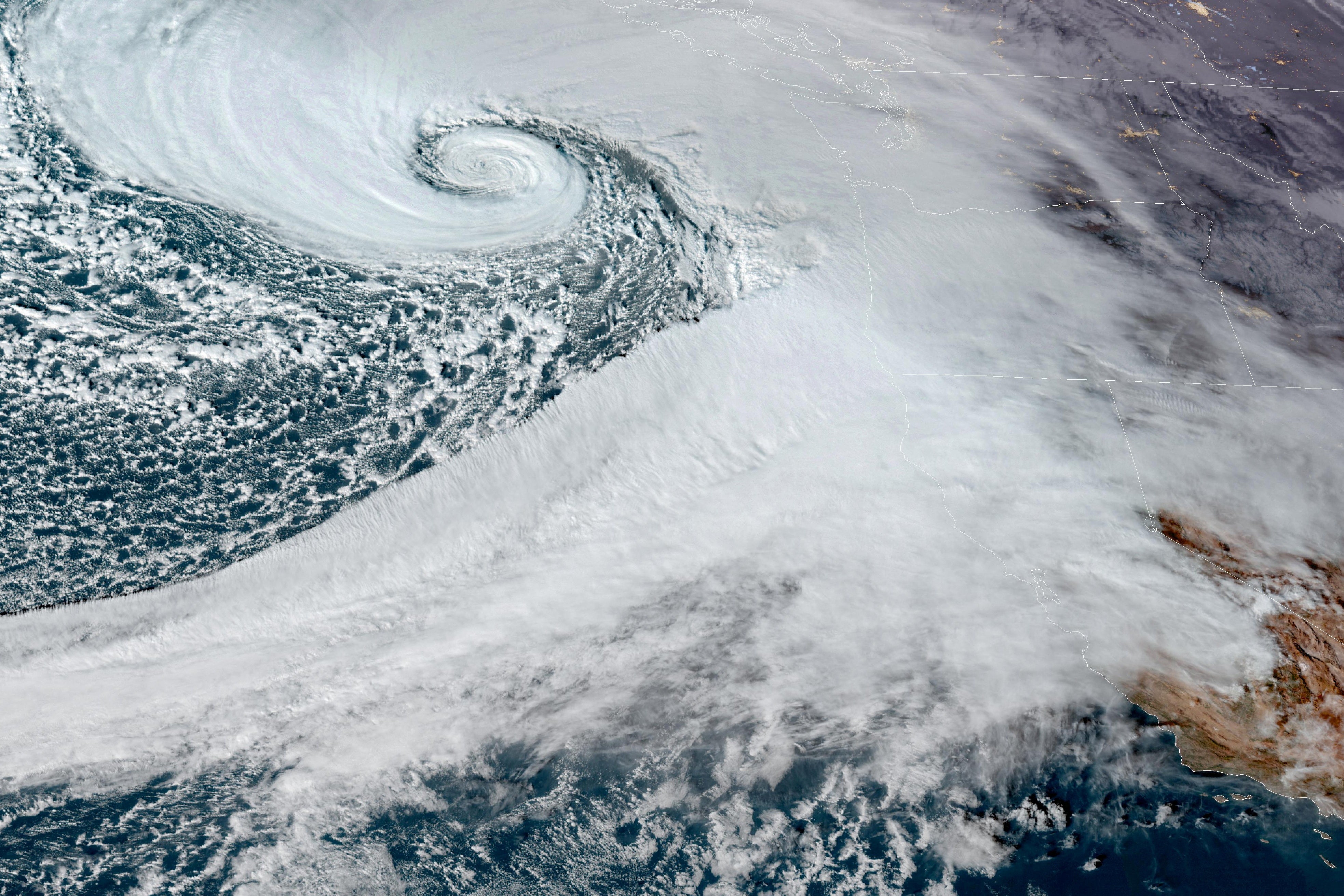
At least two people have died and hundreds of thousands have been left without power after the bomb cyclone slammed into Seattle
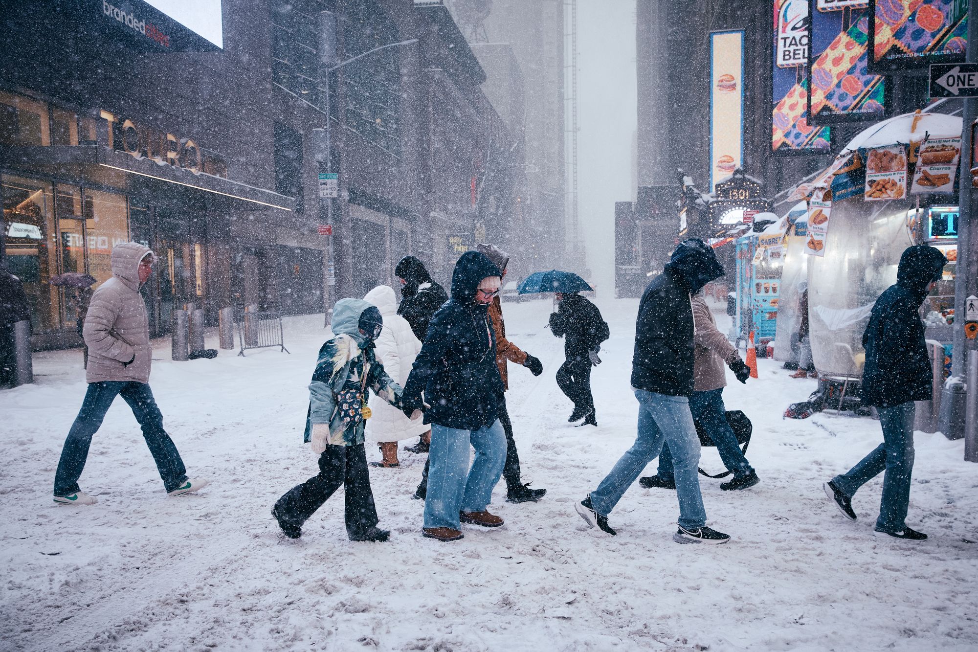
A bomb cyclone is set to rock the East Coast over the weekend, threatening millions with freezing temperatures and potential power outages.
The powerful storm is currently forming off the coast of the Carolinas and is rapidly intensifying as it begins to move stateside.
AccuWeather meteorologists have also warned that some parts of Massachusetts could be hit with up to 12 inches of snow.
Other areas, including New England, Long Island, New York, New Jersey and Delaware, could see up to 6 inches of snow, while blistering winds surge across most of the eastern states.
Huge flight delays are expected from Friday, when the storm will hit the Southern U.S. before moving northward. The extreme weather is expected to begin subsiding on Sunday, according to AccuWeather.
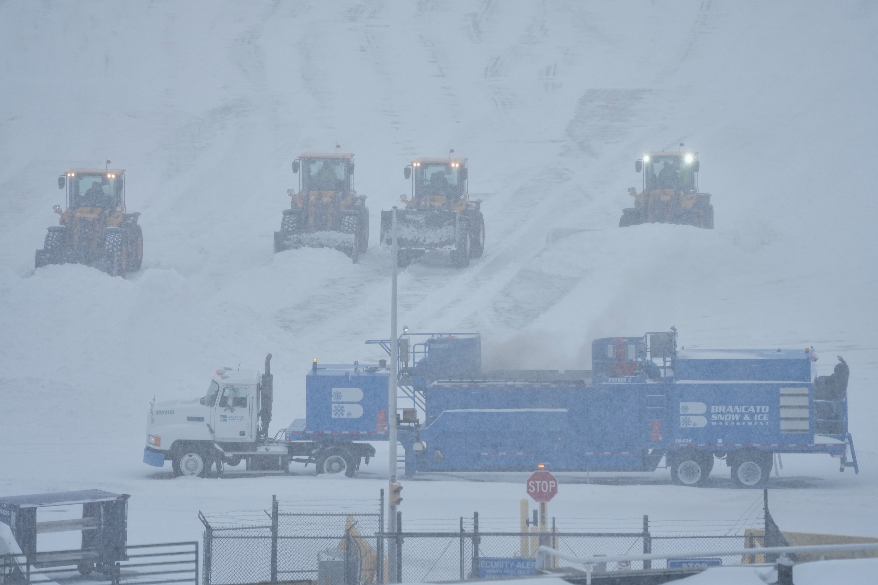
The bomb cyclone comes just days after much of the country dug itself out of another snowstorm, which saw some areas experiencing historic low temperatures.
Last week’s megastorm saw a million people left without power, when more than a foot of snow fell across 20 states. Data seen by USA Today suggested that the gruelling weather killed at least 62 people as it battered across the country.
What is a bomb cyclone?
A bomb cyclone is a term used to describe bombogenesis, the rapid intensification of a cyclone in a very short period of time.
The term refers to cyclones located between the tropics and polar regions and occurs when cold air masses slam into warm air masses, while hovering over ocean waters.
Bomb cyclones, which are also referred to as explosive cyclogenesis, differ from hurricanes because of this collision of hot and cold air. Normally, hurricanes are born out of warm, balmy air over the ocean.
In order to be considered a bomb cyclone, pressure needs to drop by at least 24 millibars over 24 hours, according to the National Ocean Service.
Although the storms have an ominous name, they are actually fairly common. North America is whipped by 18 bomb cyclones per year, a study by Robert Fritzen at Northern Illinois University found.
What was the worst bomb cyclone to hit the U.S.?
The most intense cyclonic storm to ever hit the United States is often considered to be 1993’s so-called Storm of the Century.
Stretching from Canada to Honduras, the storm formed over the Gulf of Mexico on March 12 and caused a staggering $5.5 billion in damage.
According to the National Weather Service, some areas were battered with 100 mph winds, while around 10 million homes were left without power in the U.S.
An estimated 208 U.S. citizens were killed in the blast, with 318 people being killed across North America.
The storm was described by the New York Times as "a monster with the heart of a blizzard and the soul of a hurricane."
What should you do if a bomb cyclone is heading your way?
Experts say that preparing for a bomb cyclone can help limit the dangers they present.
According to The Weather Channel, you should ensure that you are stocked up on food and water before the storm hits. Also, having a spare stash of batteries can keep electronic devices running if your power is cut
Nailing down loose items which could be blown away and become a lethal projectile is essential too, so you can limit the danger to others.
Bomb cyclones can be deadly for several reasons, meaning you should try to stay home during the worst of the storm, according to Eco Flow.
Being trapped in the extreme cold comes with the risk of hypothermia, while high winds can cause deadly objects to fly through the air or increase the risk of slipping.
Snow can also reduce visibility on the roads, increasing the risk of accidents.
Bookmark popover
Removed from bookmarks