UK weather: Heavy rain and strong winds to batter country again as Met Office expands warnings
Environment Agency puts in place five flood warnings and 33 flood alerts
The Met Office has issued new warnings for heavy rain and strong winds as parts of England have already seen more than a third of the average monthly rainfall.
Forecasters issued two more yellow weather warnings Monday morning, expanding an initial alert which ran from 11pm on Sunday until 10am on Monday, covering an area stretching from Chichester in West Sussex to Canterbury in Kent.
The first downpours are expected from 3pm to midnight across southwestern parts of Scotland.
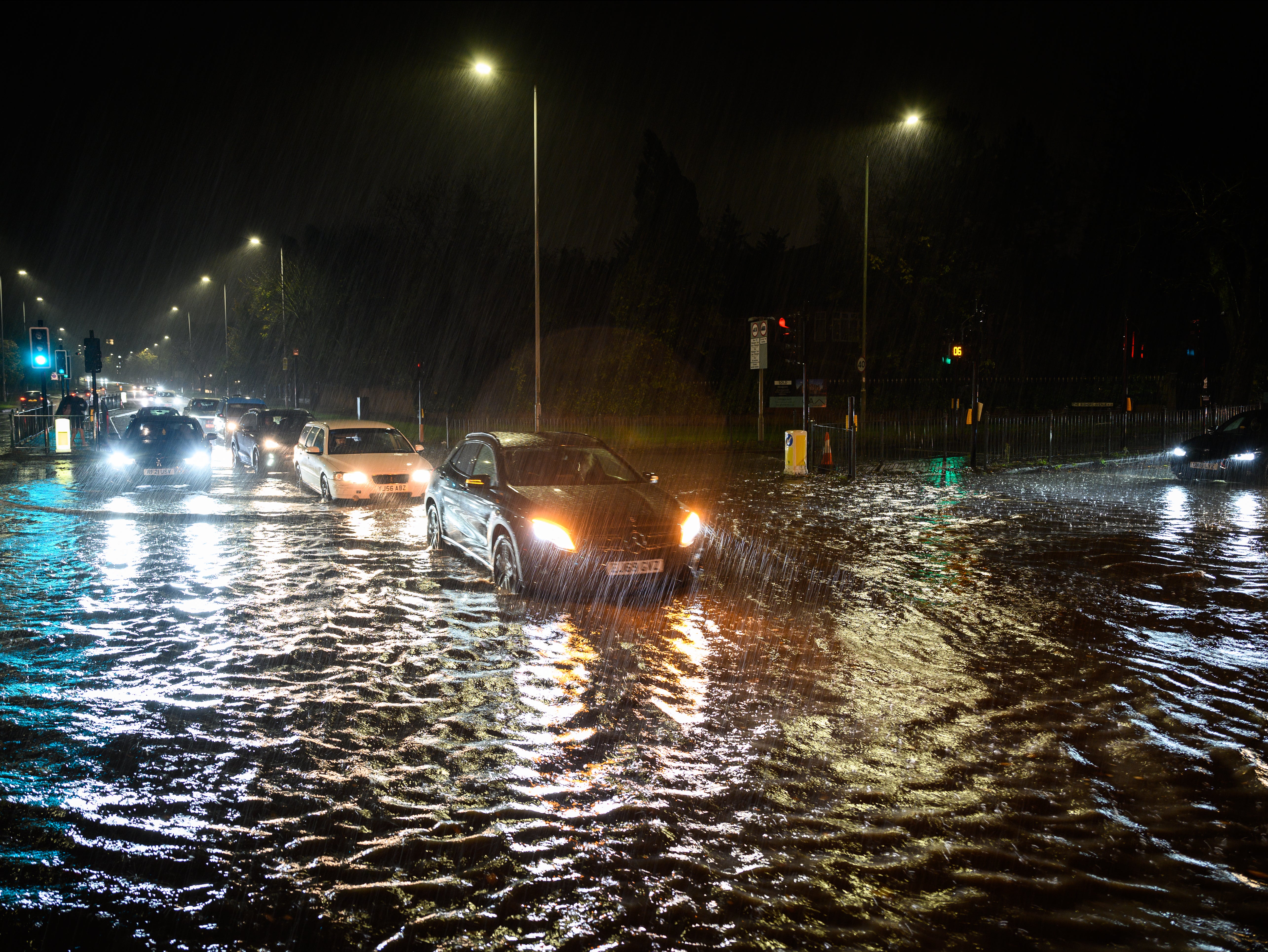
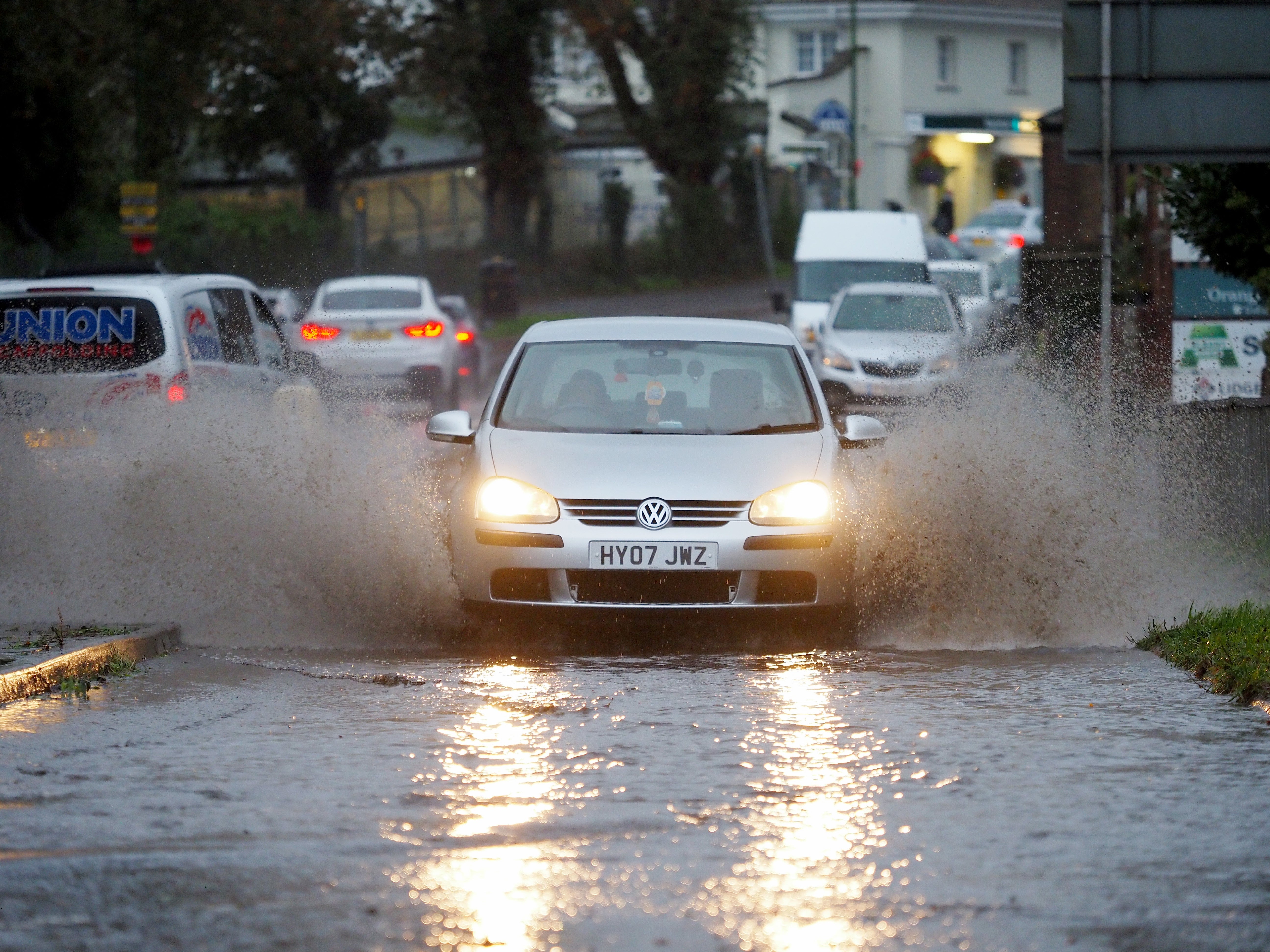
Spray and flooding on roads are likely to affect public transport and make journey times longer, the Met Office warned, while homes and businesses are also expected to be hit by a deluge.
A second weather warning for rain and strong winds has been announced across parts of Northern Ireland, Wales and southwest England, where a short downpour and squally winds are expected to inflict delays to road, rail, air and ferry transport.


Forecasters expect delays to bus and train services due to flooding on roads, which could hold up high-sided vehicles on exposed routes and bridges.
The Met Office has warned there could be short-term loss of power and potential flooding of homes and businesses.
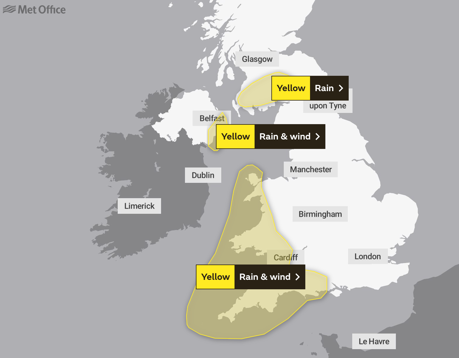
Gusts of 50-60mph, with the potential to reach 70mph on some coastlines, are also expected.
An update on the Met Office Twitter for this afternoon reads: “A cloudy, breezy and mild afternoon, with a few glimmers of brightness at times.
“Many of us will see some rain or drizzle at times, with the heaviest and most persistent rain on western hills. Turning windier too, especially in the west, with gales on coasts later.”
The Environment Agency has also issued five flood warnings and 33 flood alerts.
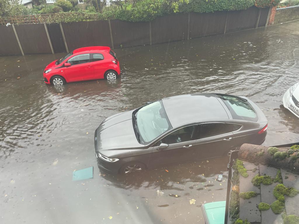
It comes after drivers faced waterlogged roads after torrential downpours brought up to two inches of rainfall on Sunday.
Areas of London suffered flooding caused by the heavy rain, with Dagenham Heathway Tube Station having to temporarily close.
Met Office outlook
Today:
A windy and rather cloudy day for many areas with scattered showers and also some longer spells of rain in the west. Driest and brightest weather in the east.
Tonight:
Band of heavy rain and very squally winds affecting western areas during the evening, easing as it moves east overnight. Clear spells and blustery showers following into the west.


Tuesday:
Rain in the east turning more showery as it clears, then windy with a mix of sunshine and showers, heaviest and most frequent in the west with possible thunder.
Outlook for Wednesday to Friday:
Heavy showers in places Wednesday, with sunny or clear spells between, easing later. Rain for northwestern areas Thursday and Friday, drier further south and east; becoming very mild and windy.
Join our commenting forum
Join thought-provoking conversations, follow other Independent readers and see their replies
Comments
Bookmark popover
Removed from bookmarks