Huge swathes of the Arctic on fire, ‘unprecedented’ satellite images show
Earth’s boreal forests now burning at rate unseen in ‘at least 10,000 years’, scientists warn
Vast swathes of the Arctic are suffering from "unprecedented" wildfires, new satellite images have revealed.
North of the Arctic circle, the high temperatures are facilitating enormous wildfires which are wreaking ecological destruction on a colossal scale.
It comes after the world’s hottest June on record which has been followed by a devastating heatwave in the US, with Europe forecast for the same treatment later this week.
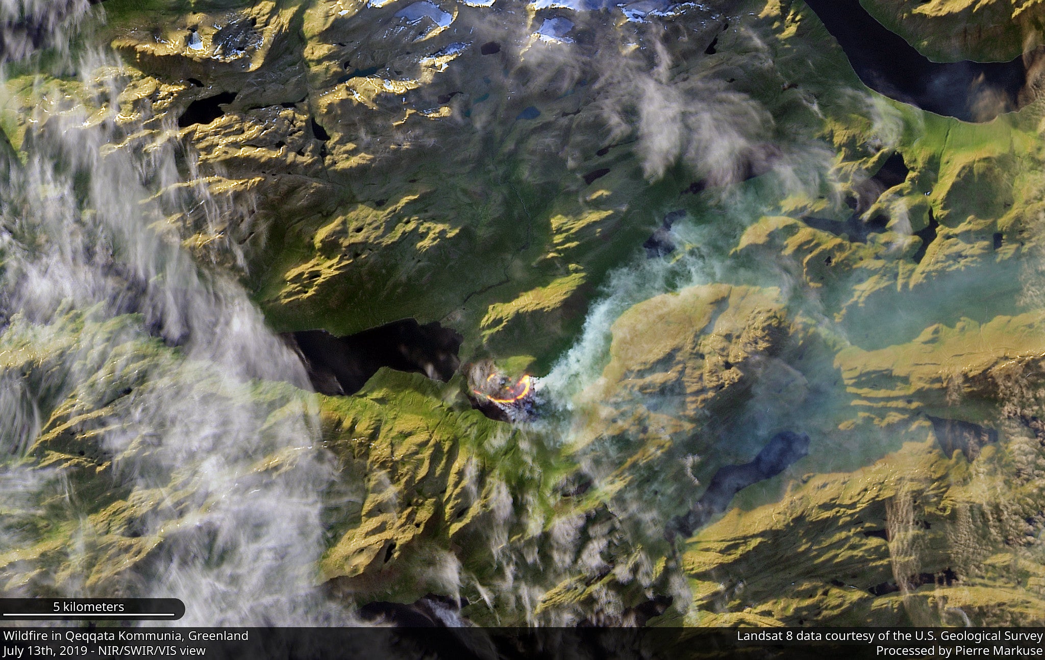
Satellite images reveal fires across Greenland, Siberia and Alaska, with warm dry conditions following ice melt on the enormous Greenland icesheet commencing a month earlier than average.
Pierre Markuse, a satellite photography expert, posted images showing smoke billowing across massive areas of uninhabited and wild land.
The pictures show forest fires and burning peat. They also reveal the extent of the damage the fires leave behind. In Alaska wildfires have already burned more than 1.6 million acres of land.
Mark Parrington, a senior scientist at the European Centre for Medium-Range Weather Forecast, said the amount of CO2 emitted by Arctic wildfires between 1 June and 21 July 2019 is around 100 megatonnes and is approaching the entire 2017 fossil fuel CO2 emissions of Belgium.
“I think it’s fair to say July Arctic Circle wildfires are now at unprecedented levels, having surpassed previous highest #Copernicus GFAS estimated July total CO2 emission (2004/2005), & last month’s 50 megatonnes … and still increasing,” he tweeted.
The World Meteorological Organisation (WMO) has described the fires in the northern hemisphere as “unprecedented” and warned of the enormous impact they are having on CO2 levels contributing to the climate crisis.
“Since the start of June, the Copernicus Atmosphere Monitoring Service (Cams) has tracked over 100 intense and long-lived wildfires in the Arctic Circle,” the WMO said in a statement.
“In June alone, these fires emitted 50 megatonnes of carbon dioxide into the atmosphere, which is equivalent to Sweden’s total annual emissions. This is more than was released by Arctic fires in the same month between 2010 and 2018 combined.”
“Although wildfires are common in the northern hemisphere between May and October, the latitude and intensity of these fires, as well as the length of time that they have been burning for, has been particularly unusual,” the organisation said, quoting Dr Parrington.
“The ongoing Arctic fires have been most severe in Alaska and Siberia, where some have been large enough to cover almost 100,000 football pitches, or the whole of Lanzarote. In Alberta, Canada, one fire is estimated to have been bigger than 300,000 pitches. In Alaska alone, Cams has registered almost 400 wildfires this year, with new ones igniting every day.”
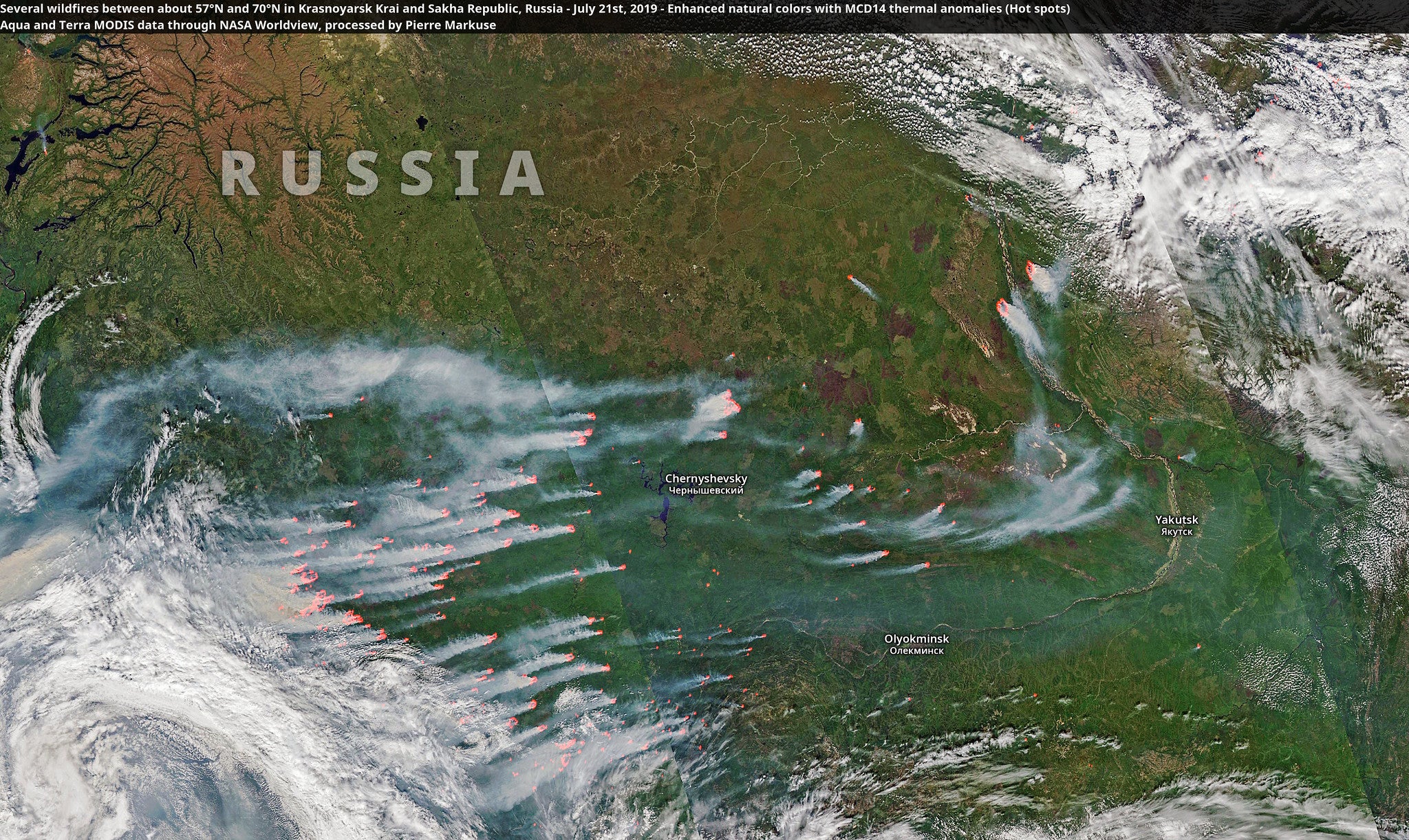
The average June temperature in the region of Siberia where wildfires are raging was almost 10 degrees higher than the 1981 – 2010 long-term average.
The WMO added: “The northern part of the world is warming faster than the planet as a whole. That heat is drying out forests and making them more susceptible to burn. A recent study found Earth’s boreal forests are now burning at a rate unseen in at least 10,000 years.”
Join our commenting forum
Join thought-provoking conversations, follow other Independent readers and see their replies
Comments
Bookmark popover
Removed from bookmarks