Stormchasers capture evolution of supercell thunderstorm
Stormchasers in the US have captured the evolution of a huge “supercell” storm from its formation until it disappears.
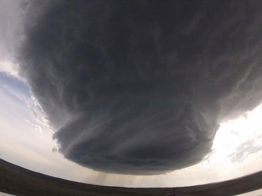
The stunning time-lapse, which has been viewed almost 2.5 million times, shows a mass of swirling clouds tighten into a rotating column reaching out of sight into the clouds.
As the storm grows larger, the chasers move away to reveal its size as it spins, dropping torrential rain, before the funnel unfurls and the clouds dissolve.
The group, Basehunters, tracked it for almost 70 miles from Wright to Newcastle in Wyoming on Sunday.
They are often found in the Great Plains of the US, where they cause much of the severe weather in the area known as Tornado Alley.
One storm can spawn several tornadoes in its lifespan and produce large hail, damaging winds, flooding, powerful lightning and heavy rain.
Video courtesy of Basehunters, see original here.
Join our commenting forum
Join thought-provoking conversations, follow other Independent readers and see their replies
Comments
Bookmark popover
Removed from bookmarks