The Independent's journalism is supported by our readers. When you purchase through links on our site, we may earn commission.
How 'free' is free satellite navigation?
Satellite navigation device manufacturer Garmin has launched an attack on "free" satellite navigation services over the mobile phone network, warning that it "isn't as free as it would like to make out" when traveling overseas.
Garmin, which manufactures satellite navigation equipment and sells navigation smartphones, says that it racked up a bill of up to £39 (€46) in roaming fees doing the 298 km drive from Calais to Paris, which required downloading 12-13 megabytes of data per journey.
It used an Android handset and Google Maps Navigation for its tests, which were conducted using both a pay-and-go and contract SIM card from UK mobile network O2 - although the results are likely to be similar with most global networks.
Recently European legislation has capped the amount that data costs whilst roaming (using a mobile phone outside of its home country), but rates remain at between €0.80 and €1 per megabyte and users aren't warned until they've spent €40 in fees.
Garmin says that for some routes the cost could be up to 20 pence (€0.23) per mile for navigation - far more than fuel and a nasty surprise at the end of the vacation.
“We are encouraging anyone driving abroad this year on holiday to be aware of the costs," said Garmin spokesman Anthony Chmarny.
"Sometimes it can be difficult to tell whether a mobile phone application has maps included or if it relies on the mobile network to download maps, which can lead to huge mobile bills."
For travelers looking to avoid costs associated with roaming, there are a few options.
Some mobile phone networks sell individual data bundles that can be used overseas and provide an inclusive allowance which could make using over-the-air services such as Google Navigation or TeleNav more cost-effective overseas.
Alternatively, driver could use an app which comes preloaded with maps, such as the TomTom app or the Megellan RoadMate apps - although they are considerably larger than apps which pull mapping data from the cloud.
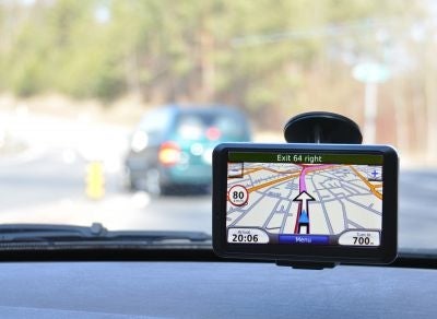
Finally, GPS devices from traditional satellite navigation providers such as Garmin and TomTom are normally preloaded with maps, meaning that they don't need to download any routing - and the "Live" services that do require a cellular connection are normally included in the price.
Join our commenting forum
Join thought-provoking conversations, follow other Independent readers and see their replies
Comments
Bookmark popover
Removed from bookmarks