Clay tablets dating back 4,000 years used to show locations of long-lost ancient cities
Researchers analyse trade data on 12,000 artefacts to build picture of vanished settlements
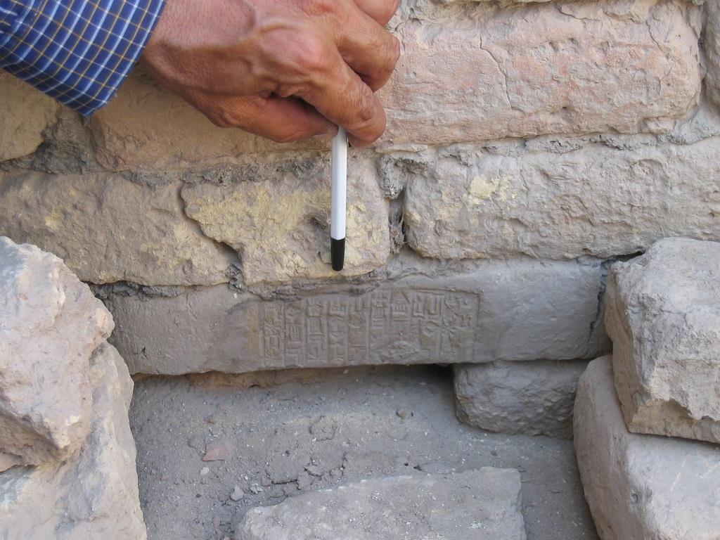
A team of historians and economists have translated 4,000-year-old clay tablets inscribed by Bronze Age merchants to locate long-lost ancient cities.
The artefacts have been excavated from the ancient city of Kanesh, which is now situated in modern-day Turkey.
Written in cuneiform script, one of the earliest systems of writing, the tablets are a mixture of business transactions, shipment documents and contracts, including marriage certificates.
The tablets were inscribed by merchants of the ancient Middle Eastern kingdom of Assyria.
Using the inscriptions, Harvard University lecturer Gojko Barjamovic and three economists believe they have developed a system to identify the location of lost cities, by examining the trade shipments recorded on the tablets.
The clay artefacts contain mentions of ancient cities and settlements, some of which have been unearthed and others which remain unknown.
In total, Mr Barjamovic translated and analysed 12,000 tablets, which give detail of hundreds of trade interactions among 26 cities.
The location of 15 of these cities are known and 11 remain lost.
Although the coordinates of the lost settlements are not given, the researchers believe they have the rough location of the cities.
At the time, trade was dictated by geographic distance as goods were transported by road, which meant cities located closer together traded more while those further apart traded less.
Using this data the researchers managed to create a system to quantify distance based on how frequently cities traded with one another.
The system is dubbed a “structural gravity model” and gives an estimate as to where the lost cities might be.
Using data on the tablets, the team has estimated the location of the 11 lost cities, which they then compared to locations given by historians.
“For a majority of the lost cities, our quantitative estimates come remarkably close to the qualitative conjectures produced by historians, corroborating both such historical models and our purely quantitative method,” the researchers wrote.
“Moreover, in some cases where historians disagree on the likely location of a lost city, our quantitative method supports the conjecture of some historians and rejects that of others.”
The cities still need to be found to confirm whether the system works.
Join our commenting forum
Join thought-provoking conversations, follow other Independent readers and see their replies
Comments
Bookmark popover
Removed from bookmarks