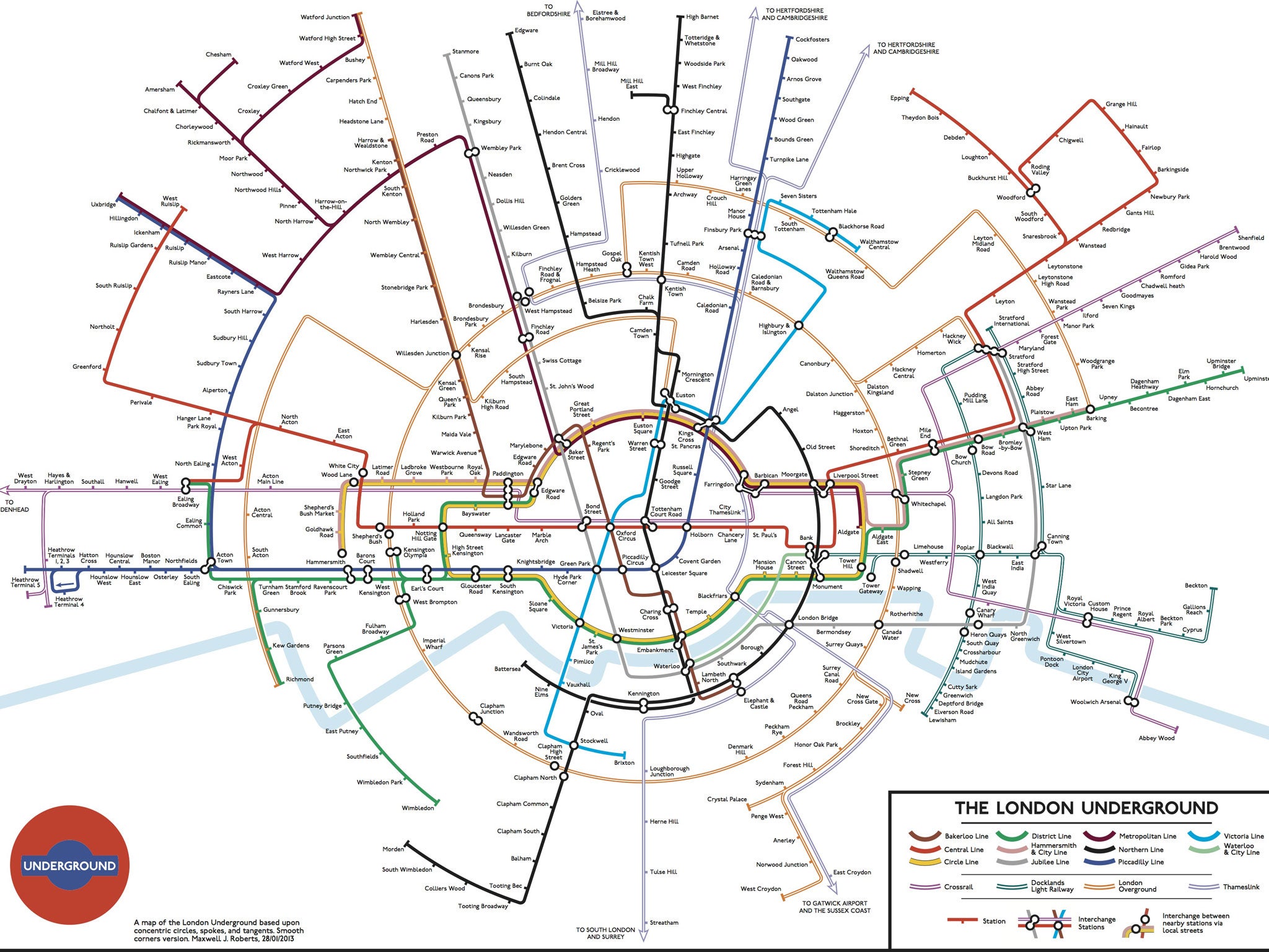
All aboard the Circular line: The latest alternative Tube map from Maxwell Roberts
The London Underground map is the definitive guide for Londoners and visitors moving around the capital. However, as more lines and stations are added it is getting a little cluttered.
The new route of the Overground connecting from Surrey Quays to Clapham Junction, the extension of the Northern line and the reintroduction of the Thameslink recently led to efforts by Francisco Dans and Jonathan Fisher to rework the classic Tube map.
But this week, alternative Tube map veteran Maxwell Roberts (in 2007 he designed a map based on the above-ground distances between stations) unveiled his latest map (above), proposing a network of straight lines and concentric circles.
Click the image above for an enlarged version
The current London map divides London by zones and leaves suburbs aside, but with this one London feels whole, including the Thameslink line and the forthcoming Crossrail, neither of which are featured on the current standard map.
However, Mr Roberts thinks that this model is not ready yet to send to TFL for comments, as he told Annie Mole's blog: 'No great advances in usability here, but it was fun to make it.'
Join our commenting forum
Join thought-provoking conversations, follow other Independent readers and see their replies
Comments
Bookmark popover
Removed from bookmarks