Atlantic storms could bring more heavy rain at the weekend
Weather experts said up to 50mm of rain could fall in some areas
Boxing Day sale shoppers were soaked as downpours continued across the country today - and there were warnings that an Atlantic storm would bring more heavy rain at the weekend.
While the heavy rain was expected to ease off tonight, it is forecast to remain fairly wet, with rain falling on and off for the rest of the week, a Met Office spokesman said.
Meanwhile, a storm brewing in the Atlantic could mean the last weekend of one of the wettest years on record could be hit with up to 50mm of rain in some areas.
Paul Knightley, forecaster for MeteoGroup, the weather division of the Press Association said: "There is a big Atlantic storm winding itself up.
"The actual epicentre won't be anywhere near us, but it will have quite a lot of effect on our weekend.
"There will be pretty heavy rain on Saturday - there could be 25mm to 50mm in Western areas on Friday and Saturday.
"There could be gales around the coastal areas of up to 50 to 55mph, maybe more in northern Scotland."
Mr Knightley added: "It is fairly normal weather for this time of year, but given the ground is soaking wet it is going to cause a few issues.
"In another year if we had had a dry autumn it would not have been as much of a problem."
A Met Office landslide warning remained in place as walkers were urged to take extra care in "dangerous conditions".
The Met Office, which issued the warning following advice from the British Geological Survey, said coastal areas in the south-west of England were in particular danger of collapsing cliff edges and rockfall, but stressed that all areas enduring heavy rain were at risk.
A Met Office spokesman said it was difficult to predict whether the flooding situation would improve.
"It is drying up at times so it is not continuous," he said.
"It won't help the flooding situation but it is difficult to say whether it is going to get any worse than before."
Rail and road networks were badly hit in the days leading up to Christmas, with a number of key routes struck by weather-related delays and National Rail warned of further disruption in the south-west tomorrow.
First Great Western trains today told people not to attempt travel tomorrow.
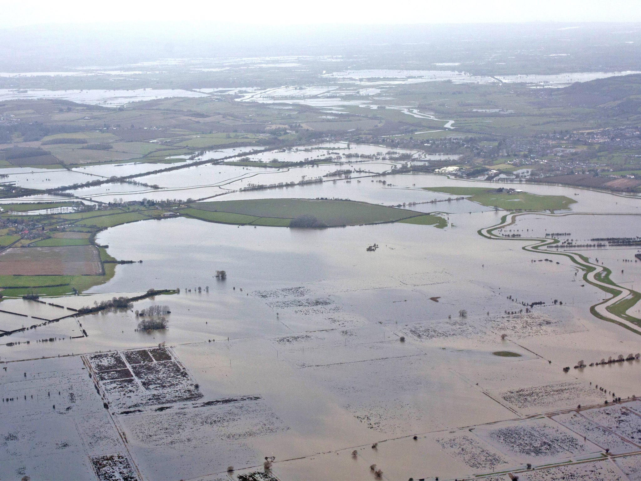
The Environment Agency has 119 flood warnings in place, urging residents to take immediate action against expected flooding while 228 less severe flood alerts have been issued across most of England and Wales.
The agency has removed 76 flood warnings and alerts in the last 24 hours.
The Scottish Environment Protection Agency has removed all its warnings.
Around 470 properties have flooded since last Wednesday, while Floodline revealed it had received 18,000 calls during the recent wet weather.
The worst-affected areas have been south-west England and stretches along the south coast from Cornwall to Kent, along with Wales and northern Scotland.
In Devon and Cornwall alone, 245 properties flooded over the weekend, and although a number of people were evacuated, most have now returned home.
The sodden Christmas comes towards the end of what is expected to be one of the wettest years in Britain since records began.
The UK's average rainfall in 2012, excluding December, was 1,202mm - placing it 13th in the list of wettest years since records began in 1910.
The year 2000 remains the UK's wettest year, with an average rainfall of 1,337.3mm.
PA
Join our commenting forum
Join thought-provoking conversations, follow other Independent readers and see their replies
Comments
Bookmark popover
Removed from bookmarks