Britain braces for 110mph winds as 250mph jet stream hits from Atlantic
Gale force winds and driving rain are expected to be followed by snow
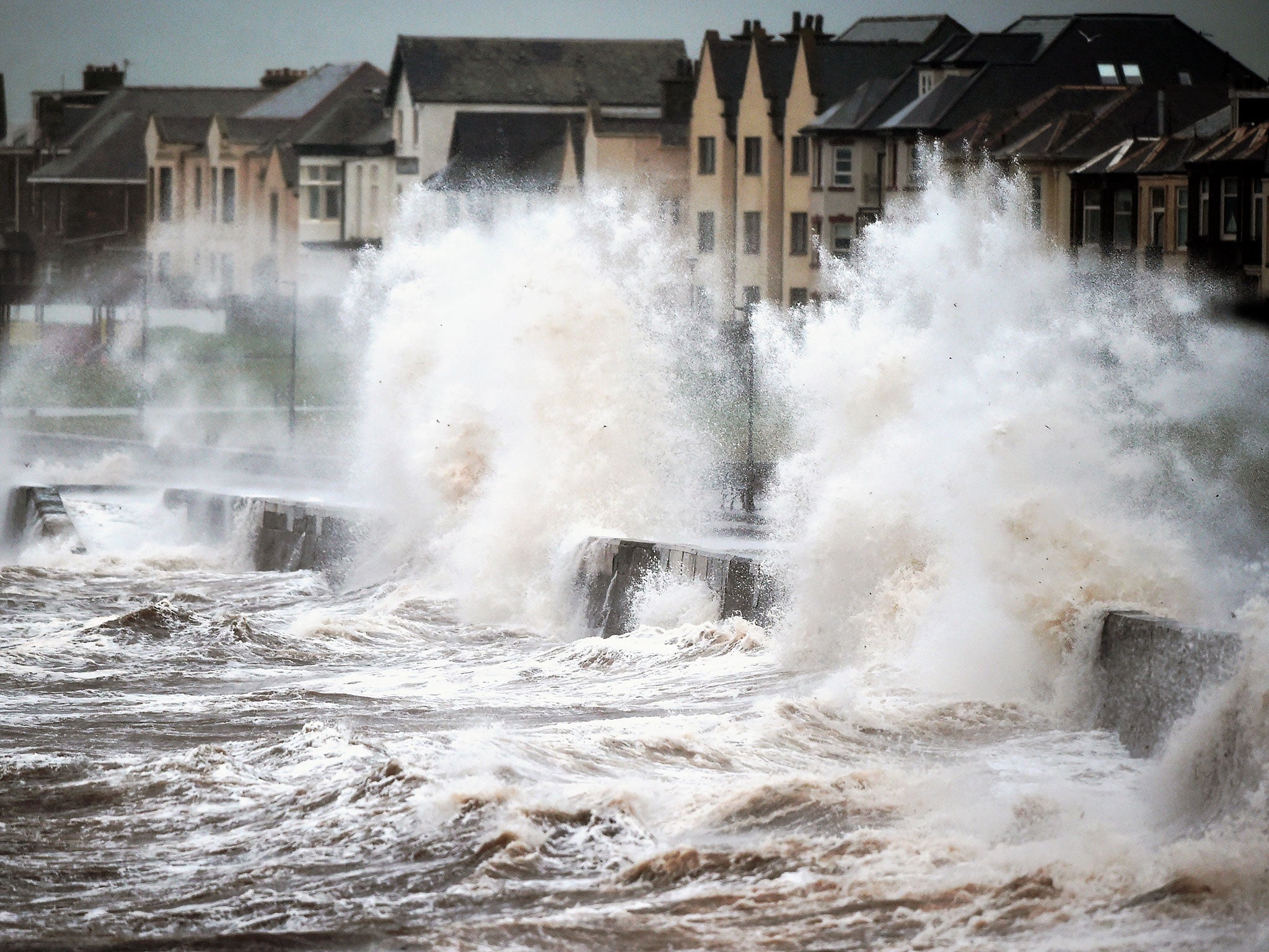
Britain is set to face gale force winds of up to 110mph this evening whipped up by a jet stream over the Atlantic and snow fall will follow in parts of the country.
Two amber warnings, the second highest, have been issued by the Met Office for the north and central belts of Scotland, including the largest cities of Edinburgh and Glasgow.
It is feared that the extreme weather, stemming from the 250 mph jet stream, will affect the Friday morning rush hour.
The warning for the central Forth-Clyde valley runs from midnight to 8am, while the warning in the north is in place from 10pm to 10am.
Thousands of pounds worth of damage could be caused by the strong winds and there are fears that buildings could be damaged, trees uprooted and power lines and travel routes affected.
The powerful gales have been created by the jet stream, which was caused by warm air hitting a pocket of cold air over the US and is now heading for the north of Scotland.
Over the coming days there will be two “vigorous depression” in the UK, according to forecasters.
Mark Wilson, a meteorologist at the Met Office told The Independent: "While we expect winds speeds to reach 80mph across Scotland, in exposed areas there could be gusts as high as 100 or even 110mph."
The remainder of Scotland has been issued with a yellow warning, as winds of 70-80mph are expected. In England, Wales and Northern Ireland strong winds of 60mph are forecast.
Will Lang, chief meteorologist at the Met Office, said: "The winds will be at their strongest through the early hours of Friday and this brings the potential for disruption across Scotland, but there is a chance that strong, gusty winds could persist into the early part of the morning rush hour as well.
"We'd advise anyone planning to travel during the early part of the morning and into the early rush hour to be prepared for some transport disruption and check traffic and travel conditions before heading out to ensure you can make your journey safely."
Driving rain will set in on the west coast and sweep across the country into the early hours of Friday morning.
The weekend will see further storms and gales. Weather warnings have already been issued for Saturday.
Despite these poor conditions, the temperatures are “exceptionally mild” for this time of year and are hovering around 14 to 15 degrees.
John Seymour, national manager of the AA's severe weather team, said: "Scotland, particularly, is going to take something of a battering and drivers need to be prepared for possible widespread travel disruption and challenging driving conditions across the affected areas.
"We would encourage people to check the weather and traffic updates before departing and to heed any police warnings about whether it is safe to travel.
"If you have no choice but to drive, keep your speed down as sudden gusts can catch you out and there is a risk of debris on the roads."
Next week snow looks likely as temperatures are set to plunge. High ground in Scotland and Northern Ireland, as well as in north-west England and Wales could see snowfall.
Benedetta Dini, deputy chief meteorologist, said: "After the very mild conditions of Friday, we'll see a marked drop in temperatures during the day on Saturday.
"This could mean we see some snow showers with accumulations of a few centimetres possible in Scotland, Northern Ireland and high ground in northern parts of England. Higher ground in the north could see snow accumulations of perhaps 10-15 centimetres.
"There will also be a risk of ice on untreated road surfaces, so anyone planning to travel in the warning area should be prepared for difficult driving conditions, particularly on higher routes."
Additional reporting by PA
Join our commenting forum
Join thought-provoking conversations, follow other Independent readers and see their replies
Comments
Bookmark popover
Removed from bookmarks