Here we snow again! Another cold snap could turn the country white
Large parts of the England and Scotland could see traffic disruption on Monday morning
Most of the country could see snow over the coming days, with forecasters predicting a troublesome Monday morning commute for millions.
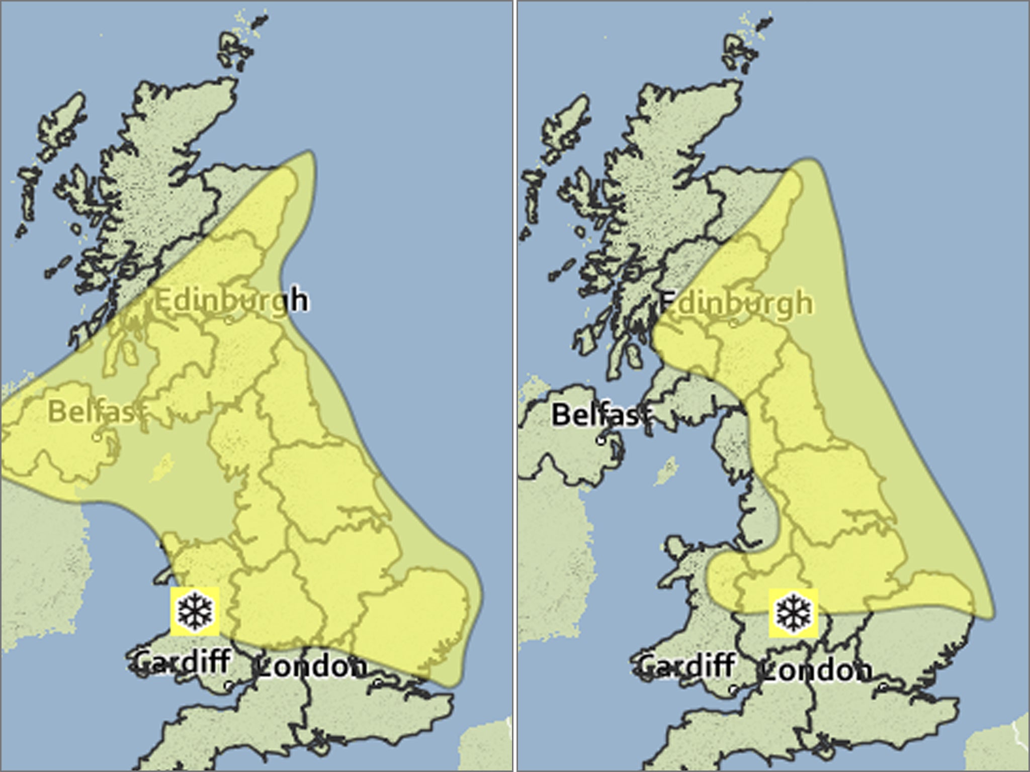
The Met Office has posted a yellow 'Be Aware" warning of snow. It currently covers an area north of a line between southern Essex and mid-Wales, and south of a line from above Northern Ireland and Aberdeen.
The Sunday alert, valid from 6am, says: "Early rain over western Britain is expected to turn to snow as it spreads eastwards across much of England, Wales and southern Scotland during the course of Sunday. Early rain over Northern Ireland is also likely to turn to snow, whilst other parts of Scotland are affected by wintry showers.
"Accumulations at lower levels may exceed 10 cm over parts of the Midlands, Wales Northern England. Over ground above 300 metres accumulations in excess of 20 cm are possible. The public should be aware of possible disruption, particularly to travel."
But on Monday, central and southern England could see the morning rush hour disrupted by two to five centimetres of snow.
Paul Mott, a senior forecaster with MeteoGroup, the Press Association's weather service, said there could be light snow over parts of Scotland and northern England from about 3am tomorrow.
"There could be further light snow in those areas during the afternoon, which will struggle to settle, but in the evening there will be more significant snow developing in central and southern parts of the UK. It won't be everywhere, we are thinking of parts of the Midlands, parts of Wales, East Anglia, areas to the north of London.
"London could see a couple of centimetres, but it is more likely in suburban areas north of the capital.
"The snow could make conditions difficult in the Monday morning rush hour, but it is not expected to last long into the day, and temperatures above freezing should see it go."
Join our commenting forum
Join thought-provoking conversations, follow other Independent readers and see their replies
Comments
Bookmark popover
Removed from bookmarks