Hurricane Gonzalo puts UK on storm alert as Met Office issues weather warning
Gonzalo has passed through Bermuda cutting out power to half of its inhabitants and is now expected to downgrade before hitting the UK
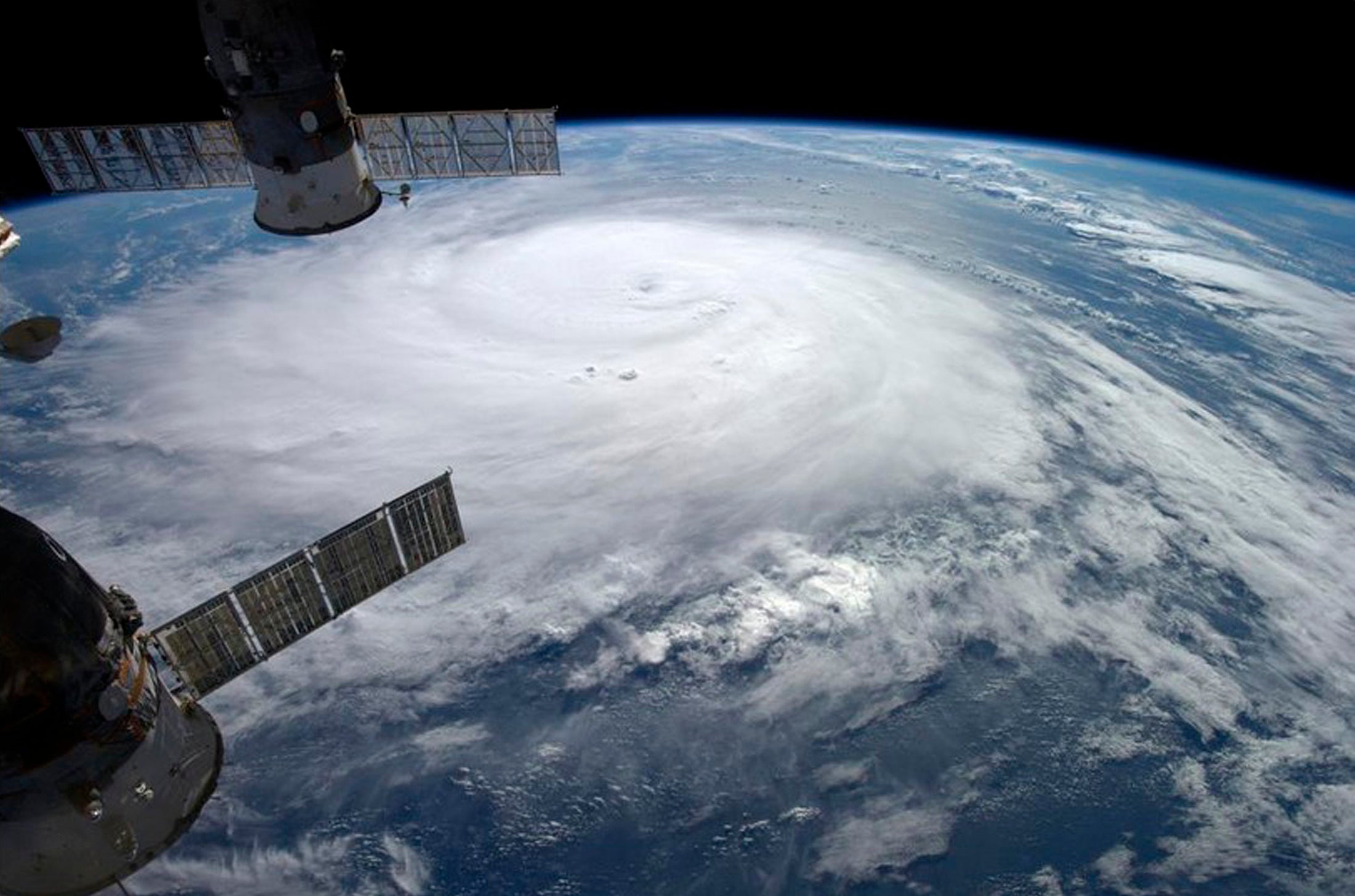
After tearing through Bermuda, flattening power lines and knocking out electricity for half of its inhabitants with torrential rain and gale-force winds, Hurricane Gonzalo is expected to downgrade in strength before hitting the UK.
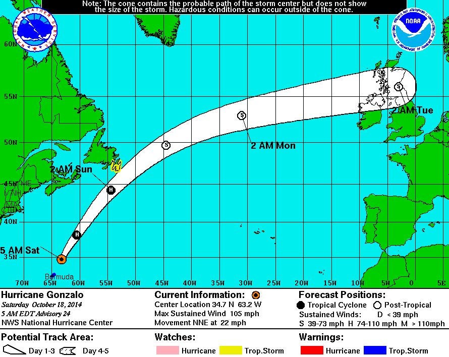
Gonzalo has now passed the tiny cluster of Atlantic islands after hitting on Friday, though it is now curving north-eastwards and looks set to hit north England and southern Scotland head on.
“It will be a very ex-hurricane by the time it reaches us,” Simon Partridge, a forecaster at the Met Office told The Independent.
“What is left of it will be strong winds – some gale force winds at times – and it is currently expected to arrive late Monday night/early Tuesday morning and is tied into the reason why we’ve issued a yellow warning for wind.”
A boomerang-shaped section of the UK has been warned to brace for heightened winds as a result of Gonzalo, including to the north of London to northern England, parts of north Wales and Northern Ireland, as well as south-west Scotland.
The yellow warning has been put in place due to level of damage that could be sustained – most notably through rush hour – on the roads, as well as damage to trees which could cause further destruction or injury.
Mr Partridge added though there will be local gales and gusts, with possible wind speeds of 35mph and gusts up to 50mph, there should only be a normal band of rain for this time of year.
“Some of the stronger winds will be at its tail-end heading north-westerly,” he said, and that Britons could feel like the temperature has lowered somewhat the day after it arrives.
“Wednesday will feel cooler [amid the recent warm weather we’ve been enjoying], but it will be about average for this time of year.”
According to the US National Hurricane Centre, Gonzo is currently being tracked at 22mph with maximum sustained winds of 105mph.
It struck Bermuda as one of two separate significant storms to do so within a week – days previously Tropical Storm Fay also damaged homes and wiped out power lines.
“We only had very few days to clean and get the trees out of our house, Marlie Powell, the owner of Kingston House Bed & Breakfast, told the Press Association.
“There's a lot of loose debris around the island already, which is not good.”
At its peak it was a category four hurricane with winds of 145mph, but was a category two when it hit Bermuda.
“It will weaken as it crosses cooler waters and start to make the transition into a mid-latitude depression,” the Met Office said in a blog post yesterday.
Britain has recently basked in warmer-than-average temperatures thanks to tropical air associated with storm Fay making its way across the Atlantic.
The lowest temperature recorded in the Isle of Wight last night was 17 degrees.
Join our commenting forum
Join thought-provoking conversations, follow other Independent readers and see their replies
Comments
Bookmark popover
Removed from bookmarks