Lake District hill becomes England's newest mountain after it is found to be 3ft taller than previously thought
Independent surveyors made recalculation after trekking 5km up Miller Moss
England has acquired a new mountain after experts discovered a Lake District hill is a metre taller than originally thought.
Miller Moss becomes the 446th official mountain in England and Wales after it was found to be 610.1m high, rather than 609m. The official threshold is 609.6m or 2,000ft.
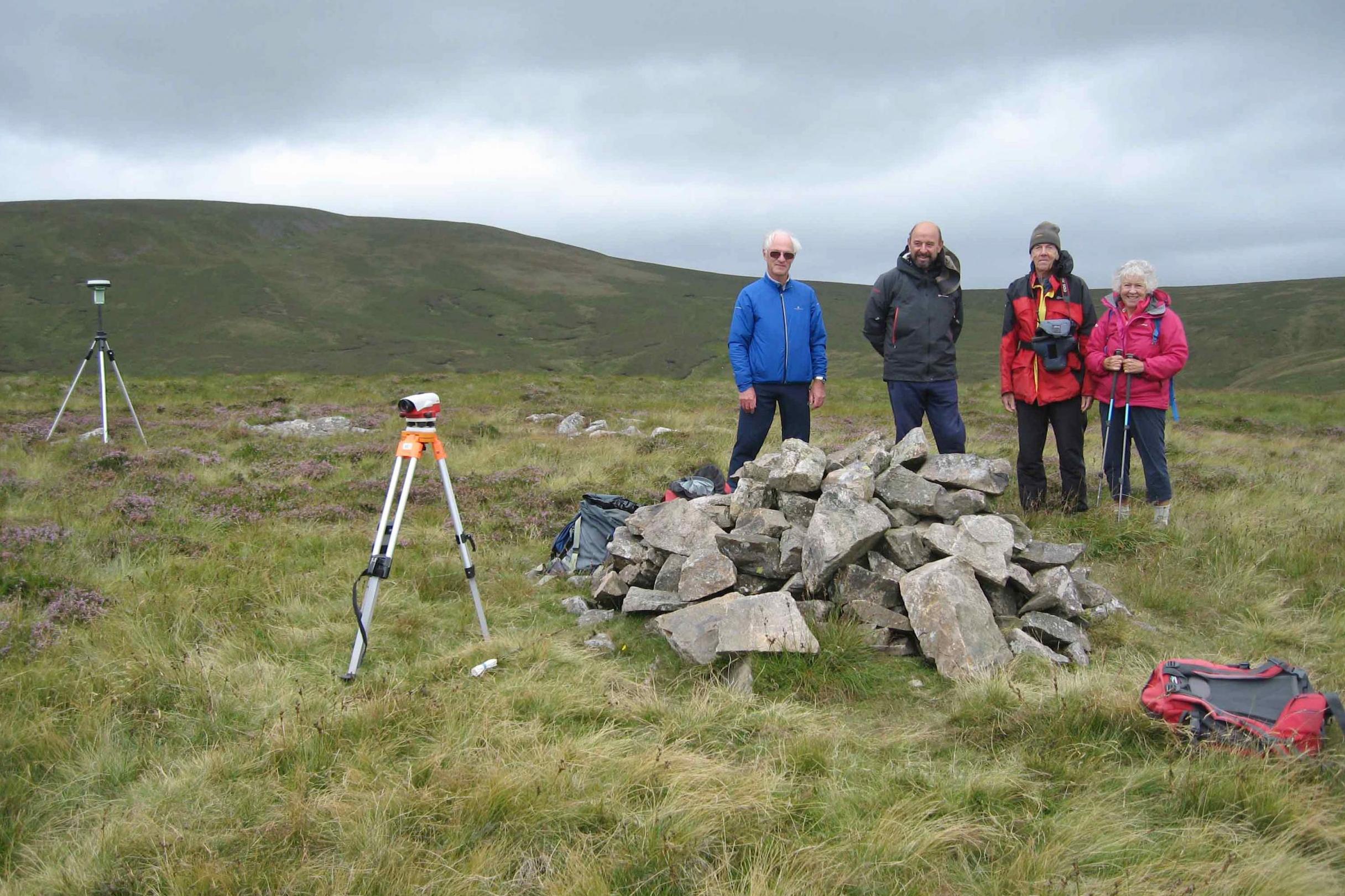
The discovery was made by independent surveyors John Barnard and Graham Jackson, who have spent more than a decade checking the height of hills that are close to the cut off mark.
It means Miller Moss will now be included in The Mountains of England and Wales – a book by Anne and John Nuttall widely considered the defining authority on the subject – while Ordnance Survey has confirmed it will alter its maps.
Mr Barnard, 69, a retired business planner, said: "Ordnance Survey measure hills and mountains by flying a plane over and taking photographs, a process called photogrammetry.
"They can then use those to make a 3D model and measure heights but it only gives an accuracy of plus or minus 3m.
"This was recorded on their maps as 609m but they round up or down to the nearest metre so we knew there could be an error and there was a good chance it could reach over 2,000ft.”
He and Mr Jackson made their discovery after climbing 5km up the peak with Mr and Mrs Nuttall on August 1 with satnav-style equipment that takes more accurate readings.
He said: “We've made it our passion. We've measured a lot of these hills in the past and found several mountains in England and Wales that have been reclassified over a ten-year period.
"The equipment we use is very similar to the satnav in your car, it collects information from specific satellites that send down signals and works out where you are and how high you are, although obviously it's more complicated than that.
"Often you do these things and it doesn't make any difference, changes in classification are quite rare because the OS data is very good.
"It's a nice feeling when you do find one, but I think we have found pretty much all the key ones now."
A spokesman for Ordnance Survey said: "We have been working with John and Graham for several years and have supported them in verifying their survey results for many summits across Great Britain.
"As the national mapping agency OS maintains the geospatial database for Great Britain and it is our role to ensure that any changes are checked and verified.
"We can confirm that we will be updating our maps to show a spot height of 610m for Miller Moss.
"This magic figure of 610m will now give Miller Moss mountain status and becomes another Great British mountain summit for outdoor enthusiasts to reach this summer."
Join our commenting forum
Join thought-provoking conversations, follow other Independent readers and see their replies
Comments
Bookmark popover
Removed from bookmarks