Storm Babet: Amber warning issued as floods and 70mph winds to hit UK
Storm Babet will unleash a month’s worth of rain in just days on the UK
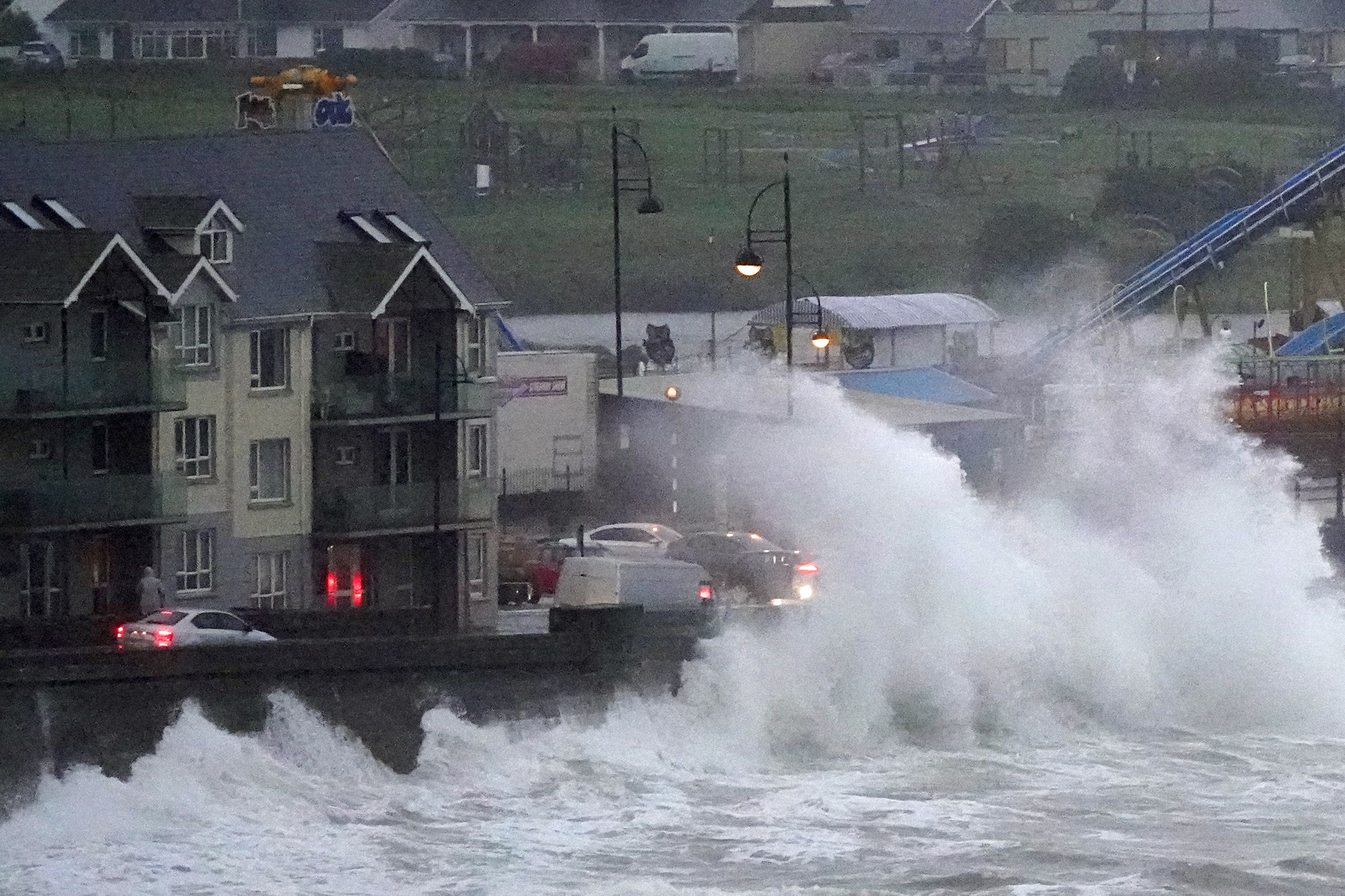
An amber warning has been issued as Storm Babet’s gale-force winds and heavy rain are expected to cause flooding in waterlogged areas of the north.
The Met Office escalated their yellow warning for rain, as some areas in Scotland could see more than a month’s worth lash down in just few days from 6am on Thursday.
Forecasters have warned of dangerous driving conditions and “fast-flowing and deep floodwater” that could pose a danger to life.
As much as 150 to 200mm of rain could fall on central and eastern areas of Scotland, including in communities badly hit at the start of October by weather so bad it was compared to the Beast from the East in 2018.
Scotland typically receives around 168mm of rainfall in October but the country will receive more than this in the span of a few days.
Parts of England can expect more than 100mm of rainfall during the week, with some isolated areas facing up to 150mm.
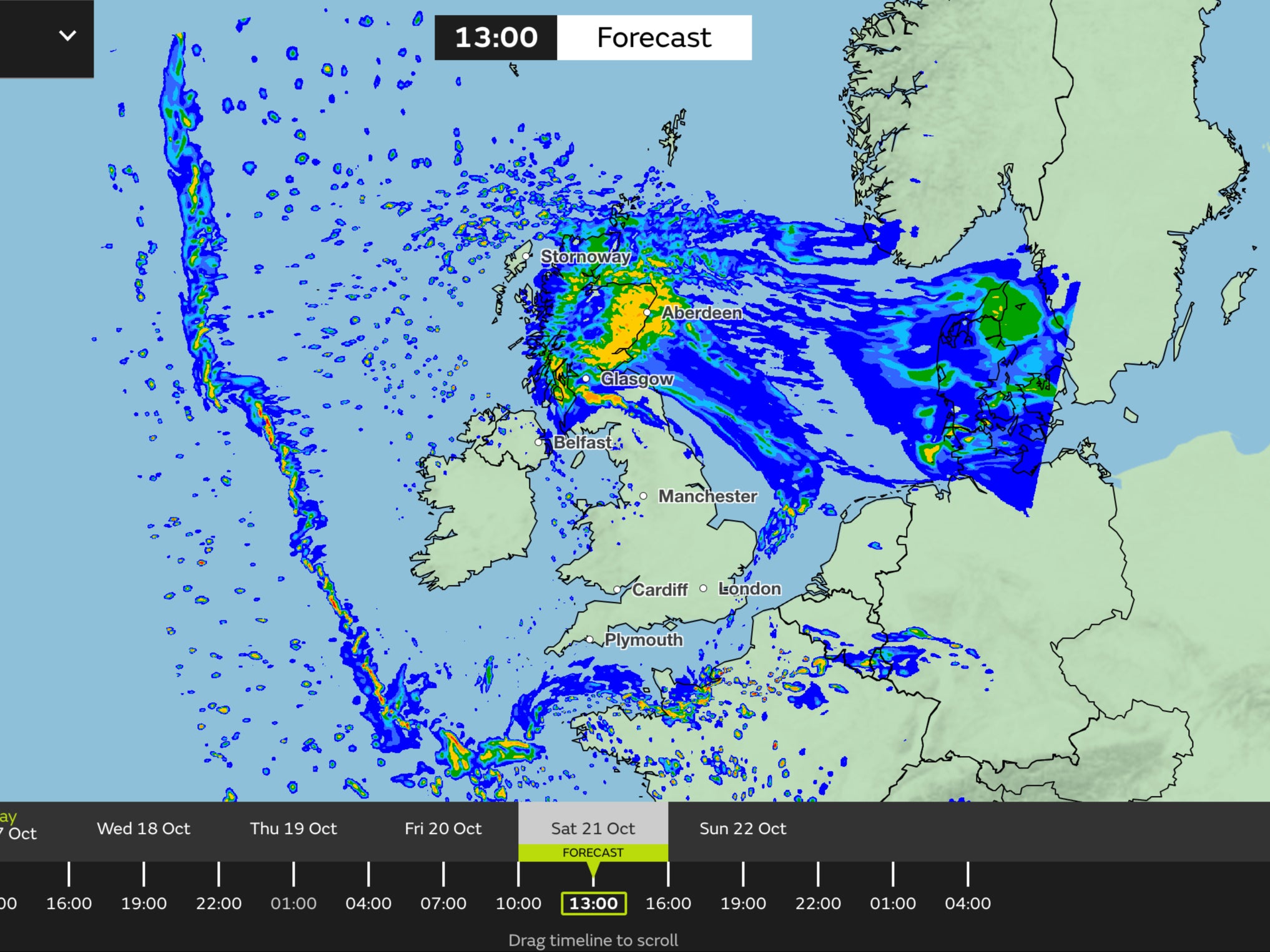
Separate yellow warnings are in place for Northern Ireland from 2pm on Wednesday until 10am on Thursday, and across vast swathes of Scotland and northern and eastern England from 6am on Thursday to 6am on Saturday.
Met Office spokesman Stephen Dixon said: “A disruptive period of weather is on the way.
“There’s some high totals (of rain) which have the potential to disrupt travel plans… (there’s) the possibility of power cuts, as well as the obvious risk of flooding.
“As you look at Wednesday, the first pulse of rain is looking to particularly influence Northern Ireland, Wales and the south-west of England, and into Thursday.
“But as you move from Thursday and into the week, that shift very much focuses more towards central and eastern Scotland, but also some central and eastern areas of England as well.”
Gusts of up to 70mph are also likely in Scotland, with a yellow warning for wind in place for northern and eastern parts of the country from 3am on Thursday and noon on Friday.
Grahame Madge, from the Met Office, said winds coming from an unusual direction could cause different impacts.
“These can include fallen trees which can have less resilience to winds from a different direction (as we saw with Storm Arwen),” he said.
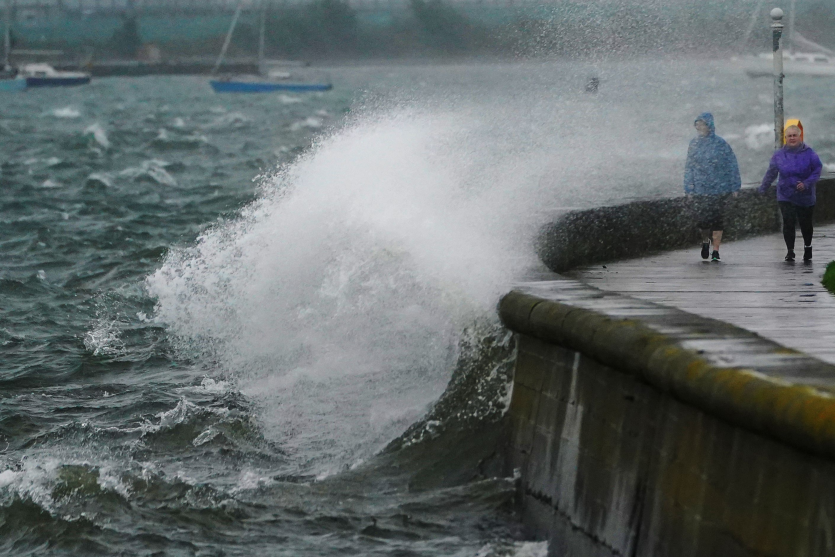
“Also harbours, seafronts and coastlines can experience more unusual impacts such as wave action and erosion. These can create potentially hazardous local conditions which people are not normally used to.
“Coastal visitors such as anglers, boat enthusiasts and photographers are reminded to take extra care.”
David Morgan, flood duty manager for the Scottish Environment Protection Agency (Sepa), said: “Storm Babet will bring heavy rain and high winds across Scotland from Wednesday evening, starting in the south-west before moving across to the north east through Thursday and into the weekend.
“Flood alerts and warnings will be issued as required, and we continue to work with the Met Office to monitor the situation 24/7.”
The Royal National Lifeboat Institution has urged the public to exercise “extreme caution,” particularly along exposed cliffs, seafronts and piers.
Join our commenting forum
Join thought-provoking conversations, follow other Independent readers and see their replies
Comments
Bookmark popover
Removed from bookmarks