UK weather: ‘Winter coming down from the Arctic’ this weekend as temperatures drop, Met Office says
Country set for weekend of ‘umbrellas up and down’ weather
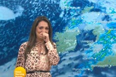
The UK will see “winter coming down from the Arctic” this weekend, as masses of cold air and rain push southwards, tempering a long spate of more extreme, albeit mild, conditions.
While the coming days should bring relative calm and some sunshine after a period of named storms and weather warnings, with the risk of flooding having mostly abated on Friday, temperatures will also dip “quite a bit below average”.
“We’re going into a much colder, showery set up for this weekend,” said Met Office forecaster Tom Morgan.
“So the good news is this weekend isn’t going to be a washout like it was for people last weekend, but there will be some showers around and it will be much colder.”
The unseasonably warm highs of 19C seen on Thursday are set to plummet, with the mercury reaching 15C at best on Friday, with some parts of the country to feel “a good deal colder than that”.
“Overnight we’ve seen quite a cold air mass arrive from the north, so winter coming down from the Arctic, and we’re seeing showers spreading southwards as we speak,” Mr Morgan told The Independent.
Despite the promise of widespread rain, most of the country will also experience bouts of sunshine, characterised by Met Office meteorologist Aidan McGivern as “umbrellas up and down” weather.
Friday and Saturday will bring a mixture of sunny spells and scattered showers, with thunder and lightning also likely over northern England and Wales. Scotland’s Munros will also receive a dusting of snow.
“It’s quite chilly in fairly brisk northwesterly winds on Saturday but there will be some sunshine in between the showers,” said Mr Morgan. “It’s definitely going to be a day where you need a coat if you’re heading out and you’ll be very lucky if you don’t catch any showers at all.”


Sunday is set to be the best day of the week, with drier, sunnier and less windy conditions across the UK.
While parts of the east coast – particularly East Anglia – will still see some spells of rain, temperatures will feel slightly warmer as the weekend comes to a close.
Next week, meanwhile, will see a return to more changeable conditions, with Monday bringing a wetter day in all parts of the country. Temperatures will remain below average.
However, there’s a “slight signal that from the middle of the week onwards conditions could become a bit drier and more settled, with a risk of fog and frost”, Mr Morgan said.
Join our commenting forum
Join thought-provoking conversations, follow other Independent readers and see their replies
Comments
Bookmark popover
Removed from bookmarks