UK weather mapped: Yellow warnings for snow and ice still in place amid fears of power cuts
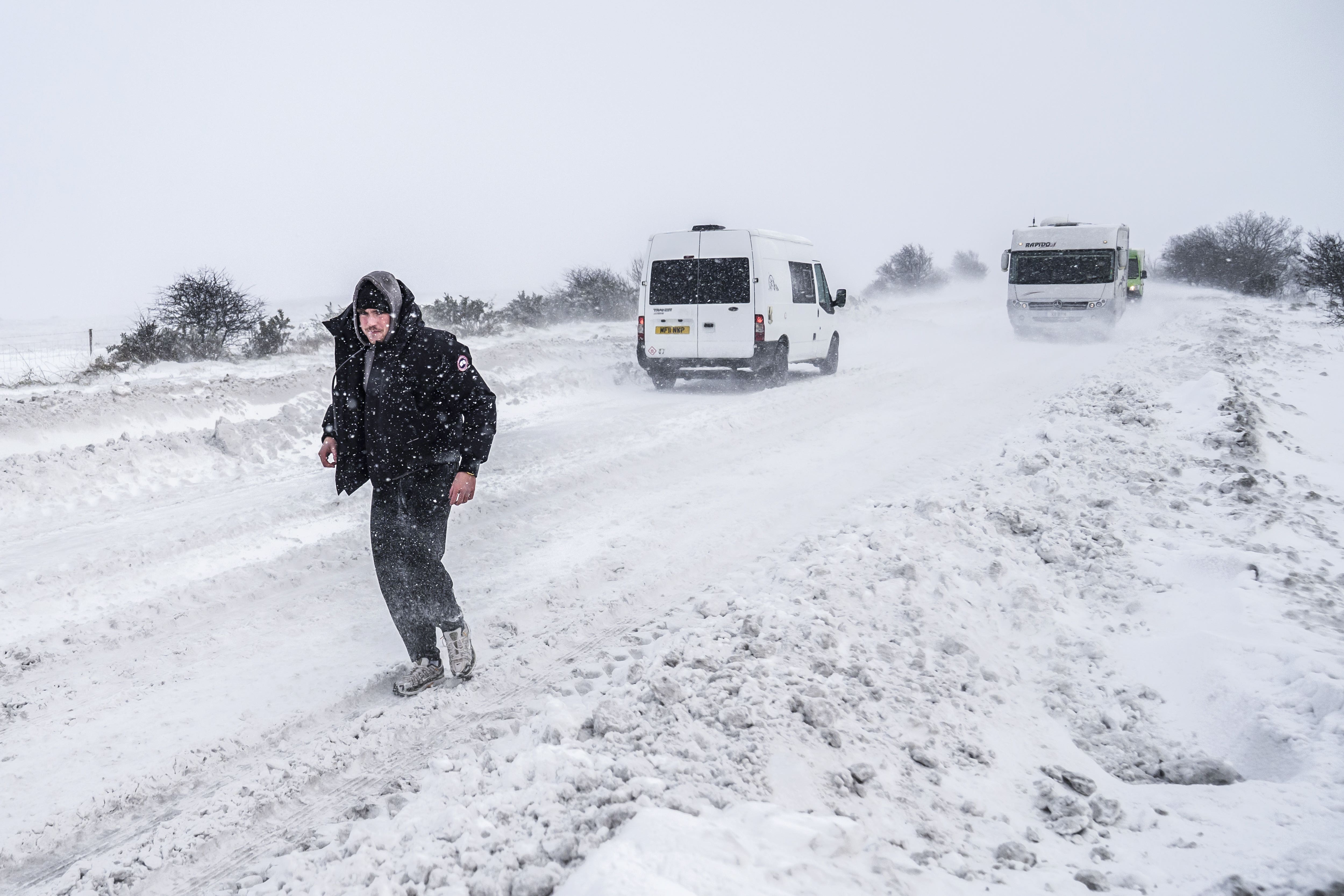
Further snow showers could cause more delays on roads and on public transport throughout Sunday
Yellow weather warnings for snow and ice remain in place for parts of the UK, with the north of Scotland braced for further travel disruption.
Further snow showers could cause more delays on roads and on public transport throughout Sunday and into Monday.
While more serious amber weather warnings for the north of Scotland expired on Saturday at noon, a yellow warning is still in place until midday on Monday.
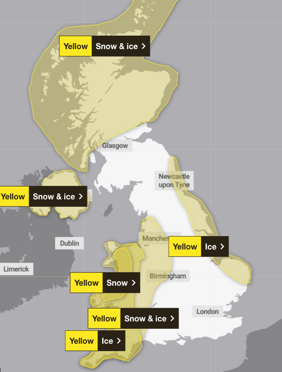
Separate warnings for snow and ice are in place for Wales, Greater Manchester and South West England, while much of the east coast of England is covered by a yellow warning for ice.
The wintry weather led to ScotRail announcing several train cancellations on Saturday in the north of Scotland.
Roads in the north-east of Scotland were also shut, with severe delays reported on the A90 between Brechin and Stonehaven because of snow drifts.
Police strongly advised people in Orkney against travelling due to the conditions on the roads.
Roads around Badenoch and Strathspey in the Highlands were badly affected, with police advising against all but essential travel.
The Met Office warned that heavy snow showers could see some rural communities cut off, as well as a risk of power cuts in some areas.
Arctic air plunged much of the UK into sub-zero temperatures in the first days of January, with nearly -6C being recorded at Loch Ness on Friday night.
The Met Office said: “Snow showers are expected to continue through the weekend, being brought well inland by strong northerly winds.
“Winds should ease somewhat into Sunday, with showers by then most prevalent around coasts. Snow showers should finally begin to ease during Monday morning.
“With temperatures inland likely remaining below freezing through the weekend, thaw of lying snow is not expected.”
On Saturday afternoon, Network Rail Scotland said that some lines in northern Scotland were seeing snow accumulations of around 20cm.
LNER said there was “major disruption” to their services north of Dundee, which was expected to continue into Sunday afternoon.
Join our commenting forum
Join thought-provoking conversations, follow other Independent readers and see their replies
Comments
Bookmark popover
Removed from bookmarks