Mapped: Met Office issues thunderstorm and heavy rain warnings across UK for tonight
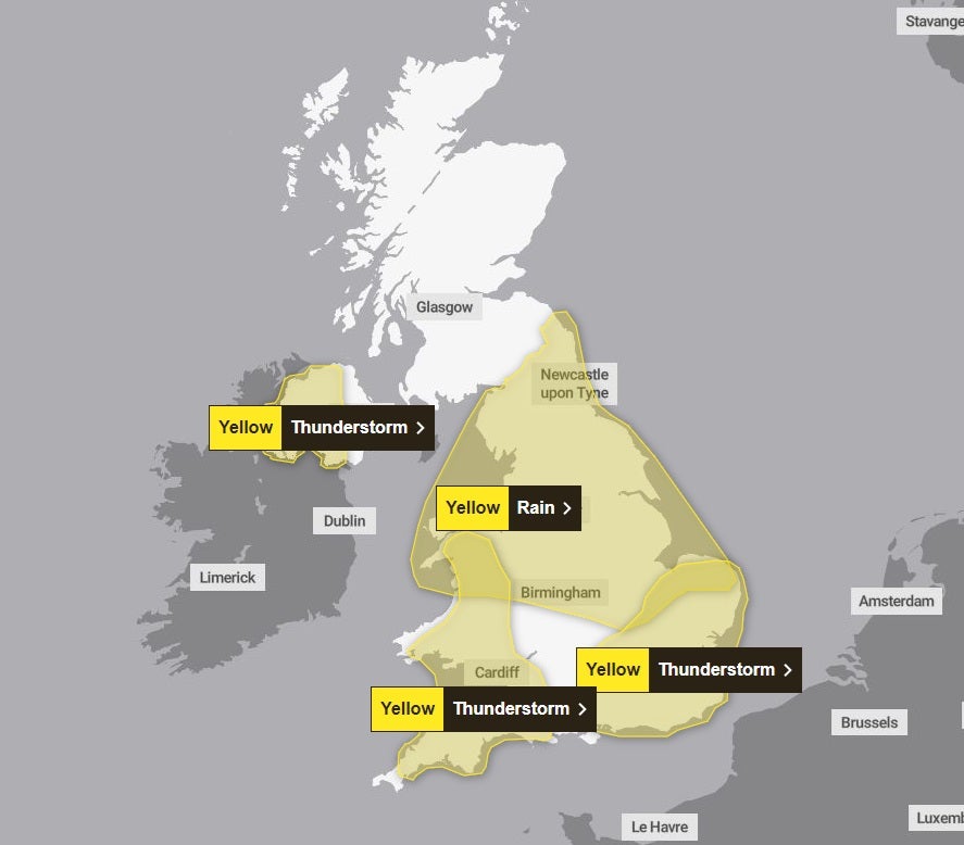
The Met Office has issued thunderstorm warnings for London, the South East, South West and Wales
Thunderstorm alerts have been issued for much of the UK with the Met Office warning of sudden flooding in impacted areas on Tuesday evening.
A yellow weather warning for thunderstorms is in place for London and the South East until midnight, and until 9pm for the South West, Wales and Northern Ireland.
A separate warning for rain will also be in place for the Midlands and north of England from 12.15am on Wednesday until 6am on Thursday.
The thunderstorm warnings state there could be sudden downpours leading to difficult driving conditions, disruption to trains and buses as well as the chance of flooding and power cuts.
Frequent lightning strikes and hail may also be seen.
Places could see between 30-40mm of rain, with some even getting 150mm, said the Met Office, which is urging people to keep looking at the weather forecast over the next few days.
A Met Office spokeswoman said the sudden change in weather was down to an area of low pressure approaching the UK from the east.
She said: “There are lots of warnings going on, with thunderstorms moving into rain warnings. There are large rain warnings covering quite a large area of central and northern England, Scotland and Wales for Wednesday and Thursday.
“This is because there is an area of low pressure approaching the UK from the east.
“The precise track of the low pressure which would determine where the rainfall comes is still uncertain at the moment and is something we are keeping an eye on.
“We would encourage people to keep an eye on the forecast over the next couple of days to see how that evolves.”
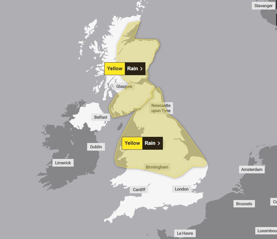
Chief meteorologist Andy Page said a band of heavy rain will move into the north of the UK on Tuesday due to low pressure in the southern North Sea.
He added: “Areas exposed to the strengthening northerly winds are most likely to see the highest rainfall amounts, though exact details regarding the track of the low and thus where we might see the highest rainfall totals remains uncertain.”
Those in the north of England and Scotland under the yellow warning for rain are being told to watch out for difficult driving conditions and flooding.
Join our commenting forum
Join thought-provoking conversations, follow other Independent readers and see their replies
Comments
Bookmark popover
Removed from bookmarks