UK weather: Mini heatwave bringing temperatures up to 35C for Wimbledon
Most of Britain will enjoy dry and fine weather next week but the hottest temperatures will be in the South East

A mini heatwave is due to arrive in the UK next week, just in time for Wimbledon.
Temperatures are expected to top 30C in parts of south-east England, which will bask in at least six days of dry and sunny weather, according to the Met Office.
The outlook for the last days of Glastonbury, the Goodwood Festival of Speed and London Pride on Sunday is looking more mixed, with the possibility of showery rain.
A spokesperson for the Met Office said next week would see a “real change” in temperatures, which have been average or below normal for the rest of June.
A tropical continental airmass is bringing the heat up from Spain and over France, which is expected to reach 40C.
The Met has forecast hot days and humid nights for the start of July, with temperatures in Scotland expected to reach the mid 20s and southern Britain to reach the mid 30s.
“It’s worth saying that there is some uncertainty about how much of the hot weather from the continent will reach us, and it may only last a couple of days before temperatures drop a little,” a spokesperson said.
“As is traditional with hot weather in the UK in the summer it may end with thunderstorms.”
The heat could make conditions sweltering for tennis players at Wimbledon and the 500,000 spectators expected to watch the likes of Andy Murray, Roger Federer and Maria Sharapova.
The Hampton Court Flower Show is also starting on Tuesday, which is forecast to be 28C and sunny for the opening day.
A mostly dry day is expected at Glastonbury today, with sunshine for much of tomorrow and the possibility of rain showers on Sunday.
Next week’s heatwave comes after unsettled weather caused by the remnants of Tropical Storm Bill.
On Thursday, flash-floods hit parts of the North East, sending torrents Earlier today, parts of the North East of England experienced flash-flooding when the remnants of Tropical Storm Bill passed over the region.
Cars in Cullercoats in Tyne and Wear were pictured struggling to pass through flooded streets.
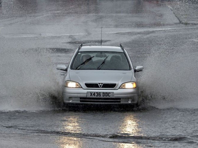
However, although the showers could continue across the North East - with the possibility of some heavy downpours - the weather system is not expected to last.
Motorists are being advised to keep hydrated and ensure that their cars have enough engine coolant.
Luke Bosdet, a spokesperson for the AA, warned that new road surfaces could melt in the heat.
He said: “The thing about roads is that they act a bit like storage heaters - they tend to hold the heat. It is normally in late July and August that we start to see damage to the roads.”
Join our commenting forum
Join thought-provoking conversations, follow other Independent readers and see their replies
Comments
Bookmark popover
Removed from bookmarks