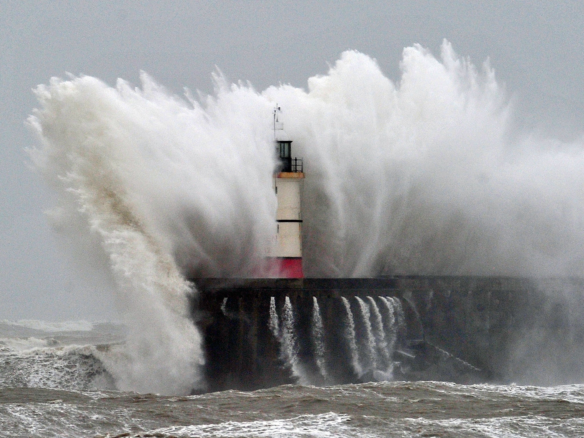
UK weather: Nine-metre waves and high rivers forecast as heavy rain and strong winds batter Scotland
Met Office issues amber 'be prepared' warnings for rain in the Grampian, Central, Tayside and Fife areas
Warnings of high rivers and large coastal waves have been issued as persistent rain and strong winds continue to batter parts of Scotland.
The Met Office has issued an amber "be prepared" warning for heavy rain in the Grampian, Central, Tayside and Fife areas, in force until Monday night.
It said parts of north-east Scotland could experience offshore waves of up to nine metres - taller than two double-decker buses.
The Scottish Environment Protection Agency (Sepa) has 24 flood warnings in place, the majority of which are in Tayside, and three flood alerts.
The warnings follow severe flooding caused by Storm Frank last week, which left many stranded, in temporary accommodation or without electricity.
Vincent Fitzsimons, Sepa's hydrology duty manager, said: "Persistent rain has been predominantly affecting the north-east of the country since Friday night.
"Rivers have been rising since Saturday and flood warnings have been issued. It's important to note that the rain is less intense but more prolonged than during Storm Frank.
"This means that rivers will rise more slowly but then stay high for much longer - from Sunday through till Tuesday. The peak for most areas will be on Sunday night and Monday morning."
Mr Fitzsimons said river levels in the north-east were of most concern, including those around Kintore, Inverurie, Brechin and Aberdeen, but the agency was also keeping a close eye on communities in the Borders and Caithness.
He added: "As always, we are working closely with partner organisations to give local authorities the latest information in areas where river banks and defences have been damaged by Storm Frank, for example in Ballater.
"In addition, strong winds along the east coast means that the public need to take care from wave impacts particularly in Aberdeenshire, Caithness, and the Northern Isles."
A number of roads remain closed in Perthshire, Angus and Aberdeenshire while others have been affected by surface water.
Police Scotland Tayside Chief Inspector Alastair Reid said: "We are asking people to stay away from rivers and already flooded areas so you don't put yourself in danger. River banks may be unstable and could be liable to give way.
"Additionally, we are advising people to park their vehicles away from areas close to rivers and to park on higher ground where possible.
"We also ask that motorists do not ignore road closure signs and avoid driving through flood water as there will be unseen dangers, including lifted manhole covers.
"The closures are there for a reason and are to protect your safety. By ignoring these closures you put yourself at risk as well as the emergency services."
The Met Office said: "Over the period ending late Monday, many areas look like receiving a further 40-80 mm of rain, with some of the high ground receiving 100-150 mm - this in addition to that which has fallen over the previous 24 hours.
"However, this looks like being fairly evenly spread out, which should slightly ease the resulting impacts.
"Given the saturated nature of the ground, there is a greater risk of surface water and river flooding than might normally be expected."
Press Association
Join our commenting forum
Join thought-provoking conversations, follow other Independent readers and see their replies
Comments
Bookmark popover
Removed from bookmarks