UK weather: Travel disruption as snow falls across country after temperatures plummet overnight
Parts of Scotland and northern England could drop to -11C on Tuesday night
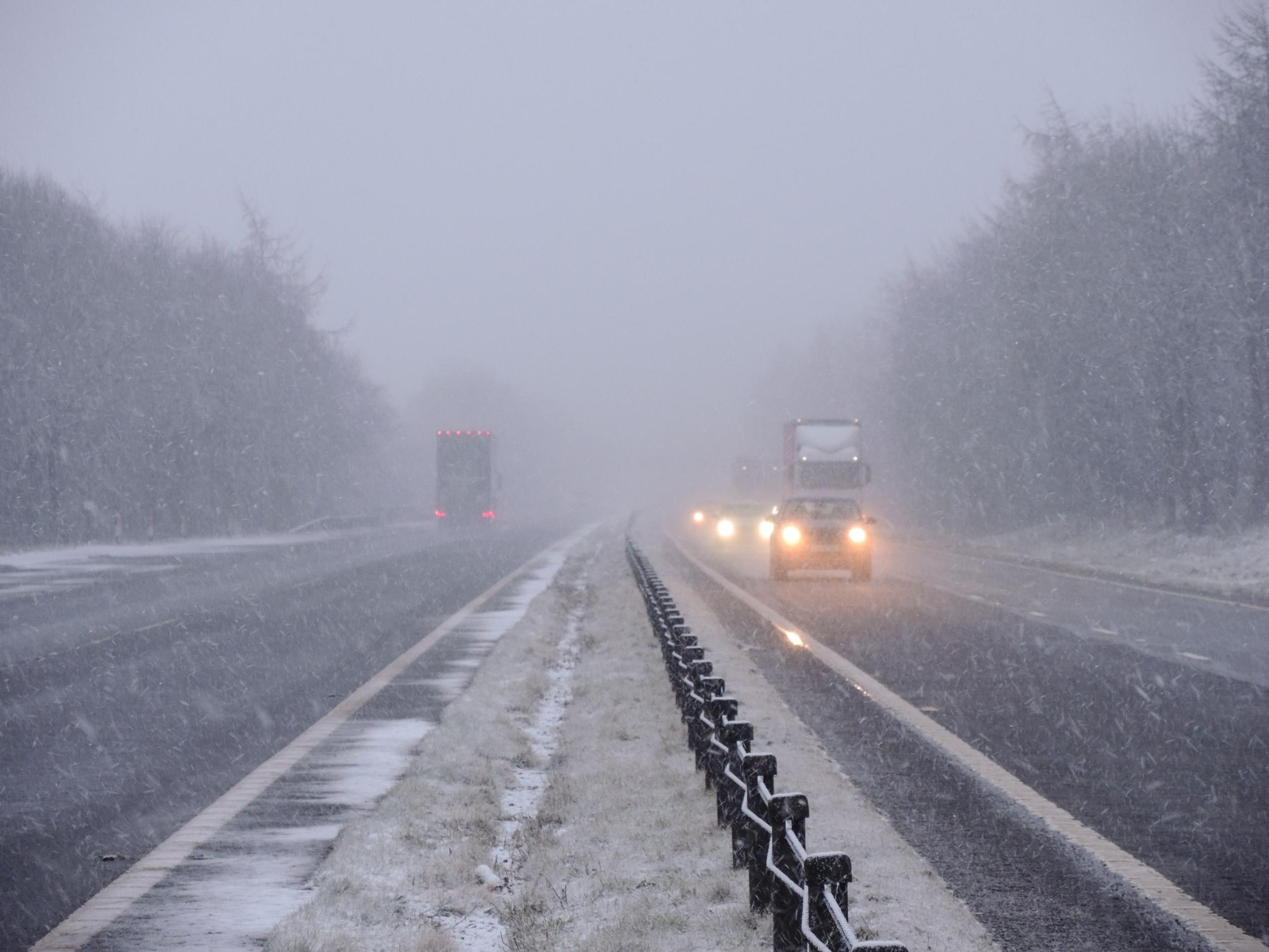
Treacherous conditions on Britain’s roads have led to car crashes and travel disruptions as heavy snow fell overnight and freezing conditions gripped the country.
A multi-vehicle collision on the icy M5 near Stroud has been reported by Gloucestershire Police. Meanwhile, two lorries got stuck on the A6075 between Kirton and Walesby according to Nottinghamshire Fire and Rescue Service.
As many as 70 flights from Heathrow airport were cancelled, British Airways said. Ten more have already been cancelled today and further flight disruptions are expected, particularly at East Midlands Airport.
Police Scotland urged road users to travel with caution, while on the Isle of Man a road was closed due to snow and motorists were warned of difficult conditions on higher routes.
This week is set to be one of the coldest of the year so far – temperatures are set to drop even further overnight, with parts of Scotland and Northern England possibly falling to -11C.
Forecasters have said we can expect a “prolonged cold period” as the chill is expected to continue into the weekend and stay colder than average for the rest of the month.
Two yellow severe weather warnings for snow and ice are in force, with one covering Wales, northern England and Midlothian until 3pm as a spell of sleet and snow moves south-eastwards.
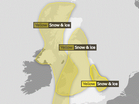
A further yellow snow and ice warning is in place until 10am on Wednesday as sleet, snow and hail showers, some heavy, hit western areas.
The Met Office has updated another warning of snow and ice in effect from 3pm on Tuesday until 9.30am on Wednesday for parts of eastern England.
Much of the country has already seen snow and more is expected to fall in almost every part of the UK.
Between 1cm and 3cm of snow is expected to fall widely on Tuesday and hilly areas could see up to 5cm.
It comes after snow showers left between 1cm and 2cm in Kent and Essex on Monday and caused several crashes on the M20.
Mr Burkill said: “As we go through the next 24 to 48 hours, it’s going to stay cold, and we are going to see some snow and pretty much anywhere in the country could see something.”
Another band of snow, sleet and rain will sweep across the country from Wednesday to Thursday and bring a “milder blip” in the weather, Mr Burkill said.
But he added: “The cold weather is likely to return as we go towards the weekend.
“Really much of February and perhaps even into March it is going to stay on the cold side, so temperatures generally below average, with further frosts and also the risk of rain, sleet and snow as well.”
Additional reporting by Press Association.
Join our commenting forum
Join thought-provoking conversations, follow other Independent readers and see their replies
Comments
Bookmark popover
Removed from bookmarks