UK weather: Thunderstorm warning issued by Met Office with torrential downpours and risk of floods
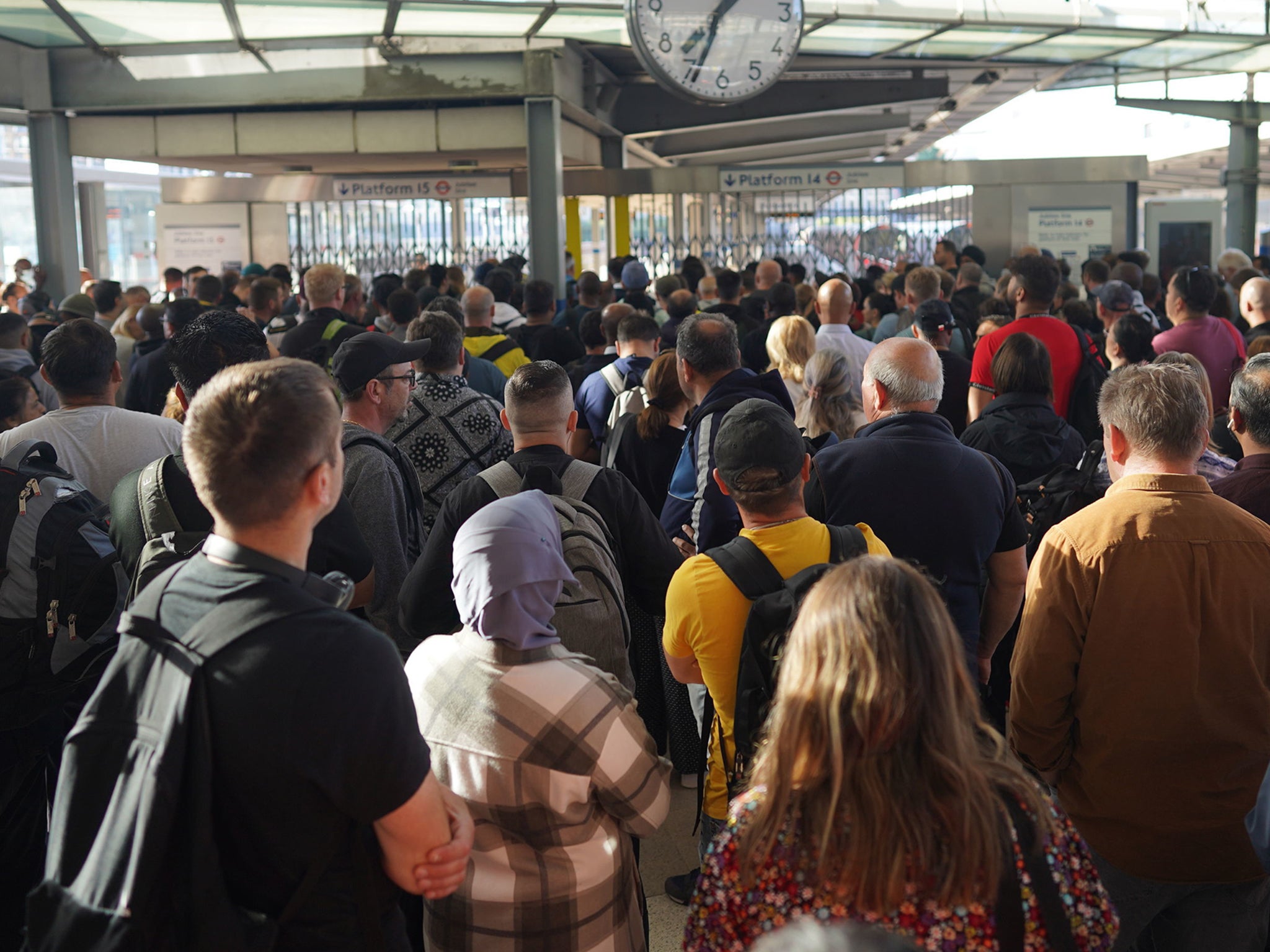
The dangerous weather comes amid Britain’s worst rail strikes in 30 years
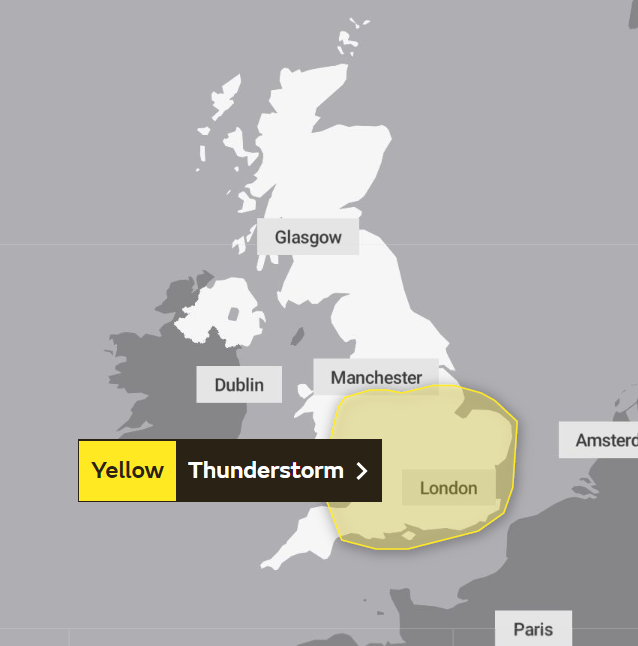
The Met Office issued a warning for thunderstorms across parts of England and Wales on Thursday.
The forecaster announced the yellow weather warning for much of southern England and Wales as well as parts of the north west. It added that there is a chance of torrential downpour, flooding and disruption to transport.
The disruption comes as rail strikes are set to resume on Thursday across swathes of the UK and the start of Glastonbury which is held in south west England.
“Thunderstorms are likely to break out in some areas, particularly during the afternoon and early evening. While most places will probably miss them, where thunderstorms do occur there is a chance that in a few places up to 40 mm of rain could fall in an hour or so and 40 to 60 mm could fall in two or three hours,” the Met Office said.
“These torrential downpours may be accompanied by frequent lightning, whilst gusty winds and hail may also affect a few places. The exact location of the thunderstorms will be hard to pinpoint, so the warning area will be kept under review and updated if necessary.”

The forecaster issued the warning from 10am on Thursday, 23 June to 11.59pm that day, adding that some homes and businesses could be flooded quickly, with damage to some buildings from floodwater, lightning strikes, hail or strong winds.
The Met Office’s Aidan McGivern said the thunderstorm warning for Thursday may be a result of heavy showers spotted over France which were drifting north.
The weather forecast for Friday and Saturday predicts more showers, locally heavy and thundery moving northeast. The forcaster added that the weather would be widely unsettled, cooler and breezy from Saturday with heavy showers in the west. Warmest in the northeast.
The storm comes as the UK has seen spates of warm weather over 32C last week and 25C this week in parts of England.
Power cuts could also result from the thunderstorm as well as services to homes and businesses such as water. The Met Office added that there is a small chance some communities could be cut off by flooded roads.
Ahead of Glastonbury which opened its gates on Wednesday, meteorologist Tom Morgan, from the Met Office, said this year's weather outlook would be “one of two halves”.
Temperatures could reach 27C at the 900-acre site - 9C higher than usual - in the lead-up to the world-famous event. However, the mud synonymous with Glastonbury is still set to make an appearance, with showers and thunderstorms predicted from Thursday onwards.
Join our commenting forum
Join thought-provoking conversations, follow other Independent readers and see their replies
Comments
Bookmark popover
Removed from bookmarks