Weather warnings as heavy showers to cause flooding across UK in weekend washout
The Met Office has issued a yellow weather warning for areas in the South of England, Scotland and Northern Ireland
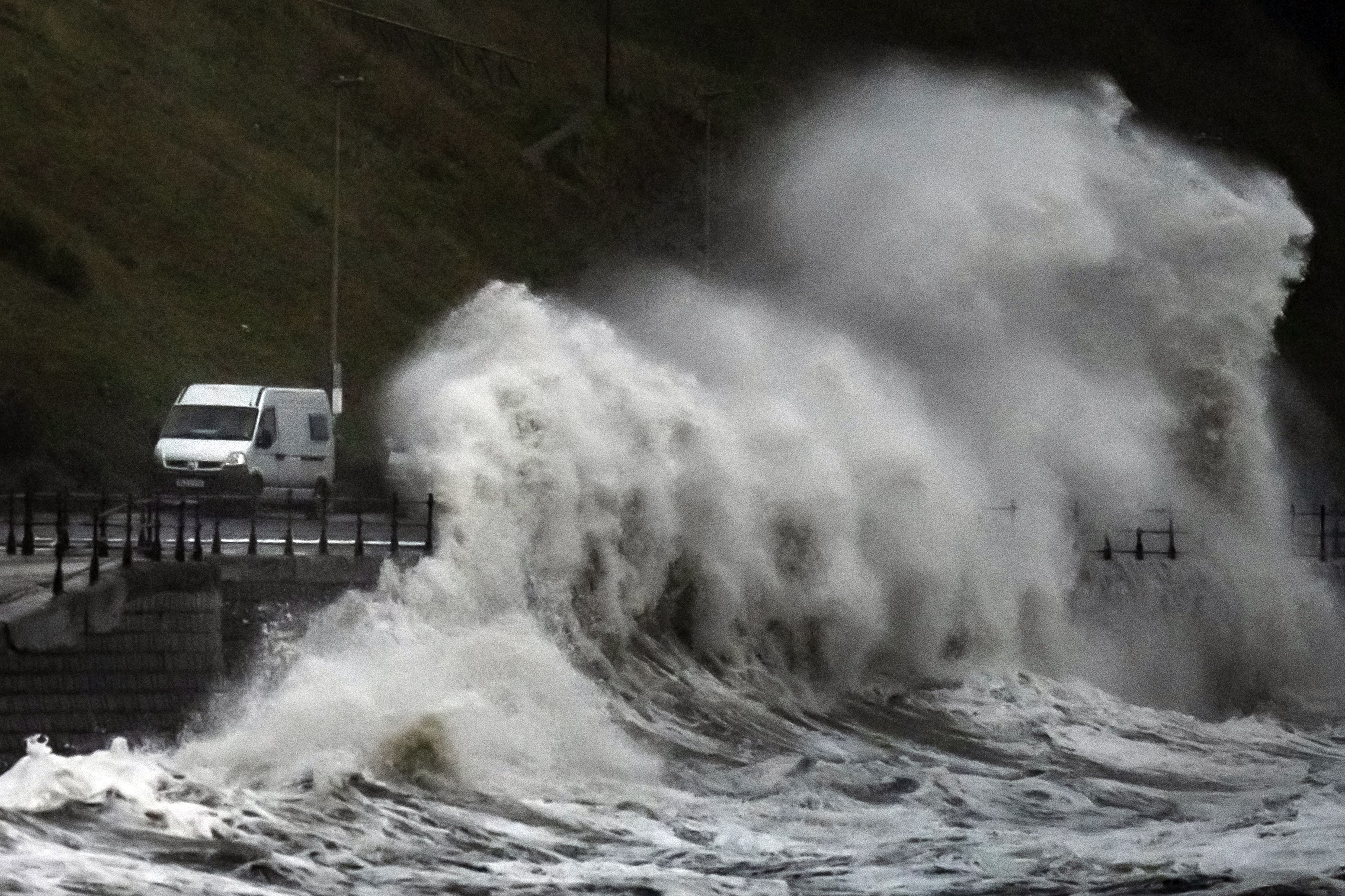
Thundery heavy showers and strong winds over the weekend could cause flooding to already soaked parts of the UK, forecasters have warned.
The Met Office issued a yellow warning today for areas in London, the south of England, the Highlands and north east of Scotland and Northern Ireland, which are set to be lashed by wet weather over the next few days.
Forecasters have warned there is a small chance that homes and businesses could be flooded in the south of England, along with train delays and cancelations all weekend, coming into the beginning of next week.
There is also a slight chance of power cuts and loss of other services to some homes and businesses across the UK.
In Scotland, the Met Office has warned that fast-flowing and deep floodwater could lead to road closures and smaller communities being cut off by flooding.
Some rail services in Scotland have been suspended, with customers advised to check their journey before travelling.
The latest Scottish Flood Forecast said “significant flooding impacts” are likely in the northeast on Friday and Saturday due to torrential downpours.
The worst affected regions could see 70mph gusts or up to nearly four inches of rain. the Environment Agency has 39 flood warnings in place, stretching from north-east to south-west England.
It comes after areas across Scotland and north-east England were battered with the worst of Storm Babet, which caused serious damage and several deaths when it hit last week.
Met Office forecaster Dan Stroud said: “On Saturday we’ve got frequent showers across the south and west which will move across Wales and into the south-east during the morning, before a more general area of cloud and rain moves up, bringing heavy rain and strong winds.
“That will move northern eastwards during the course of Saturday and into Sunday, behind it showers which could be locally heavy and thundery and particularly squally.
“We do have a yellow rain warning covering London and the south-east until the end of Sunday, talking about fairly heavy rain, 15 to 30mm, some spots could see highs of 50 to 70mm with some strong, gusty winds, there could be some localised impacts.
“The band of cloud and rain will continue moving northwards during Sunday, especially focused in eastern Scotland, which is already rather sensitive following the high rainfall from Storm Babet, so more unwelcome rain for that patch of the world and we have a yellow rain warning in place there today and tomorrow, talking about 50 to 80mm of rain accompanied by strong, gusty winds of 50 to 70mph.
“On it’s own the rainfall totals are not that high but given the fact we’ve had all that rain from Storm Babet it doesn’t take much for there to be localised impacts because the ground is already saturated.”
Join our commenting forum
Join thought-provoking conversations, follow other Independent readers and see their replies
Comments
Bookmark popover
Removed from bookmarks