Heatwave set to break record for most consecutive September days over 30C
Temperatures are forecast to peak on Saturday in London, which is set to be the hottest day of the year.

The heatwave is about to break the record for the most consecutive days with temperatures above 30C in September, the Met Office has said, with Saharan dust generating vivid sunsets and sunrises in the clear conditions.
Wednesday was the third day above 30C, matching a record seen on four previous occasions, most recently in 2016.
The high temperatures are expected to continue on Thursday and through the weekend, peaking as high as 33C on Saturday, which is likely to be the hottest day of the year.
Stephen Dixon of the Met Office said temperatures above 30C in September are uncommon but not unheard of – the month’s highest daily temperature reading was 35.6C in 1906 – but the length of this heatwave is particularly unusual.
Climate change makes heatwaves hotter and longer and the changing patterns in the UK’s weather are consistent with scientific forecasts.
Including yesterday, we’re up to three on this event and expect to exceed 30C today. This would be the most consecutive days of temperatures above 30C in September
Prolonged heat above 30C also leaves older people and those with respiratory or cardiovascular diseases at greater risk, with the UK Health Security Agency issuing an amber warning until Sunday evening.
Mr Dixon said: “On four occasions in Met Office climate statistics has September had three consecutive days of temperatures above 30C.
“Including (Wednesday), we’re up to three on this event and expect to exceed 30C (on Thursday). This would be the most consecutive days of temperatures above 30C in September.”
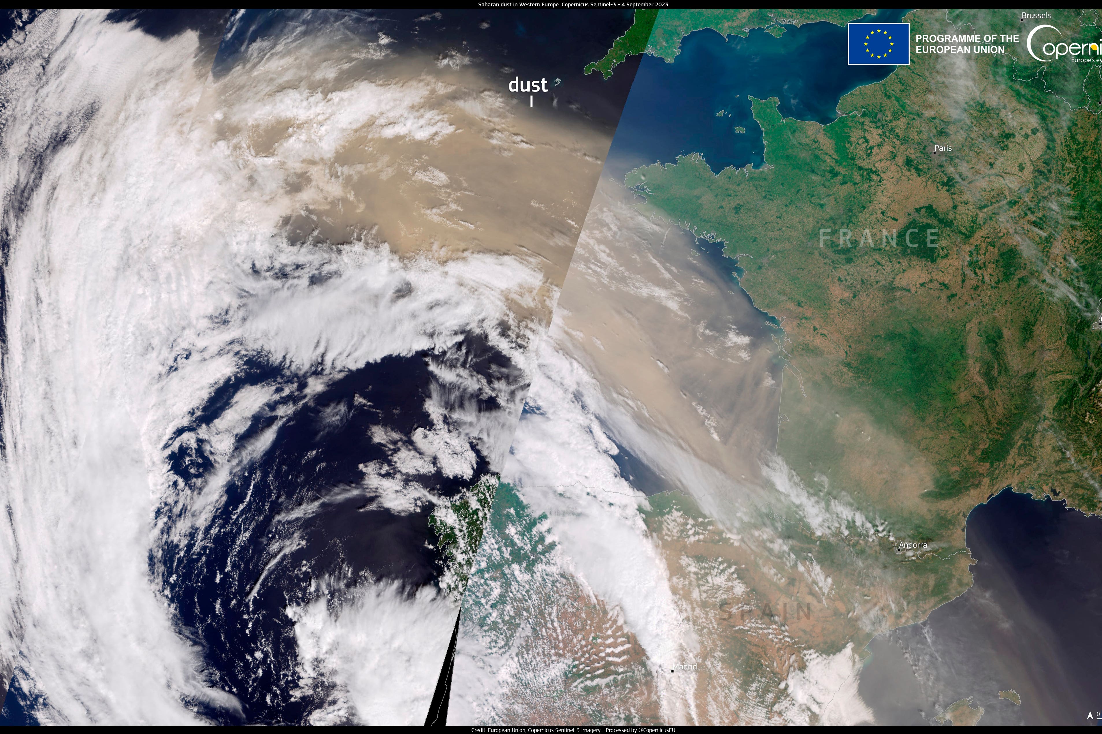
Clear and settled conditions have also given rise to glowing sunsets and hazy dawns as dust from the Sahara is blowing north in the atmosphere.
The plume was captured on satellite imagery moving across the Mediterranean and stretching for more than 1,200 miles on its way to the the UK and Scandinavia.
It is contributing to worsening air pollution this week, with hot, still weather known to also increase ground levels of harmful ozone.
Mr Dixon said: “Saharan dust is one factor in the air quality forecast.
“Moderate levels of air pollution are expected across the UK on Saturday, with some high levels also likely for central and eastern parts.
“Air pollution levels will look to reduce from Sunday, as we start to transition to this more unsettled picture from the north west.”
Dust brings red skies because particles in the atmosphere scatter blue light more than red, which is why the sky appears blue during the day.
When the sun is low in the sky, like at dawn and dusk, the light has farther to travel and so the blue light is scattered too much for us to see it, with the Saharan dust exacerbating this effect and turning the skies a deeper red.
The folklore expression “red sky at night, shepherd’s delight” is true in many cases, the Met Office has said, as it means high pressure and fair weather is moving in from the west, “whereas red sky in the morning, shepherd’s warning” – means that high pressure is beginning to move away.
Mr Dixon said: “Saharan dust in the atmosphere is generally decreasing in concentration in the coming days and the remnants of that air is expected to push away as the UK returns to a more mobile Atlantic weather pattern from early next week.”
Bookmark popover
Removed from bookmarks