UK weather: Temperatures to plunge from Easter Monday after 21C bank holiday highs
Forecasters say temperatures will range from the high teens across the country to around 20-21C in the south on Sunday
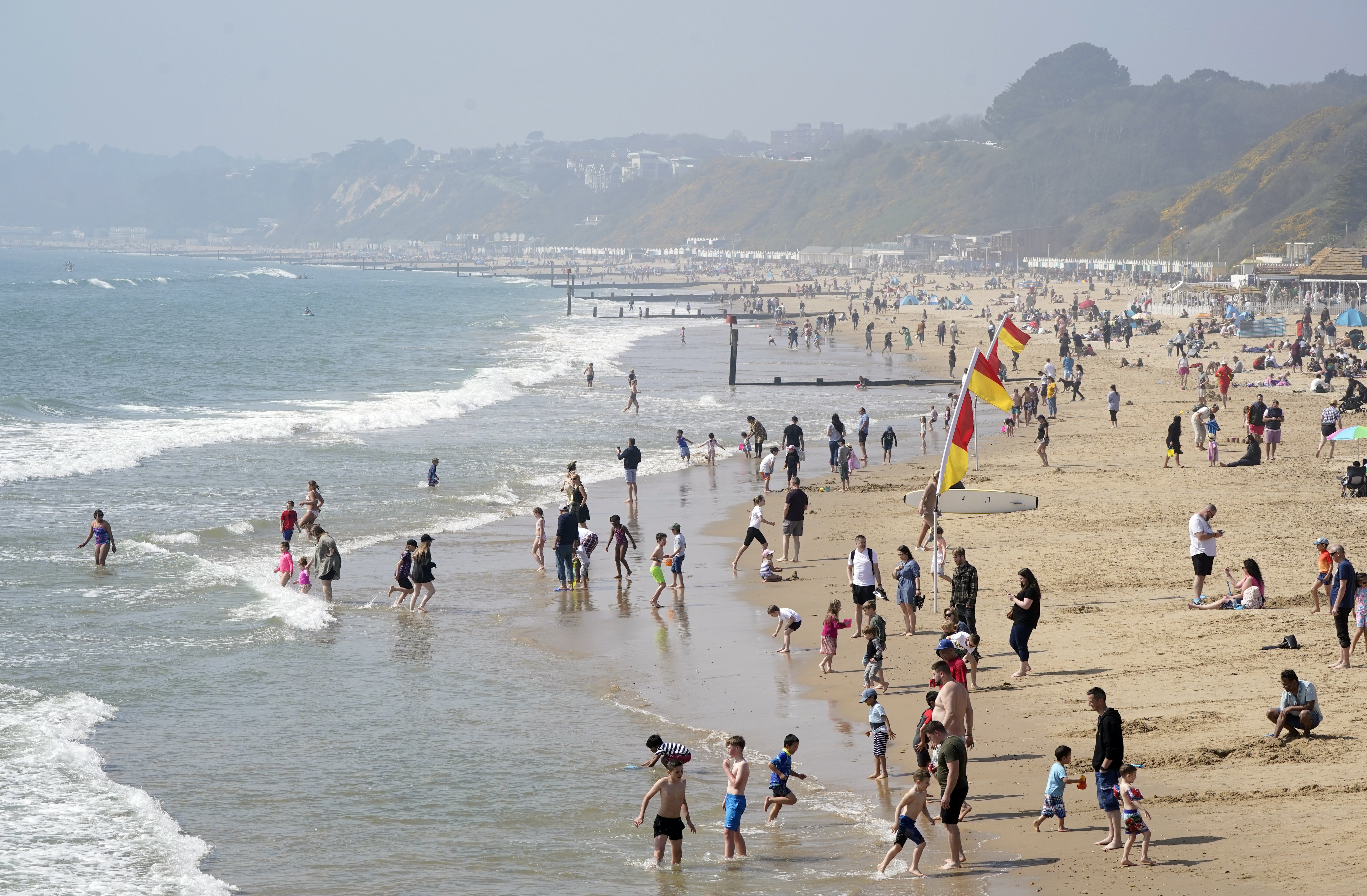
Britons have been basking in bank holiday sunshine, with more to come before temperatures plunge next week.
Met Office forecasters expect 20-21C highs in the south of England on Easter Sunday, in a third day of good weather for holidaymakers.
Good Friday saw the warmest day of the year so far with 23.4C recorded in St James’s Park in London.
But temperatures will start to drop from Easter Monday with some scattered rain and cloud moving in over the week.
Marco Petagna, a spokesperson for the weather agency, said: “The idea is temperatures gradually just creeping down each day for the next few days across the UK.
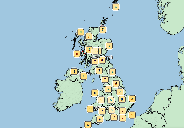
“But today there’s plenty of fine weather still around – most areas seeing some warm sunshine, looking at temperatures of sort of high teens locally to 20 or 21.
“The central belt of Scotland could locally get to 20, locally in England and Wales could get to 20-21 as well.
“But [it will be] slightly cooler out towards the west – Northern Ireland, western Scotland and the far west of Wales and Cornwall seeing some rain coming – so for them some slightly more unsettled weather.
“But for most areas, we’re staying fine today.”

Mr Petagna said rain will push in from the west overnight, which will be “weakening” as it goes so the far east may stay dry.
Easter Monday will see some scattering of showers and it will be slightly cooler as temperatures start to drop, he said.
“The further south and southeast you go the better chances to stay fine again but [it will be] slightly cooler tomorrow at 19 in the southeast, low to mid-teens elsewhere,” Mr Petagna added.
Mr Petagna warned of high levels of pollen for those with hay fever while UV levels are moderate with the “sun as strong now as during August”.

The forecaster also said Easter Sunday and Monday may be the last of the dry bright weather for the week.
“Tuesday and Wednesday could see a few showers, particularly across the south of the UK,” he said.
“And then the second half of the week is when we get an easterly wind developing, more in the way of cloud pushing in from the east with some patchy rain but still a lot of relatively dry weather too.
“But the trend is certainly for temperatures to take a bit of a dip so we’re sort of back down to low locally mid-single figures by Thursday.”
MET OFFICE OUTLOOK
Today:
Early fog patches soon clearing leaving most places fine, warm and dry, best of the sunshine in the east. Cloudier in the far west with some rain over western Scotland, Northern Ireland and, later, parts of Wales and southwest England.
Tonight:
Early evening cloud in the west spreads eastwards overnight, cloud thick enough for some rain at times, mainly in the north and west. Clear spells follow, and a chilly night.
Monday:
Sunny spells for most, but probably cloudier for parts of East Anglia and the Southeast. Some showers in the north and west, mainly Scotland and Northern Ireland. Cooler than today.
Outlook for Tuesday to Thursday:
Dry for most with sunny spells. Chance of catching the odd shower, most likely Tuesday and Wednesday in the south. Temperatures near normal, but feeling cooler on the east coast.
Bookmark popover
Removed from bookmarks