Snow to sweep most of UK on weekend but rain to follow with end to cold snap
A band of snow and rain will sweep most of the country on Saturday night but milder air will follow on Sunday.
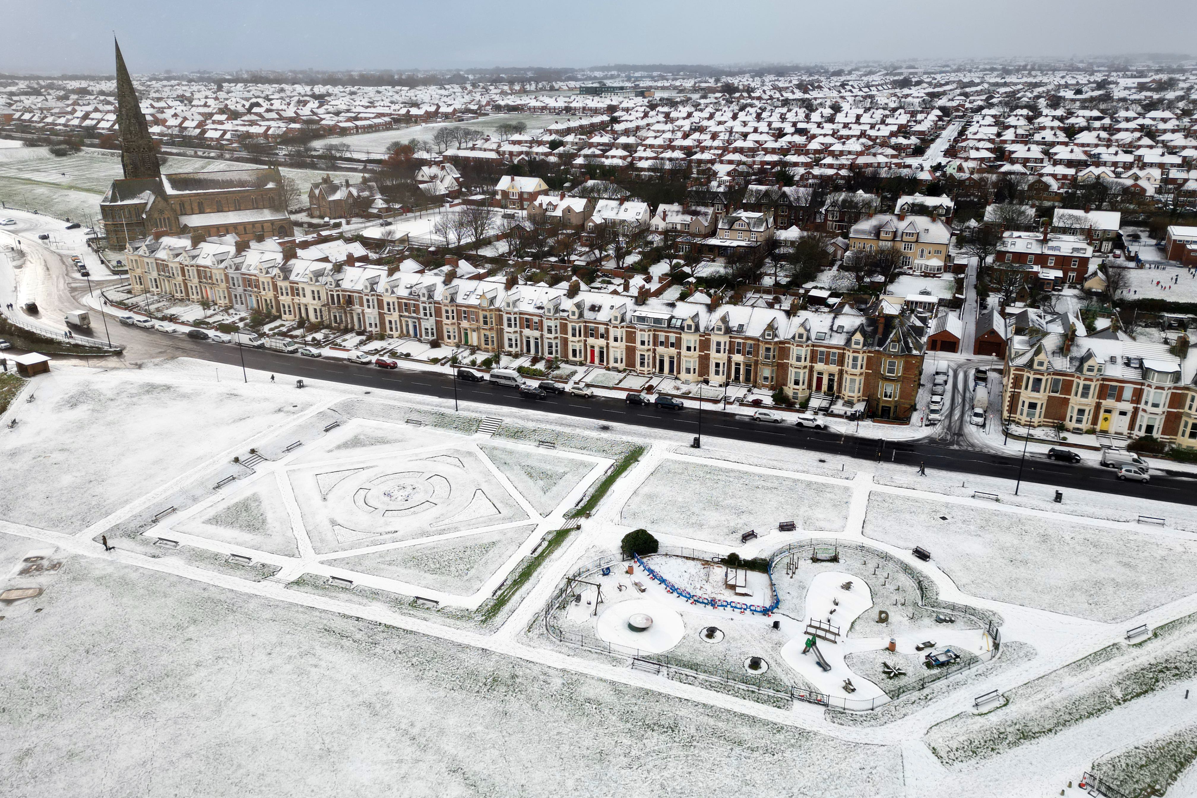
Most of the UK will see another blanket of snow over the weekend followed by a band of rain and milder air, bringing an end to the cold snap, forecasters have said.
The Met Office has issued a yellow weather warning for snow and ice covering the majority of Scotland, Wales, the north of England and the Midlands from 3am to 9pm on Sunday.
Another warning for snow and ice will also cover most of the south of England from 3am until 11am on Sunday.
Forecasters say the UK will be swept by snow on Saturday night with the potential for up to 15cm in the north of Scotland.
But a band of rain followed by milder air will move in on Sunday, bringing an end to the current cold snap.
It comes as the current severe weather conditions have caused major disruption across the UK in the last few days.
Meanwhile, engineers have warned that some people on Shetland could be without power until the weekend as they work to reconnect thousands entering their fourth day without power after significant snowfall.
Met Office meteorologist Ellie Wilson said: “A band of rain and snow is going to be moving north-eastwards across the country through Sunday.
“It’s bringing milder air behind it, but that milder air bumps into the cold air that’s where we’re seeing where the snow is likely to fall.”
Ms Wilson said the snow could fall up to 8cm over Wales and 15cm in the north of Scotland.
But she added: “That snow will quickly be followed by rain so any of those accumulations shouldn’t last too long.
“Because of the current cold conditions that we’ve seen, any of that snowfall will be falling onto cold frozen surfaces so there is a risk of ice here through the morning.
“That rain will quickly be following closely behind later on Sunday,” she added.
Ms Wilson said temperatures on Sunday afternoon onwards will be “on the rise” and will likely hit 9-10C in the west.
While it will still feel cold in the morning in Scotland and the north of England, she said: “Once that rain band arrives, it will be getting warmer.”
The meteorologist said that temperatures will likely have risen to 11-13C across the UK on Monday.
Asked if this is the end to the recent cold weather, she said: “For the time being, yes, it does look like it’s the end of the cold conditions we’ve been seeing recently.”
From Monday onwards, the UK will see “a slight trend” of temperatures dipping closer to average, nearing single figures but it will not be “quite as cold as we’ve seen over the last few days”.
A Met Office yellow warning for snow and ice remains in place across much of northern Scotland, including Shetland, and north-east England, Yorkshire and Humber until 11.59pm on Thursday.
Another yellow weather warning for snow and ice covering Shetland and Orkney kicks in at 12am on Friday and will be in place until 10am.
Engineers from Scottish and Southern Electricity Networks (SSEN) Distribution have been facing severe weather as they work to restore power to about 2,400 properties which remain off supply in Voe, Brae, Yell and the West Mainland, on Shetland.
Bookmark popover
Removed from bookmarks