Tube strike: The map that shows calories burnt walking between Underground stops
All London Underground stations are scheduled to be closed from 6.30pm on Wednesday
The average commuter faces a long walk into work tomorrow as the capital’s Tube shuts down owing to industrial action.
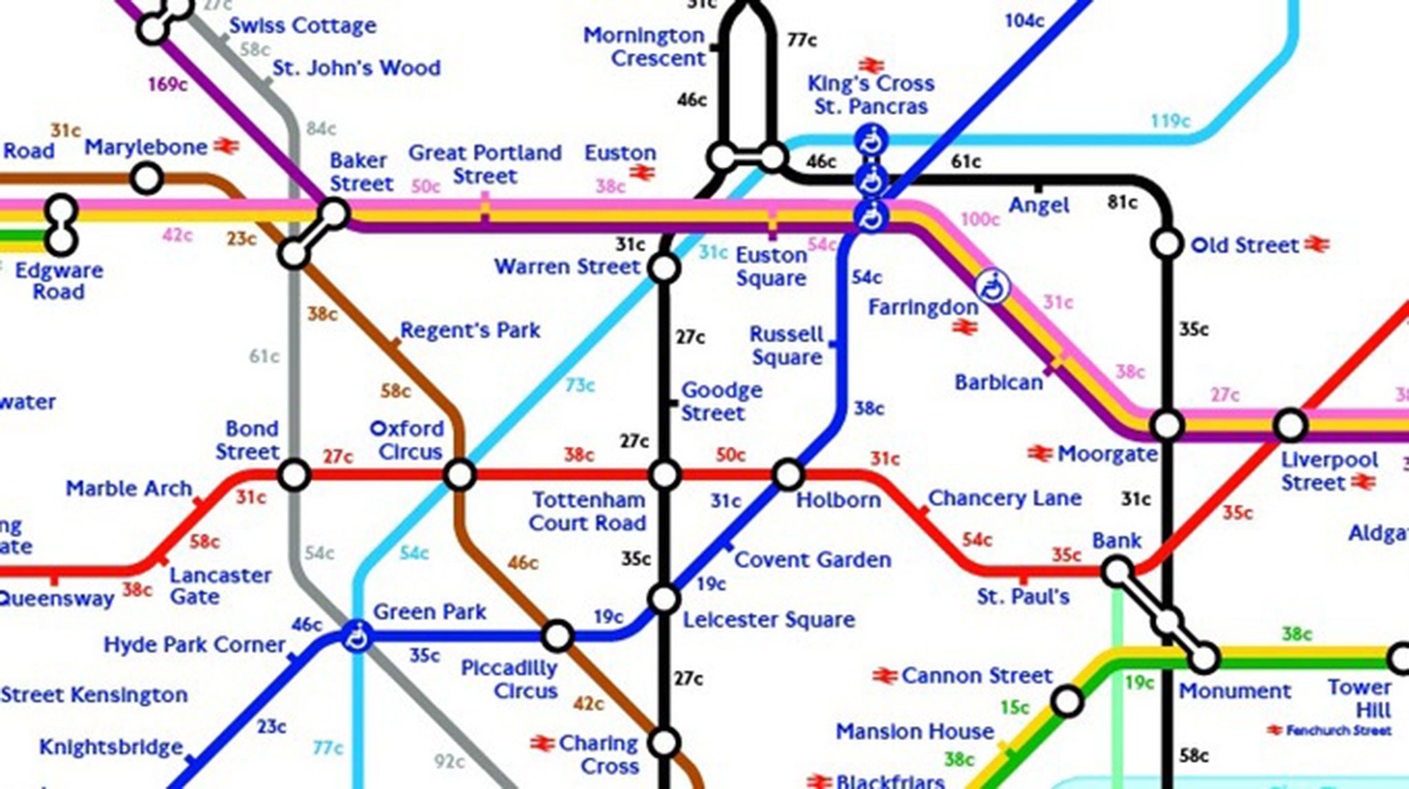
But there is one positive: a Tube map showing exactly how many calories you’ll burn per station.
Members of four unions, RMT, TSSA, Unite and Aslef, are downing tools and walking out from 6.30pm tomorrow over a running dispute over the implementation of night Tubes. Last minute talks to avert the strike ended without a resolution on Monday.
It will be the second Tube strike in as many months, and will see every single London Underground line shut – meaning thousands of commuters will take to the streets to get to and from work.
If you need something to cheer you up as you trudge, this map – produced by Tasked.com – shows you just how many calories you are burning.
Walking between Pimlico and Vauxhall (for example) will burn off 69 calories, while the epic stretch from Caledonian Rod and Kings Cross on the Piccadilly line will lose you 104 calories.
Join our commenting forum
Join thought-provoking conversations, follow other Independent readers and see their replies
Comments
Bookmark popover
Removed from bookmarks